Story so far: “Any aggression by Pakistan in the Sir Creek area will be met with a resounding response that will change both history and geography,” warned Defence Minister Rajnath Singh on October 2, 2025. Celebrating Vijayadashami with the troops stationed in the Indian Air Force (IAF) base in Bhuj, Mr. Singh cautioned Islamabad against any misadventures in the 96-km-long strip of waters which has been under dispute since 1914.
The two nations have been recalibrating their naval strategies since India launched Operation Sindoor in May 2025, hitting terror and military sites inside Pakistan and Pakistan-occupied Kashmir (PoK). Focus on the strategically significant Sir Creek has renewed since then, as experts believe Pakistan has a ‘perceived military edge’ in that region.

Location of Sir Creek and importance
Originally known as ‘Ban Ganga’, the 96-km creek flowing into the Arabian Sea, separating Rann of Kutch in Gujarat’s western border from Pakistan’s Sindh Province in its southwestern border, was named ‘Sir Creek’ after a British representative during the colonial years. The marshlands in Sir Creek is the largest fishing grounds in Asia and is home to untapped petroleum, minerals, oil and gas reserves. Apart from the economic and strategic significance of the creek, the water body is ecologically sensitive. India and Pakistan have laid claims to the Territorial Sea, Exclusive Economic Zone, and Continental Shelf in the creek.
Dispute over Sir Creek
History
During the British Raj, Rann of Kutch fell under the Princely State of Kutch while Sind came under Bombay Presidency — directly under British administration. In 1908, the Kutch Darbar and the Sind administration laid disputing claims on a small sector in the western portion of Rann. However, the dispute was settled by the British administration after its Bombay government passed a resolution on February 24, 1914, delineating the borders between the two Provinces.
Depicted via a green line on a British-approved map, the resolution awarded the entire Kori Creek, which lies to the west of the Rann of Kutch to the Kutch Darbar and the entire Sir Creek to Sind i.e. Bombay Presidency. Post-partition, Kutch became a part of India, while Sindh Province fell under Pakistan. This reignited the border issue, now between two sovereign nations — making it an international dispute from an interstate issue under the British Raj.
Pakistan claims that the borders between Kutch and Sindh lies on the eastern bank of Sir Creek i.e. the green line connecting the mouth and top of Sir Creek as mentioned in Paragraph 9 of the resolution. However, India claims that that in Paragraph 10 clarifies that the adopted line extends from the top of Sir Creek, east to where it joins Sindh — depicted in blue dotted lines. It also states that as Sir Creek changes its course over time, the western boundary should be taken as the ‘centre of the navigable channel of Sir Creek’. India claims that this effectively make the river’s course the boundary between Sindh and Kutch.
Talks and dispute resolution
In 1956, the Prime Ministers of India and Pakistan agreed to entrust the demarcation of the entire western boundary to the Central Surveys of India and Pakistan as a matter of the highest priority. However, the survey was never done. After the 1965 India-Pakistan war, both nations agreed to establishing a UN tribunal for final determination of the boundary between Kutch and Sindh.
On February 19, 1968, the tribunal awarded 90% of the disputed territory in the Rann of Kutch to India while 10% of territory including Rahim Ki Bazar, Dhara Banni and Chhad Bet was awarded to Pakistan. It stated, “The Resolution of 1914 divided the disputed area by a new line along the Sir Creek, from its mouth to its top, and then follows the blue dotted line due East until it joins the Sind boundary marked in purple.”
Discarding Pakistan’s claim of half and half division of Rann of Kutch, the UN tribunal ruled, “No principle of a half and half division of the Rann was proved ever to have existed and the 1914 Resolution does not mention such a principle. Pakistan’s contention that the vertical line was meant to be a boundary between Sind and the Rann as an entity about which there was a distinct dispute between the two neighbours, is also not convincing. The purple line, i.e., the Macdonald line, never was anything else than the Sind-Kutch boundary.”
However, the tribunal failed to resolve the Sir Creek dispute stating, “This agreement leaves out the matters submitted on the portion of the boundary along the blue dotted line and the boundary in Sir Creek.”
India-Pakistan ties soured after the Kargil war in 1999. Months after the war, a Breguet Atlantic maritime patrol aircraft of the Pakistan Navy was shot down over the Rann of Kutch by the Indian Air Force’s MiG-21 after it disobeyed instructions to land at an Indian base. The Atlantic had manoeuvred to escape from the MiG pilots and was shot down by a heat-seeking air-to-air missile.
Several attempts to resolve the Sir Creek issue has failed through the years with the latest attempt occurring in 2007. A joint hydrographic survey was conducted in January 2007 and talks were held shortly after with an exchange of maps. However, the contention remains unresolved
Current scenario
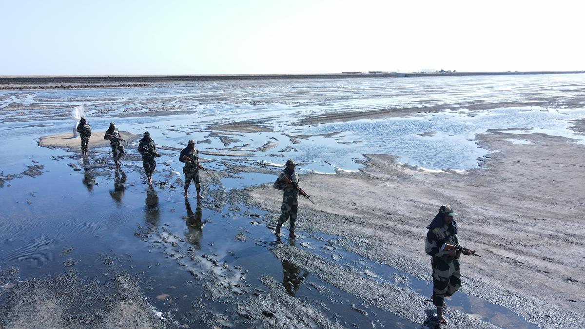
Since the usage of the sea route from Karachi to Mumbai in 2008 by Pakistani terrorists on 26/11, patrolling along the Kutch coast has increased. Both Indian and Pakistani fishermen have been detained by the respective military, through the years, for accidentally crossing the disputed international border in Sir Creek.

BSF jawans keep vigil near seized Pakistani boats at 1170 Harami Nada at Kori Creek India-Pakistan International Border in Gujarat. File
| Photo Credit:
The Hindu
In 2016, the Border Security Force seized a Pakistani boat with nine fishermen in this area but found nothing objectionable in it. In 2019, India received intelligence inputs of infiltration of Pakistani commandos or trained terrorists. The Indian Coast Guard and Coastal Security Police increased patrolling after several abandoned boats were discovered in Sir Creek in September 2019.
Moreover, Pakistan has been increasing its military presence in the area for the past two years while India’s construction in Sir creek remains stalled since February 2023. As per reports, Islamabad has deployed quadcopters to monitor the BSF’s patrolling and is constructing a 64-men barrack at its marine post Rah-de-Pir. While the Centre approved to construct eight multi-storeyed bunkers cum observation posts at Sir Creek and ‘Harami Nalla’ marshy area in January 2023, the construction activities stalled due to the unresolved border dispute.
In the recent retaliation to Operation Sindoor, Pakistan attempted to target military installations with up to 400 drones across 36 locations, including the Sir Creek region.
Published – October 07, 2025 11:05 pm IST