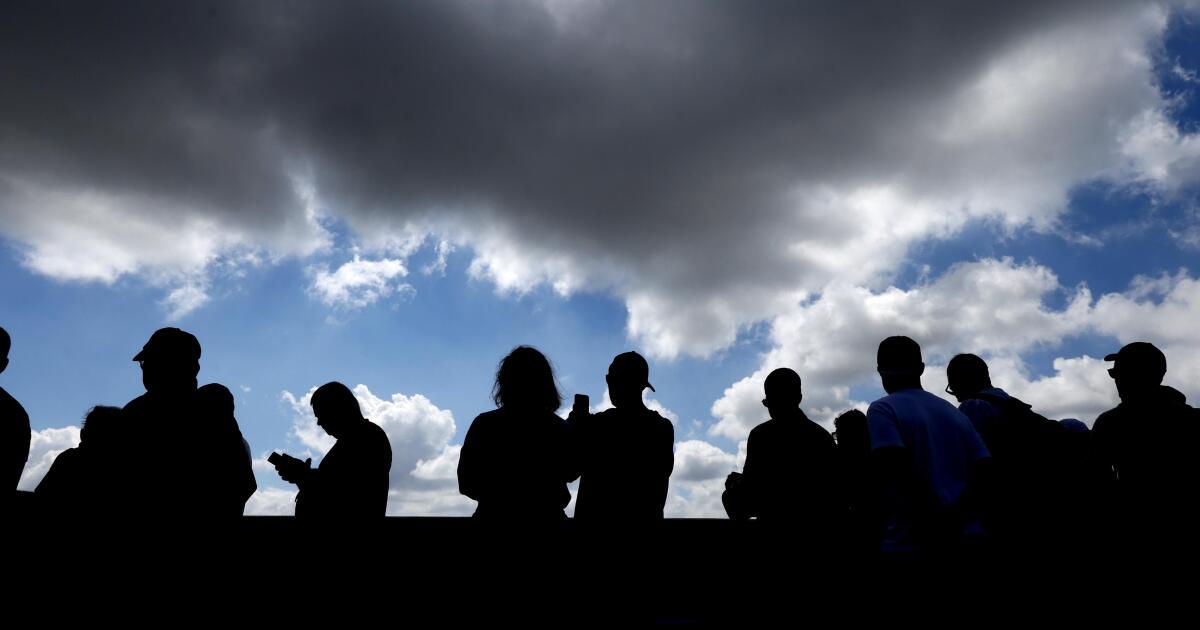
Evacuation warnings were issued for L.A. County burn scars ŌĆö including in the Palisades, Altadena, Sylmar and the Hollywood Hills ŌĆö as a wintry storm began to sweep across the state Monday, bringing the seasonŌĆÖs first major snow dump to the Sierra.
The storm, which is predicted to bring rain to Southern California by nightfall, was already pummeling Northern California on Monday afternoon, prompting hundreds of flight delays at San Francisco Airport and flood advisories in San Francisco, Oakland and Napa. Web cameras at Mammoth Mountain Resort and Bear Valley Resort showed the storm barreling in and blanketing the slopes in white.
At 3:30 p.m., the National Weather Service announced that chances had increased for significant and damaging debris flows in Los Angeles-area burn scars and urged residents to pay attention to law enforcementŌĆÖs guidance. The storm is expected to bring four to six hours of rain, powerful wind gusts and potential thunderstorm and tornado activity, according to the weather service.
HereŌĆÖs what forecasters are predicting, although they caution the situation is evolving and subject to change.
Monday into Tuesday
Isolated showers began striking the Bay Area on Monday morning, with rainfall intensifying around noon and accumulating from half an inch to an inch by 4:30 p.m., according to weather service meteorologist David Gomberg.
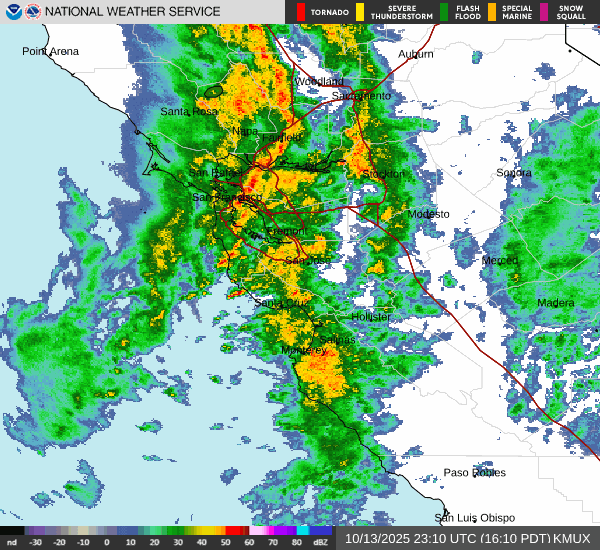
Stormy weather had moved into Northern California by late Monday afternoon.
(National Weather Service)
The core of the storm, which is expected to bring the most damaging impacts, is predicted to reach San Luis Obispo and Santa Barbara counties on Monday evening, and Los Angeles County between midnight and 2 a.m., Gomberg said. Those areas may see light showers before and after the core moves through.
ŌĆ£We could see some strong to even locally severe thunderstorms, meaning that you can get wind gusts up to 60 miles an hour. … They can take down trees, power lines,ŌĆØ said Gomberg. ŌĆ£ThereŌĆÖs even the possibility of some isolated water spouts and tornado activity across the county.ŌĆØ
Evacuation warnings are in place near the near the burn scars from the Palisades fire and the Eaton fire as well as the Hurst fire in Sylmar and the Sunset fire in the Hollywood Hills.
ŌĆ£Residents in these areas are urged to stay vigilant, monitor official weather updates, and avoid unnecessary travel during the storm ŌĆö especially if they have been advised of potential mudflow risks in their neighborhoods,ŌĆØ stated the L.A. County SheriffŌĆÖs Department.
L.A. Mayor Karen Bass urged residents to sign up for emergency alerts at NotifyLA.org and said the city was gearing up for possible flooding and mudslides.
ŌĆ£The city has bolstered the hillsides and vulnerable areas from potential debris flows in recent burn scar areas ŌĆö these resources remain in place,ŌĆØ Bass said in a statement. ŌĆ£Today, we have strategically deployed resources for the Palisades and across the city, including strike teams, rescue teams and helicopters.ŌĆØ
Peak rates of 0.25 to 0.5 of an inch of rain per hour are possible, with total accumulations of 0.75 to 1.5 inches for coastal and valley areas and 1.5 to 3 inches in the mountains, according to the weather service.
Starting at 8 p.m. Monday, a flood watch is in effect for areas in and near recent burn scars in Southern and Central California. The scars are from the Gifford, Madre, Lake, Apache, Mountain, Post, King, Canyon, Hughes, Hurst, Kenneth, Franklin, Palisades, Sunset, Lidia, Hawk, Eaton and Bridge fires that burned over the last two years. The flood watch is in effect through 3 p.m. Tuesday. Debris flows are also possible.
Flooding may also take place in urban areas, areas with poor drainage and low-water crossings, forecasters said.
The National Weather Service also issued a flood watch for burn scars in the San Bernardino County Mountains, Santa Ana Mountains and foothills and inland areas of Orange County from late Monday until Tuesday afternoon. Burn scars include those from the Bridge, Line, Apple, El Dorado and Airport fires that burned over the last five years.
Forecasters are predicting rainfall rates of 0.3 to 0.7 inches per hour in those areas.
For much of the high desert, including Apple Valley and Lucerne Valley, the San Gorgonio Pass near Banning, the Antelope Valley and the Morongo Basin, a wind advisory is in effect until 11 p.m. Tuesday, with gusts of up to 45 mph expected.
Farther north along the Central Coast and in the Central Sierra, the heaviest portion of the storm is expected to hit from 11 p.m. Monday through 5 a.m. Tuesday, said Emily Wilson, meteorologist with the National Weather Service in Hanford.
Snow levels are expected to drop to 6,000 feet, with accumulations of 4 to 8 inches from 7,000 to 8,000 feet and 1 to 2 feet above 9,000 feet. At lower elevations, hourly rain rates could range from 0.2 to 0.3 inches per hour, she said.
A flood watch is in effect from 5 p.m. Monday through Tuesday afternoon for rural and mountainous areas including Camp Nelson, Coarsegold, Oakhurst, Kernville, Fish Camp, Lake Isabella, North Fork, Auberry, Bass Lake and Yosemite Valley. A winter storm warning is in effect until 5 p.m. Wednesday for some communities near Yosemite National Park and Sequoia and Kings Canyon national parks, as well as on the Eastern Sierra slopes.
Tuesday into Wednesday
Showers may linger, but by Tuesday afternoon the most damaging impacts from the storms are expected to be over.
Cooler temperatures are expected to last throughout the state into Thursday, followed by a warming trend.
The first freeze of the fall season is expected for the Owens Valley, with overnight lows dropping to between 27 and 32 degrees. A freeze watch is in effect through Wednesday morning for Bishop, Independence, Lone Pine and Olancha.