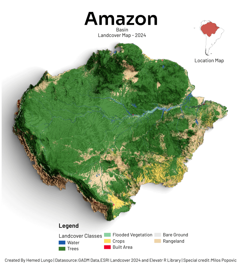
🗺️Map showing Amazon Basin Land Cover – 2024
Made with QGIS & Blender using:
🏞️Landcover Map from ESRI Landcover 2024
⛰️DEM from Elevatr Library in R programming
Posted by hemedlungo_725
🗺️Map showing Amazon Basin Land Cover – 2024
Made with QGIS & Blender using:
🏞️Landcover Map from ESRI Landcover 2024
⛰️DEM from Elevatr Library in R programming
Posted by hemedlungo_725
4 comments
There should be much more yellow
You can even see it through google.maps
Funny how the colors on the map don’t match the colors in the key.
so green that the mountains look like trees, neat
Would love to see South Africa
Comments are closed.