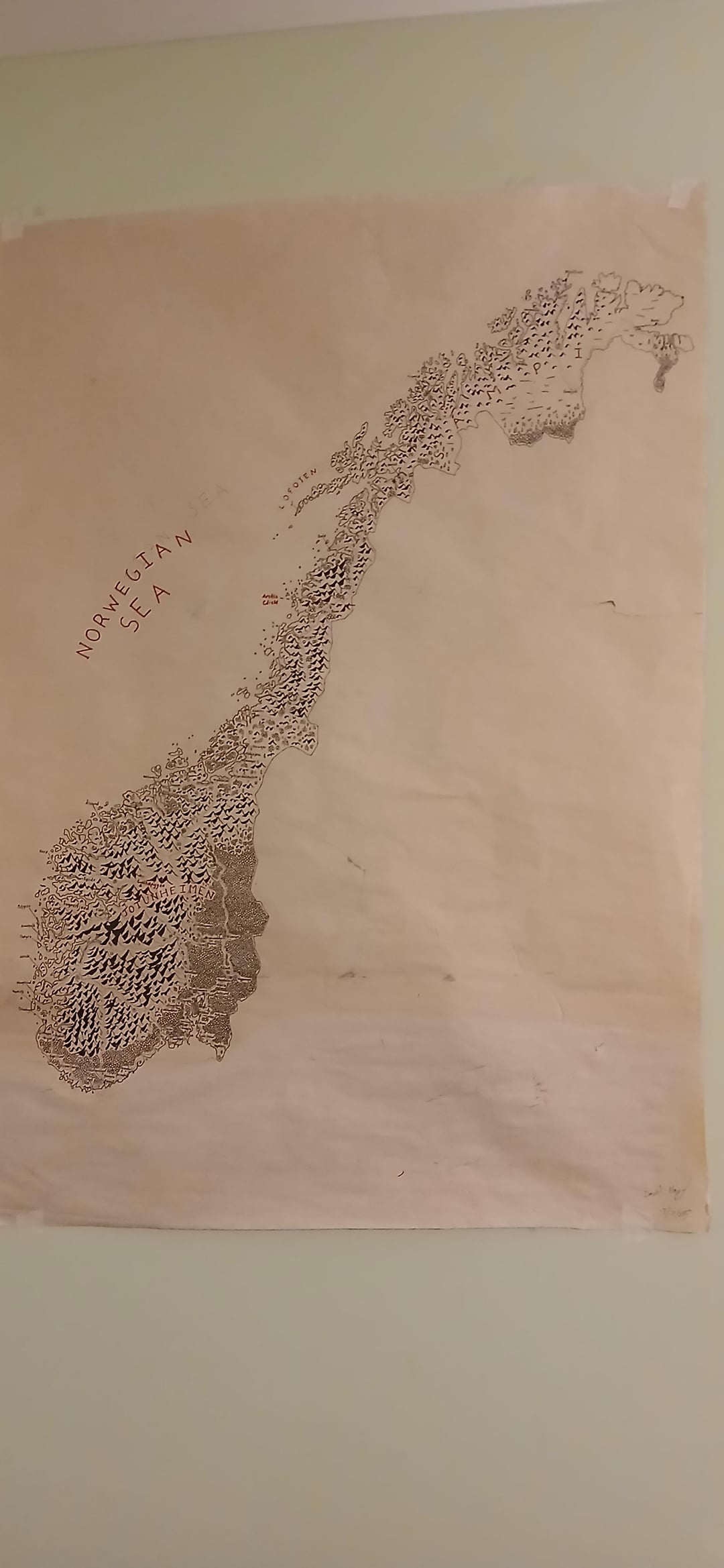
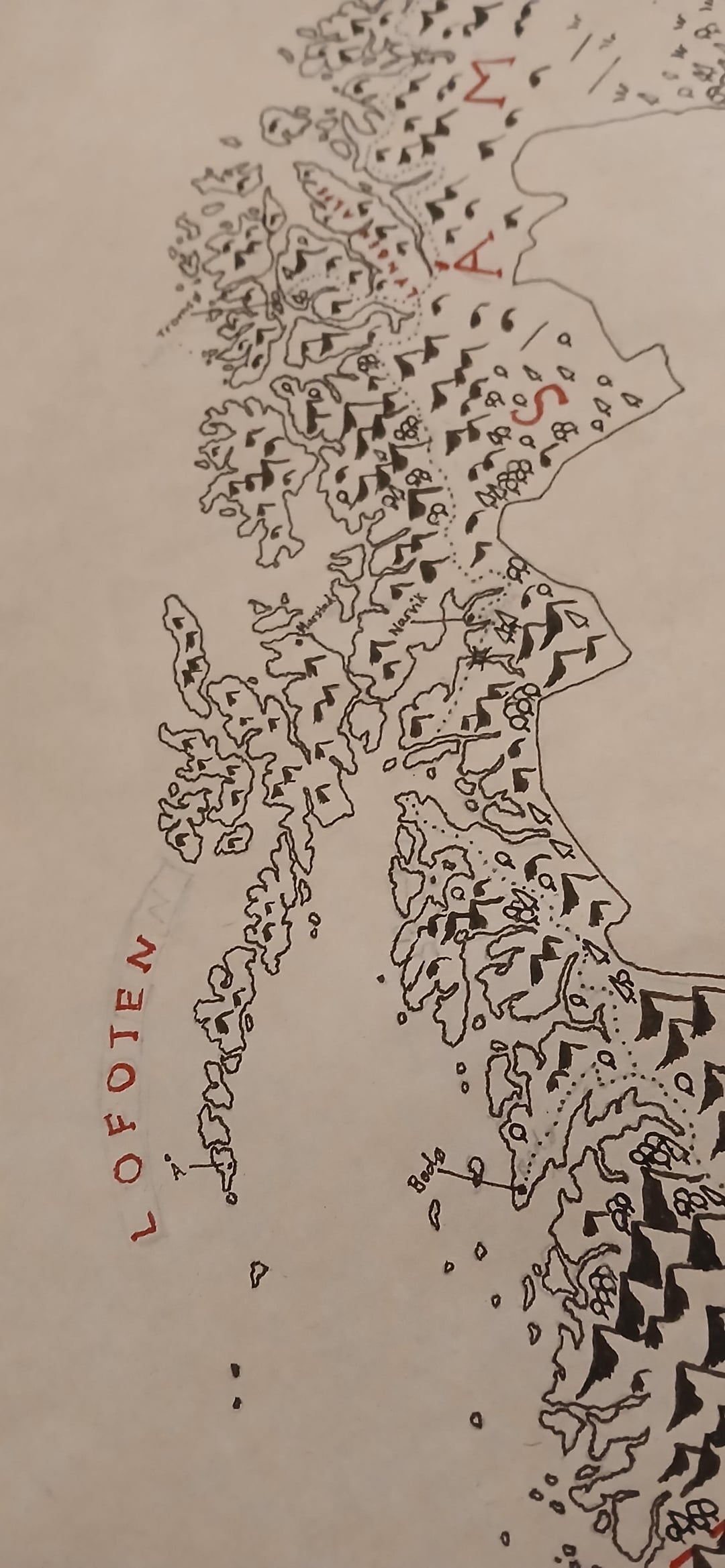
I may do Svalbard/Bjørnøya/Jan Mayen in the future.
Edit: I know Sápmi is spelled wrong. There may be more writing errors that I have not caught.
by Amehtystgeode_1236
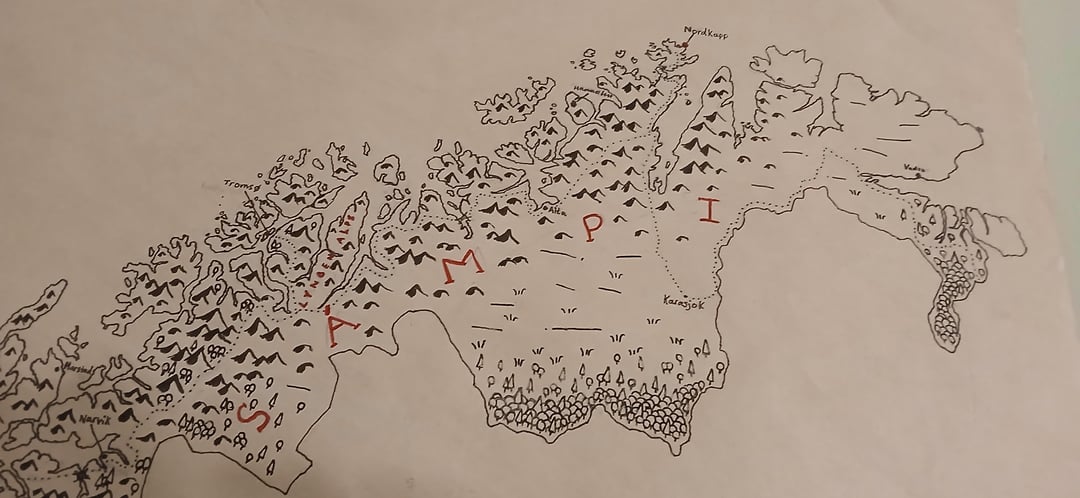
![[Original] Hand-Drawn Map of Mainland Norway](https://www.europesays.com/wp-content/uploads/2025/12/uqi9qu7xtv8g1-1080x1024.jpg)
I may do Svalbard/Bjørnøya/Jan Mayen in the future.
Edit: I know Sápmi is spelled wrong. There may be more writing errors that I have not caught.
by Amehtystgeode_1236
10 comments
I’m loving everything about this. Please make prints.
The Ghost of Tolkien demands it.
Really nice, but is the “Sampi” spelling on purpose?
In a Tolkien style map,
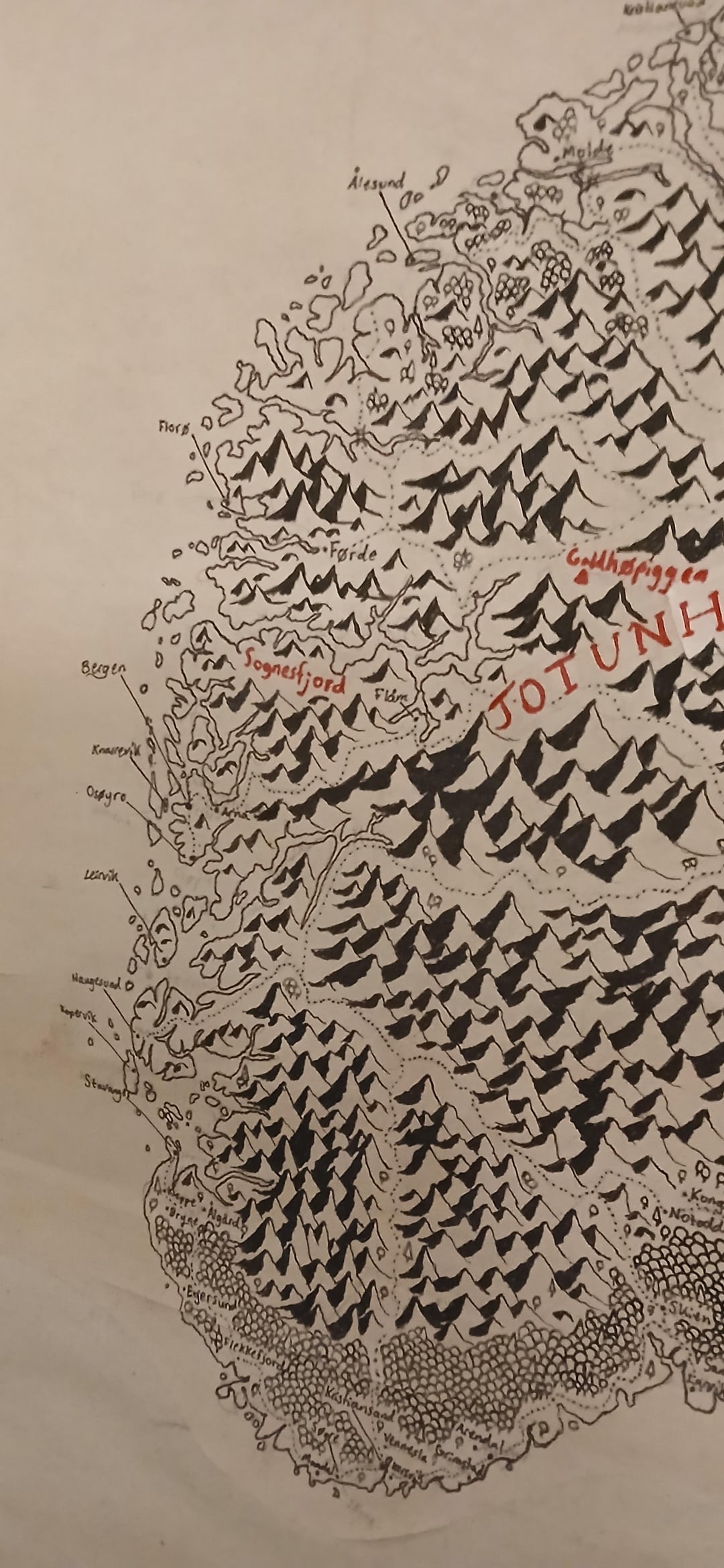
[Orkland](https://en.wikipedia.org/wiki/Orkland_Municipality)
deserves to be marked as a warning for travelers.
Just want to say that you can find old hand drawn maps on kartverket.no
Found a map made in 1790 from my area. Fun seeing how names have chamged. Like, Kverve was Qvarve if I remember correct. Vigra was Wiggeren. “-øy” then was “-øe”
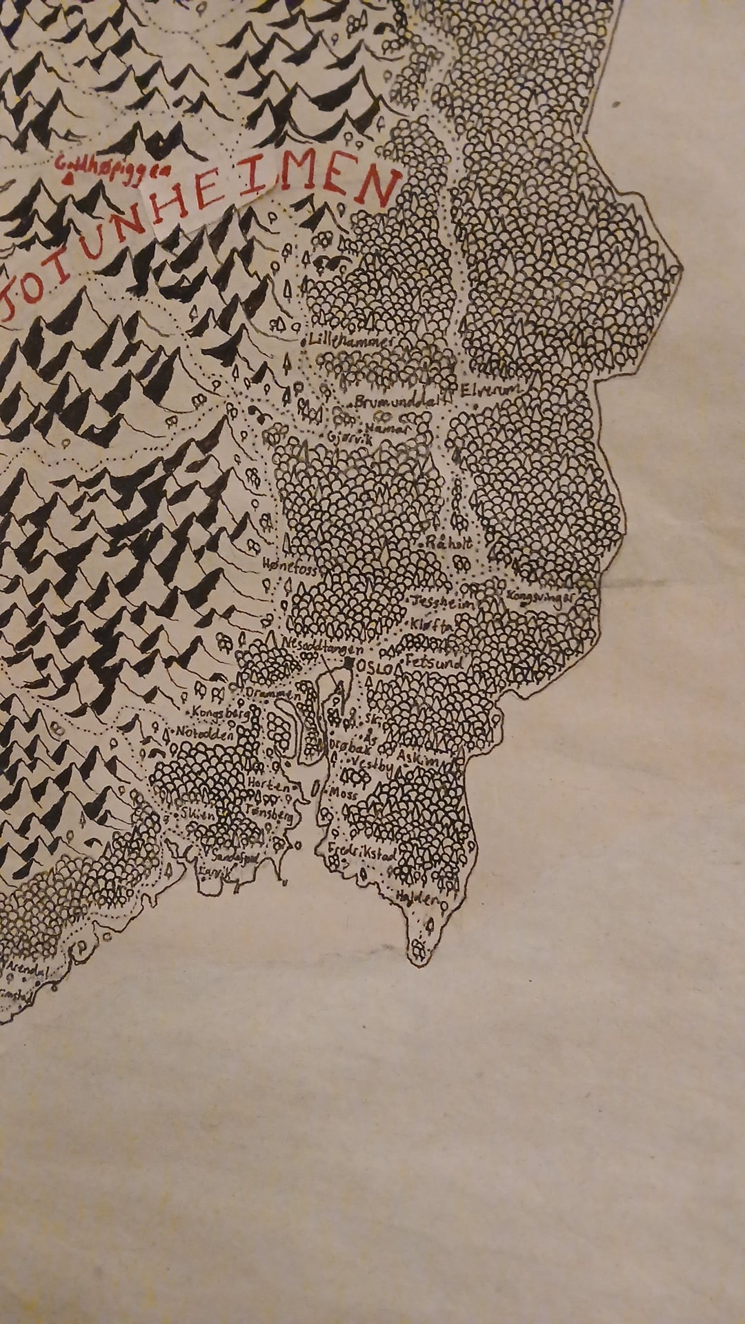
There should be mountains in the Engerdal area.. which is shown as flat on the map.
Poor Mjøsa!
This shows why we had forts in Halden and Kongsvinger in case of a swedish invasion of Østlandet
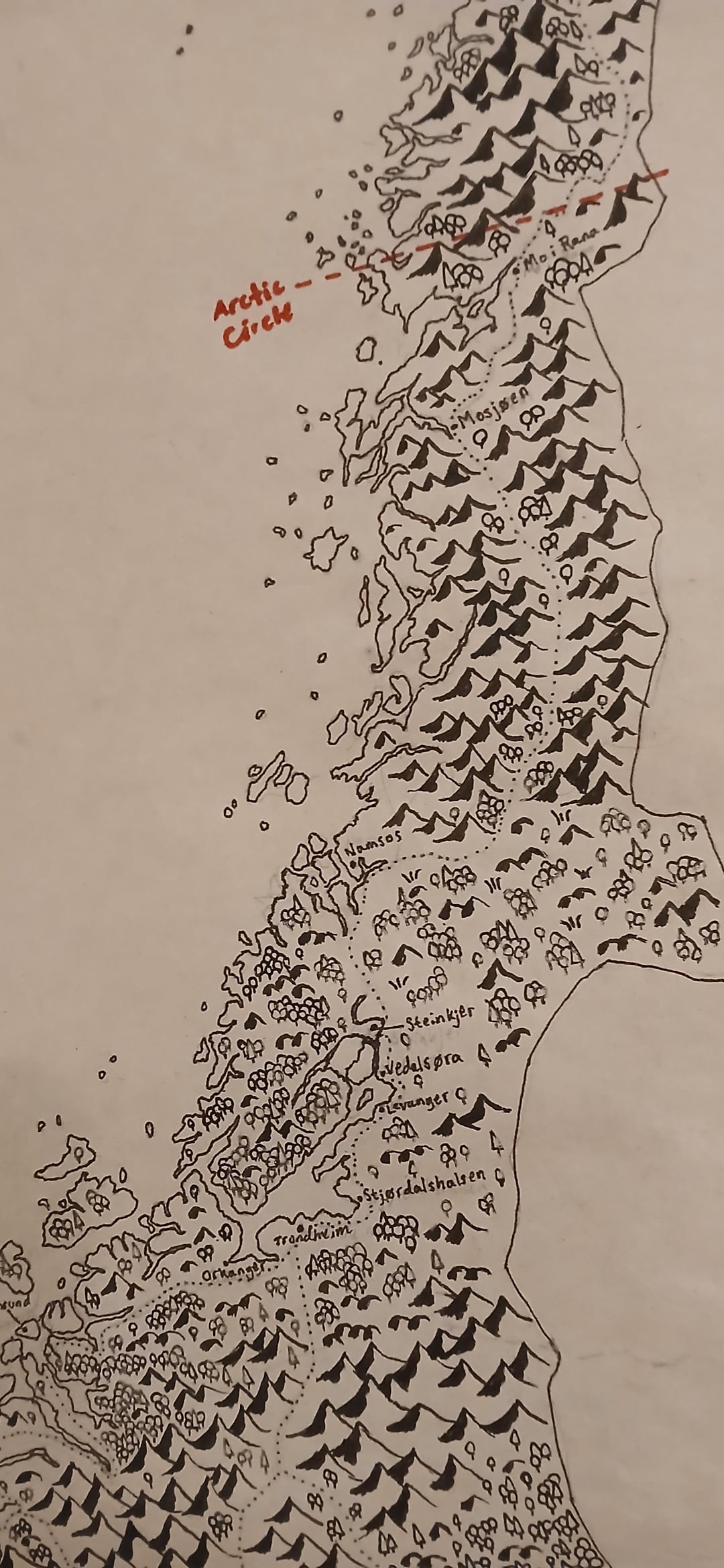
Cool stuff, but cannot see any close-up photo of the most important land. Femund/Røros area.
Man I would have this on my wall. Great job!
Good lord! Please tell me you’ll make prints!
Comments are closed.