Parts of the South Island are set to swelter on Saturday, but some regions are also bracing for heavy wind and rain throughout the weekend.
Motueka, Blenheim, Kaikōura and Christchurch are under heat alerts, with temperatures expected to hit or exceed 30 degrees.
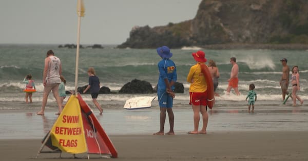
All up, 14 towns and cities around New Zealand have heat alerts today as temperatures continue to climb.
“Records could roll,” MetService said.
Kerikeri reached a record January high temperature on Saturday, exceeding 32 degrees. The previous record was 31.2 degrees on 11 January, 1983.
Meanwhile, the Public Health Service is warning that people can die from becoming overheated.
Hawke’s Bay is set to be one of the hottest regions this weekend, as the tail-end of Australia’s heatwave sweeps across the Tasman.
Medical officer Dr Matt Radford said vulnerable people, including babies and children, pregnant women and anyone with health conditions were at risk.
He said people should avoid going outside during the hottest time of the day, drink plenty of water and wear lightweight clothing.
Plunket also said children should never be left in a car in the heat and should wear sunscreen, a hat and sunglasses when they’re outside.
Hastings council is warning residents to stay vigilant to fire danger and conserve water.
The Hawke’s Bay town is expected to be the hottest part of the country – with a projected high of 38 degrees tomorrow.
Deputy mayor Michael Fowler said people should avoid spending too much time in the sun.
“Keep out of the heat, keep hydrated, look after your neighbours, look after your pets.”
The district council had taken measures to prepare for the heat.
It had closed Te Mata Park and told staff and contractors to avoid work that could create sparks – but residents also needed to ensure they were prepared to deal with near record temperatures, he said.
“Hastings used to get very excited about a 35 degree heat. Well this is going to be more than that … People need to be absolutely vigilant about this and take it seriously.”
Orange wind warning for lower North Island
On Saturday an orange strong wind warning was issued to take effect from around 6am tomorrow until early Monday morning for the Tararua District, Wairarapa and Wellington.
Severe gale northwest winds gusting to 120km/h are forecast.
MetService meteorologist Mmathapelo Makgabutlane said two weather systems were moving across the South Island, with the first beginning early this morning.
“That will bring an increase in wind speed and summer rain for western parts of the country but as we head into Sunday we have a larger weather system that arrives and that also ramps up that rain in the western part of the South Island and strong winds for almost the whole of the South Island.”
The norwesters will drive temperatures up and last overnight in both islands, with temperatures staying in the high teens.
“It will be much warmer than average for some parts of Northland and Coromandel,” on what is shaping as “a classic summer weekend” for the North Island, she said.

There are several other watches and warnings in place for the South Island.
Orange heavy rain warnings are in place for Westland and Fiordland, where up to 300mm could fall over a 30-hour period from late tonight.
A heavy rain watch also applies to the ranges of the Grey and Buller districts from midday tomorrow while there’s a strong wind watch for Marlborough, especially about the Sounds and Kaikōura Coast from 1am tomorrow.
An orange strong wind warning has been issued for Canterbury about the High Country and the foothills from 10pm today. Severe gales northwesterlies gusting up to 130 kilometres are predicted.
Heavy rain and strong wind watches are also in place for the headwaters of the Canterbury lakes and rivers in the Arthur’s Pass area.
Heavy rain watches and strong wind watches have also been issued for the weekend for the headwaters of the Otago lakes and rivers, Fiordland, Otago, Southland and Stewart Island.
Fire warning
Paihia and Russell, Whangārei, Whitianga, Tauranga, Whakatāne, Gisborne, Napier, Hastings, Masterton are also under heat alerts today.
Fire and Emergency warned the weekend’s conditions – heat, wind and low humidity – were a “perfect storm” for wildfires.
The risk was highest in Canterbury, Marlborough, Wairarapa, Hawke’s Bay, Tai Rāwhiti, and Northland, it said.
In several areas across the country fires are banned or restricted.
Red zones have a total fire ban, and in yellow zones, people may need to apply for a permit – go to checkitsalright.nz to check and apply.
All permits in Canterbury are suspended from midnight Friday until 8am on Monday.
There’s no permit needed in green zones.
Full list of MetService warnings and watches
Heavy Rain Warning – Orange
Area: The ranges of the Westland District about and north of Haast
Period: 22hrs from 11pm Sat, 10 Jan – 9pm Sun, 11 Jan
Forecast: Expect 240 to 300 mm of rain. Peak rates of 25 to 35 mm/h expected Sunday morning and early afternoon with possible thunderstorms. Low chance of upgrading to a Red Warning.
Impact: Streams and rivers may rise rapidly. Surface flooding, slips, and difficult driving conditions possible.
Action: Clear your drains and gutters to prepare for heavy rain. Avoid low-lying areas and drive cautiously. Preparedness advice.
Area: Headwaters of the Canterbury lakes and rivers about and south of Arthur’s Pass
Period: 16hrs from 5am – 9pm Sun, 11 Jan
Forecast: Expect 200 to 250 mm of rain about the main divide, and 100 to 150 mm within 20 km farther east. Thunderstorms possible. Peak rates of 25 to 35 mm/h about the Divide during Sunday morning and early afternoon. Freezing level 3500 metres. Minimal chance of upgrading to a Red Warning.
Impact: Streams and rivers may rise rapidly. Surface flooding, slips, and difficult driving conditions possible.
Action: Clear your drains and gutters to prepare for heavy rain. Avoid low-lying areas and drive cautiously. Preparedness advice.
Area: Westland and Fiordland between Haast and Doubtful Sound
Period: 12hrs from 9pm Sat, 10 Jan – 9am Sun, 11 Jan
Forecast: Heavy rain is easing this morning. This Warning is for another period of heavy rain from this evening. Expect 100 to 130 mm of rain. Peak intensities of 20 to 25 mm/h with possible thunderstorms. Minimal chance of upgrading to a Red Warning.
Impact: Streams and rivers may rise rapidly. Surface flooding, slips, and difficult driving conditions possible.
Action: Clear your drains and gutters to prepare for heavy rain. Avoid low-lying areas and drive cautiously. Preparedness advice.
Strong Wind Warning – Orange
Area: The Tararua District, Wairarapa and Wellington
Period: 22hrs from 6am Sun, 11 Jan – 4am Mon, 12 Jan
Forecast: Severe gale northwest winds gusting 120 km/h in exposed places. Note, winds easing from the south overnight Sunday. Minimal chance of upgrading to a Red Warning.
Impact: Damage to trees, powerlines, and unsecured structures possible. Driving may be difficult, especially for high-sided vehicles and motorcycles.
Action: Prepare your property by securing items that can be picked up by strong winds. Drive cautiously. Preparedness advice.
Area: Marlborough
Period: 19hrs from 3am – 10pm Sun, 11 Jan
Forecast: Severe gale northwest winds gusting 120 km/h in exposed places. Minimal chance of upgrading to a Red Warning.
Impact: Damage to trees, powerlines, and unsecured structures possible. Driving may be difficult, especially for high-sided vehicles and motorcycles.
Action: Prepare your property by securing items that can be picked up by strong winds. Drive cautiously. Preparedness advice.
Area: Canterbury about the High Country and near the foothills
Period: 19hrs from 10pm Sat, 10 Jan – 5pm Sun, 11 Jan
Forecast: Severe gale northwesterlies gusting 130 km/h in exposed places. Note, winds easing from the south from late Sunday morning. Minimal chance of upgrading to a Red Warning.
Impact: Damage to trees, powerlines, and unsecured structures possible. Driving may be difficult, especially for high-sided vehicles and motorcycles.
Action: Prepare your property by securing items that can be picked up by strong winds. Drive cautiously. Preparedness advice.
Heavy Rain Watch
Area: Headwaters of the Otago lakes and rivers
Period: 9hrs from midnight Sat, 10 Jan – 9am Sun, 11 Jan
Forecast: A period of heavy rain, with thunderstorms possible. Rainfall amounts may approach warning criteria within 15 km east of the main divide. Moderate chance of upgrading to a Warning.
Area: Fiordland about and south of Doubtful Sound
Period: 18hrs from 9am Sat, 10 Jan – 3am Sun, 11 Jan
Forecast: Periods of heavy rain, and amounts may approach warning criteria. Thunderstorms possible from Saturday evening onwards. Note, heavy rain easing for a time this afternoon. Moderate chance of upgrading to a Warning.
Area: The ranges of the Grey and Buller districts south of Karamea, also Nelson Lakes
Period: 13hrs from 11am – midnight Sun, 11 Jan
Forecast: Periods of heavy rain, and amounts may approach warning criteria. Moderate chance of upgrading to a Warning.
Strong Wind Watch
Area: Canterbury east of the foothills
Period: 10hrs from 4am – 2pm Sun, 11 Jan
Forecast: Northwest winds may approach severe gale in exposed places. Note, winds easing from the south from late Sunday morning. Moderate chance of upgrading to a Warning.
Area: Otago
Period: 12hrs from 1am – 1pm Sun, 11 Jan
Forecast: Northwest winds may approach severe gale in exposed places. Moderate chance of upgrading to a Warning.
Area: Fiordland
Period: 6hrs from 11pm Sat, 10 Jan – 5am Sun, 11 Jan
Forecast: Northwest winds may approach severe gale in exposed places. Moderate chance of upgrading to a Warning.
Area: Southland and Stewart Island
Period: 14hrs from 11pm Sat, 10 Jan – 1pm Sun, 11 Jan
Forecast: Northwest winds may approach severe gale in exposed places, turning westerly Sunday morning and easing about inland Southland. Moderate chance of upgrading to a Warning.