
Severe storms bring prolonged rainfall, hail, snowfall in northern areas, and winds up to force 9 across multiple regions of Greece. Credit: AMNA
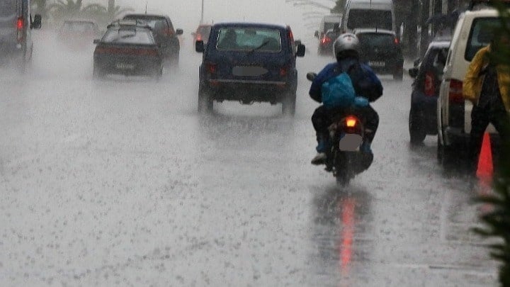
Severe weather is sweeping across much of Greece on Sunday, February 1, as a powerful storm system brings prolonged downpours, intense thunderstorms, hail, and very strong winds. The system is affecting seven regions and creating widespread disruption risks.
The National Meteorological Service released an updated emergency bulletin early in the day and warned that dangerous conditions will last for many hours. Forecasters emphasize that the main threat comes not only from rainfall intensity but also from the long duration of storm activity across multiple areas.
Meteorologists track the system in two main phases and expect it to impact Attica as well, with another burst of severe storms likely later in the evening.
Areas Facing the Strongest Impact
Forecast data shows the heaviest rain and thunderstorm activity in Thessaly, especially in the Larissa and Magnesia regional units, including the Sporades islands. Storm fronts are also moving through Pieria, Imathia, and parts of the northeastern Aegean.
Crete, western Central Greece, central Macedonia, eastern Central Greece, and Evia will also experience severe conditions. In Attica, storm strength will increase again toward the evening hours.
Colder air moving into the region will produce snowfall in semi-mountainous areas of northern Greece and in some lower elevation zones.
Storm activity will continue Monday across the eastern Aegean, while heavy rain and thunderstorms will persist into the morning in the Dodecanese and Crete.
Severe Storms Raise Travel and Flood Risk Warnings in Greece
Weather officials warn that the storms could disrupt transportation and daily movement. Drivers face poor visibility and standing water on roads, conditions that slow traffic and raise accident risk.
Low-lying urban districts face a higher chance of flash flooding, while flat inland areas may collect large volumes of runoff. Coastal and island zones will see the strongest winds, with gusts reaching force 9 Beaufort (39 to 54 miles per hour (mph)) and creating hazardous sea conditions.
Even if rainfall weakens for short periods, instability will continue across the country. Forecast models indicate another round of strengthening storms later in the afternoon and evening, especially in northern and eastern regions.