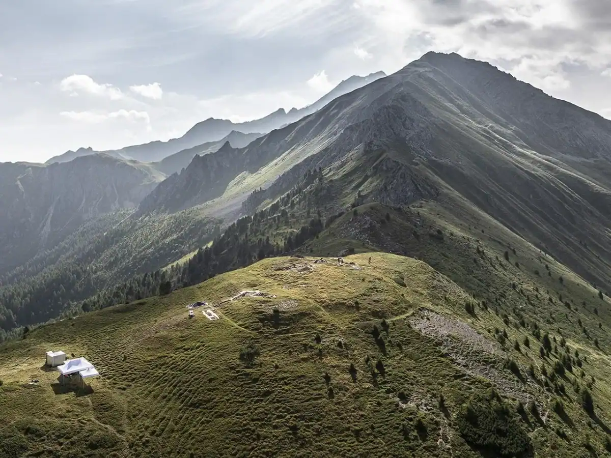
 The ancient Roman military camp was discovered at 2,200 metres in a remote region of the Swiss Alps. Fortified by three ditches and a rampart, it provided panoramic views of the surrounding valleys. Credit: Andrea Badrutt/Chur.
For two thousand years, the mountain kept Rome’s secret.
High above the valleys of southeastern Switzerland, where the air thins and snow can linger into summer, three shallow scars circled a hilltop. They appeared natural enough: modest folds in a landscape already crumpled by ice and stone. Yet they had not been carved by glaciers.
Roman soldiers had dug them.
At Colm la Runga, 2,200 metres (7,218 feet) above sea level, archeologists have identified a fortified military camp dating to the final decades of the first century B.C. Three defensive ditches and an earthen rampart enclosed the summit. Below it, almost 900 metres down the mountainside, Roman troops appear to have fought the local Suanetes around the year 15 B.C.
It sounds like this is yet another fort to the immense catalogue of Roman military sites. Yet, by connecting a camp, a battlefield, and a chain of Alpine passes, the discovery allows researchers to follow an invading, still-expanding empire across several dozen kilometres. It outlines a stark reconstruction of how an empire swallowed a mountain world.
An Empire Climbs Into the Clouds
To Augustus, Rome’s first emperor, the Alps were not idyllic scenery. They were a problem.
The new emperor had survived the one-year third civil war and presented himself as the man who had finally restored peace to the realm. Yet the Alpine peoples still controlled routes linking northern Italy with the province of Gaul (conquered just a few decades earlier by Julius Caesar), the Rhine and the Danube. Roman writers accused some mountain tribes of raiding travellers and threatening the lowlands, although such claims also supplied Rome with a convenient justification for conquest.
In 15 B.C., Augustus sent his stepsons Tiberius and Drusus to battle against the Raetians and Vindelicians controlling these passes. Roman forces advanced through several valleys at once, turning the geography of the Alps against the communities that inhabited them. The campaign opened routes to the Danube and strengthened Rome’s northern frontier, paving the way for further expansion toward Germany.
×
Thank you! One more thing…
Please check your inbox and confirm your subscription.
One Roman column apparently travelled through the Bergell valley, crossed the Septimer Pass and moved north toward Tiefencastel. Near the Crap Ses gorge, it encountered local fighters, probably Suanetes, one of the peoples later named on Augustus’s victory monument at La Turbie.
The camp above them occupied an extraordinary position. Roman soldiers standing on Colm la Runga could survey the Landwasser, Albula, Domleschg and Surses valleys, while also watching the important passage through Lenzerheide. The site offered advanced warning, surveillance and control — the fundamentals of Roman martial prowess distilled into a single panorama.
It remains unclear whether the Romans built the fort before the battle as a staging base, during the campaign as an observation post or afterward to secure their victory.
A Battle Written in Lead and Iron
 An arrowhead found at the ancient Roman military camp. Credit: Andrea Badrutt/Chur.
Until recently, Roman Switzerland seemed strangely peaceful in the archeological record. Villas, roads, settlements and monuments survived, but researchers had identified no Roman battlefield within the country.
Crap Ses changed that.
Across roughly 35,000 square metres of mountainside, archeologists, students and volunteer detectorists found thousands of military objects. They recovered sword fragments, shield fittings, brooches, arrowheads and lead sling bullets. Some bullets carried the marks of Rome’s 3rd, 10th and 12th Legions, suggesting that detachments from several units fought there.
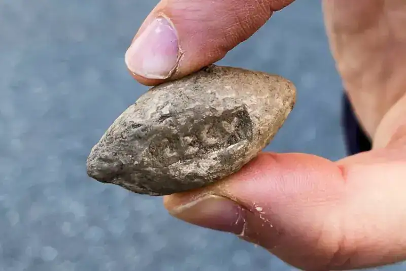 A lead slingshot bullet found on the Swiss battlefield that belonged to the 10th Roman legion. Credit: Simon Bradley/SWI swissinfo.ch
Researchers have provisionally estimated that around 2,000 Roman troops confronted between 500 and 1,000 local fighters. They suspect the Romans opened the battle with arrows, bolts and sling bullets before driving the Suanetes across the terrain, although no surviving ancient account describes the clash.
“This is the first time that remnants from a Roman battle site have been found in Switzerland,” project leader Peter-Andrew Schwarz told SWI swissinfo.ch in 2021.
“It seems that the Romans attacked their enemy on one side of the valley and then drove them over a river to the other side, before attacking again.”
Archeologists have mapped around 2,500 hobnails shed from Roman military sandals. Each nail corresponds to a Roman soldier climbing, running, turning or perhaps falling. When plotted together, these scraps of iron can reveal formations and movements that no Roman historian bothered to record. Researchers’ provisional scenario suggests that the Romans opened with long-range fire, attacked the Suanetes on one side of the valley, drove them across a river and renewed the assault on the opposite bank. The hobnail analysis may eventually sharpen that picture, but researchers have not yet published a detailed reconstruction based on the nails alone.
No human remains have emerged. The dead may have been recovered and cremated, leaving discarded weapons and broken equipment as the battle’s only witnesses. The good gear was looted and reused elsewhere.
The Fortress That Lasers Found
 Test pit to confirm LiDAR data. Credit: Andrea Badrutt / Chur
The camp might have remained invisible were it not for LiDAR.
The technology fires laser pulses from an aircraft and measures how quickly they return. Researchers use the time difference measurements to construct precise models of the ground, exposing tiny variations that vegetation, shadows and uneven terrain can conceal.
In autumn 2023, a volunteer examining high-resolution terrain data noticed an unusual formation at Colm la Runga. On the digital model, the hilltop’s apparent wrinkles resolved into an organized enclosure. Three ditches and a rampart followed deliberate lines around the summit.
Test excavations confirmed that people had shaped the ground. Archeologists then found the Roman weapons, equipment and boot nails mentioned earlier inside the fortifications. Most significantly, lead sling bullets bore the stamp of the 3rd Legion — one of the units represented on the battlefield below. The artefacts also dated the two sites to the same broad period.
The camp formed part of a military landscape that included the battlefield, an observation post at Plang Ses and routes stretching south toward the Septimer Pass.
Excavations began inside the enclosure in 2024 and continued in August 2025, while researchers analyzed the earlier discoveries. The wider CVMBAT project remains active through 2027, meaning the camp’s dimensions, internal buildings and exact role may still change as new evidence emerges.
The Volunteers Who Found an Invasion
 Credit: Thomas Kern/Swissinfo.ch
It wasn’t just professional archeologists that were involved. Volunteer detectorists, for instance, were paramount to uncovering both battlefield and camp. In 2018, amateur archeologist Lukas Schmid began finding Roman objects in an area that experts had considered largely exhausted. Over three years, he recovered around 250 pieces, including an elaborately decorated Roman dagger that helped prompt the full-scale investigation.
“Without detectorists like Lukas, we would have had no knowledge of this site,” Schwarz told SWI swissinfo.ch. “He was the one to make the first important finds.”
Another volunteer later noticed the hilltop enclosure in the LiDAR imagery. The collaboration reflects a wider change in Swiss archeology, where licensed detectorists increasingly work alongside universities and cantonal services.
The camp helps archeologists connect the battlefield at Crap Ses with the wider Roman advance through the Alps. Together, the sites show where troops travelled, where they stopped and where they fought.
Much remains uncertain, including exactly how the battle unfolded and how long the camp remained in use.