
 Whympr is expanding its digital reach into Italy, integrating high-detail 4Land topographic maps that cover iconic regions like the Dolomites and the Aosta Valley. | Photo: Whympr
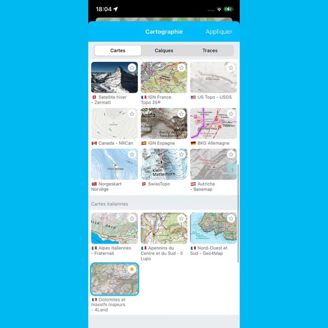
Chamonix-based outdoor platform Whympr has announced the integration of 4Land Italian maps into its mobile application, significantly expanding its topographic coverage of the Italian Alps and surrounding regions. Effective April 15, 2026, the update provides detailed mapping for essential outdoor territories including the Dolomites, Aosta Valley, and Tuscany.
The new 4Land layers utilize a 1:25,000 scale, a resolution specifically chosen for its readability during hiking and demanding alpine activities. Coverage includes the Italian section of the Tour du Mont-Blanc, the Alta Via in the Dolomites, and diverse coastal routes on Elba Island.
This integration establishes Whympr as the only application globally to provide a single interface and subscription for Italy’s four major map providers: Geo4Map, Il Lupo, Fraternali, and 4Land. In an email to SnowBrains, Whympr CEO Tim Maclean highlighted the exclusivity of the new offering:
“We are very proud of our Italian topographic map collection as we are today the only app in the world that offers an access to almost all key outdoor areas in Italy for only 25€ per year.”
 Whympr maps. | Photo: Whympr
Technical Leap in Mountain Mapping
The expansion into Italy builds on Whympr’s recent technical milestones in the Mont Blanc Massif. In December 2025, the platform released a high-resolution winter satellite map with thirty-centimeter-per-pixel clarity, allowing users to identify crevasse lines and individual ski tracks. This is paired with a 3D engine utilizing LiDAR technology to provide vertical precision down to ten centimeters.
While the ultra-HD winter satellite imagery is currently focused on the Mont-Blanc region, the new 4Land topographic layers provide a high level of detail for planning and navigation across the Italian peninsula. The platform also manages a database of over one hundred thousand documented routes, real-time avalanche bulletins, and community condition reports.
How to Access Italian Map Layers
The 4Land maps are included at no additional cost for subscribers of the Italian maps pack. Users can activate and use the new layers through the following steps:
Open the Whympr app and navigate to the “Shop” subscription section.
Select the “Italian Alps Maps” pack, priced at €24.99 per year for unlimited access.
Select the 4Land layer from the map layers menu icon on the main interface.
Whympr emphasizes that these digital tools are intended to support, rather than replace, real-world mountain judgment and safety protocols. As the company continues to acquire high-resolution data, it is increasingly viewed as a successor to platforms like FATMAP for the modern mountain athlete.
 Photo: Whympr