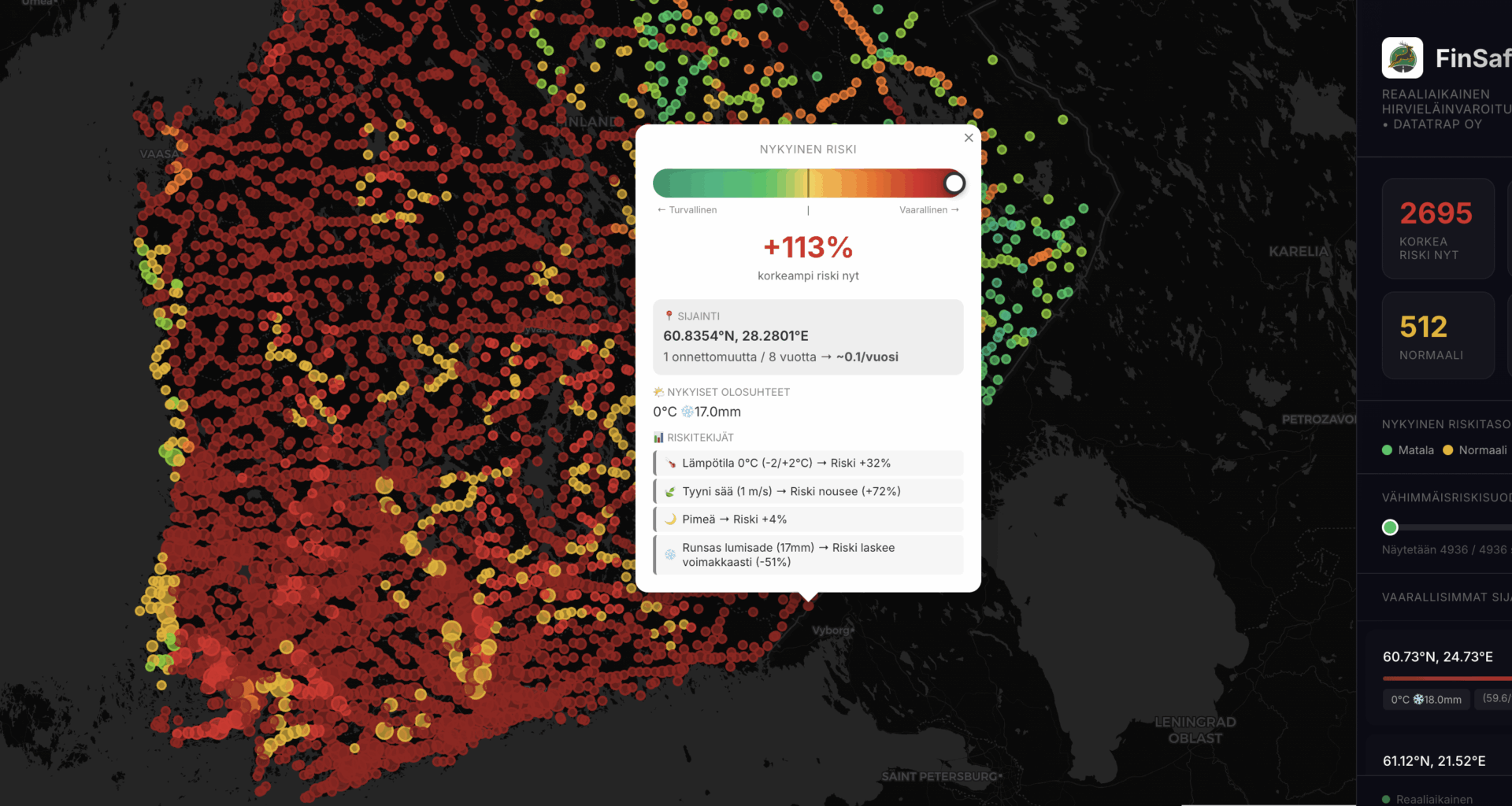
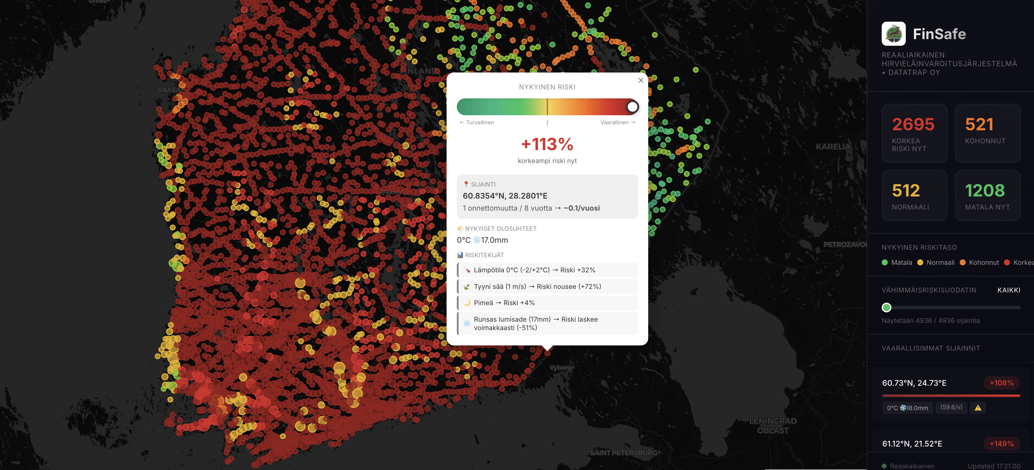
We analyzed 103,386 verified wildlife collisions in Finland and combined them with live weather, daylight simulation, and seasonal patterns.
The result is a real-time risk map that updates every 10 münutes and shows where wildlife-related accidents are most likely to occur right now — not just where they happened in the past.
Built in Riihimäki.
If people are interested, I can also share:
– a 24-hour risk simulation
– municipality-level dashboards
– or API access for research and pilots
—
orhangazikaramanoglu
1 comment
Looks super fucking useful with 90% of roads being deepest red lol