[OC] Barrow Locations in Ireland — Sarquin Tags:Ireland 2 comments You can see the interactive map of barrow locations along with a more detailed overview of their classification here: [https://www.danielkirkpatrick.co.uk/irish-history/irish-barrows-map/](https://www.danielkirkpatrick.co.uk/irish-history/irish-barrows-map/) For those who want to see the data sources check out [NMS here, ](https://www.archaeology.ie/collections-and-publications/publications/monument-class-and-scope-notes/)and the [UK Open Data here](https://www.data.gov.uk/dataset/46240fa5-db15-469e-b1c8-0460504b951c/northern-ireland-sites-and-monuments-record). For the tooling, I used QGIS and PowerQuery (Excel). The online interactive map was made in ArcGIS with initial data cleansing in QGIS. I would love a barrow but theres no room in the shed so i use gorilla buckets. Stackable baby. Ulster archaeological society recent upload talking about Mitchelstown barrow among other things in a very interesting talk Leave a ReplyYou must be logged in to post a comment.
You can see the interactive map of barrow locations along with a more detailed overview of their classification here: [https://www.danielkirkpatrick.co.uk/irish-history/irish-barrows-map/](https://www.danielkirkpatrick.co.uk/irish-history/irish-barrows-map/) For those who want to see the data sources check out [NMS here, ](https://www.archaeology.ie/collections-and-publications/publications/monument-class-and-scope-notes/)and the [UK Open Data here](https://www.data.gov.uk/dataset/46240fa5-db15-469e-b1c8-0460504b951c/northern-ireland-sites-and-monuments-record). For the tooling, I used QGIS and PowerQuery (Excel). The online interactive map was made in ArcGIS with initial data cleansing in QGIS.
I would love a barrow but theres no room in the shed so i use gorilla buckets. Stackable baby. Ulster archaeological society recent upload talking about Mitchelstown barrow among other things in a very interesting talk
![[OC] Barrow Locations in Ireland](https://www.europesays.com/forums/wp-content/uploads/2026/02/nd3pfk03zugg1-1500x1024.jpeg)
2 comments
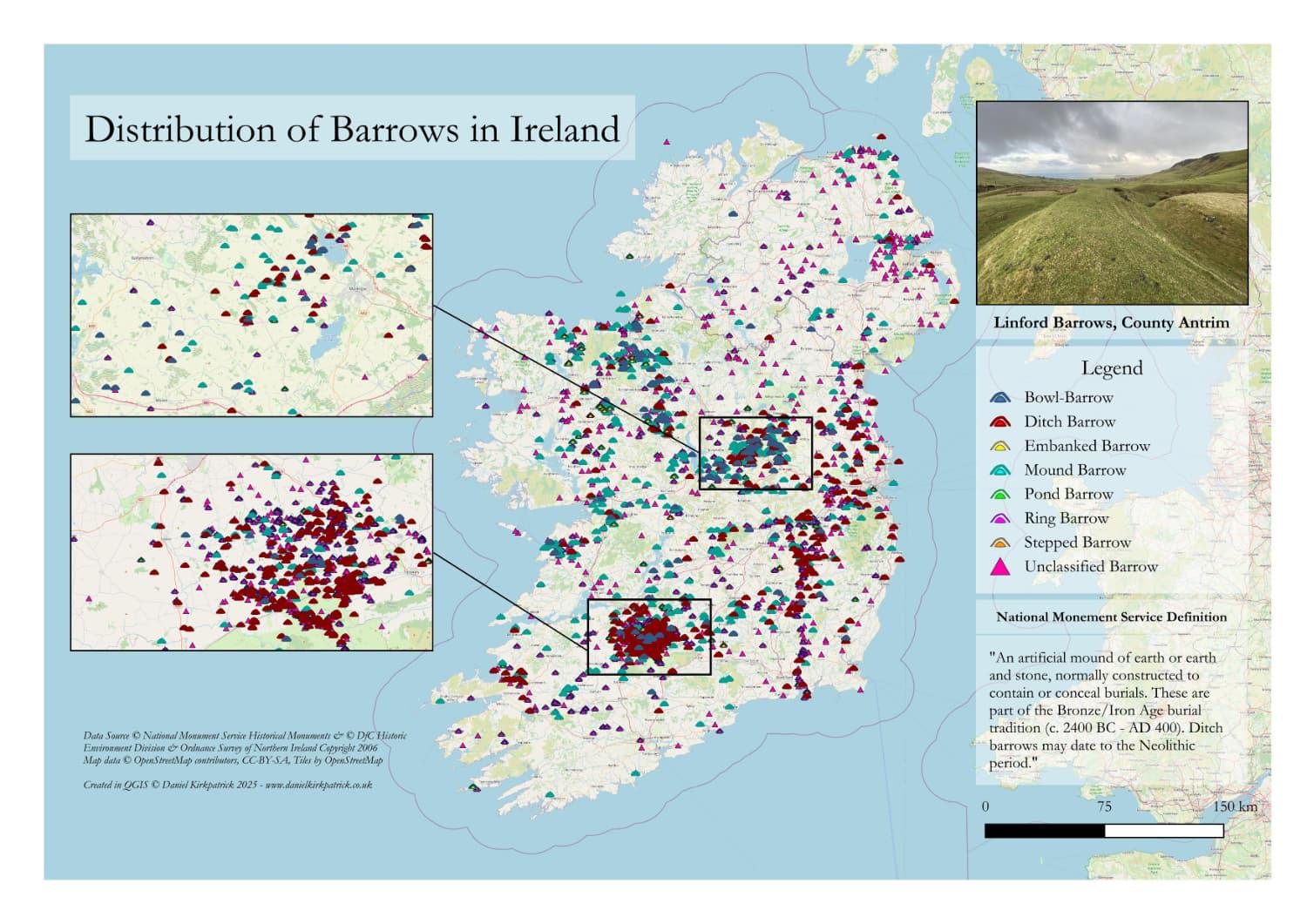
You can see the interactive map of barrow locations along with a more detailed overview of their classification here: [https://www.danielkirkpatrick.co.uk/irish-history/irish-barrows-map/](https://www.danielkirkpatrick.co.uk/irish-history/irish-barrows-map/)
For those who want to see the data sources check out [NMS here, ](https://www.archaeology.ie/collections-and-publications/publications/monument-class-and-scope-notes/)and the [UK Open Data here](https://www.data.gov.uk/dataset/46240fa5-db15-469e-b1c8-0460504b951c/northern-ireland-sites-and-monuments-record). For the tooling, I used QGIS and PowerQuery (Excel). The online interactive map was made in ArcGIS with initial data cleansing in QGIS.
I would love a barrow but theres no room in the shed so i use gorilla buckets. Stackable baby.
Ulster archaeological society recent upload talking about Mitchelstown barrow among other things in a very interesting talk