Parts of Queensland are this afternoon bracing for the beginning of days of possible severe storms and heavy rainfall.
The Bureau of Meteorology this afternoon issued warnings for severe, slow-moving storms bringing heavy rainfall to parts of the south-east coast including Brisbane, Ipswich, Beenleigh and Jimboomba, Nambour and Kilcoy, the Southern Downs and Toowoomba, Darling Downs and Granite Belt and the Capricornia, Wide Bay and Burnett, Central Highlands and Coalfields including Bundaberg, Calliope and Baralaba.
Heavy rainfall that may lead to flash flooding are possible in these areas as well as possible large hailstones in the Darling Downs and Granite Belt.
 Severe thunderstorms could bring flooding to Queensland after Christmas. (Weatherzone)
“A very moist atmosphere is in place over most of the state extending from a low pressure system and developing monsoon in place over the Northern Territory,” the warning reads.
“Slow moving severe thunderstorms have developed in this moist and unstable environment over the southeast this afternoon, which may persist throughout the afternoon and into the evening.”
Storms are possible through to the weekend with heavy rainfall in the north and centre of the state which could lead to post-Christmas flooding in parts of Queensland.
Multiple roads are likely to be affected by flooding, with catchments already wet from recent rain.
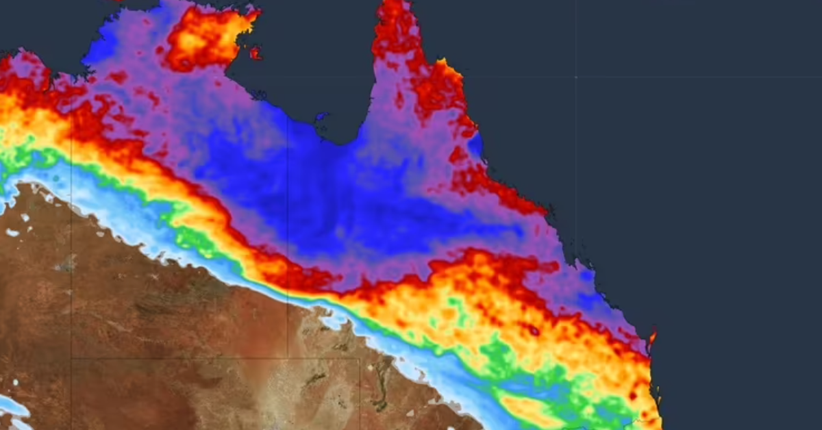
And an initial flood watch warning has been issued for parts of north-west Queensland, due to the same trough.
 A monsoon trough is expected to bring heavy rain. (Weatherzone)
“Riverine flooding is possible from Wednesday with road closures and community isolation likely,” the warning read.
The Bureau said flooding in the state’s south-west was not expected imminently but could be possible in the coming weeks as the extra water made its way downriver.