Some hobbyists believe there is potential for a somewhat similar event to unfold over the coming weeks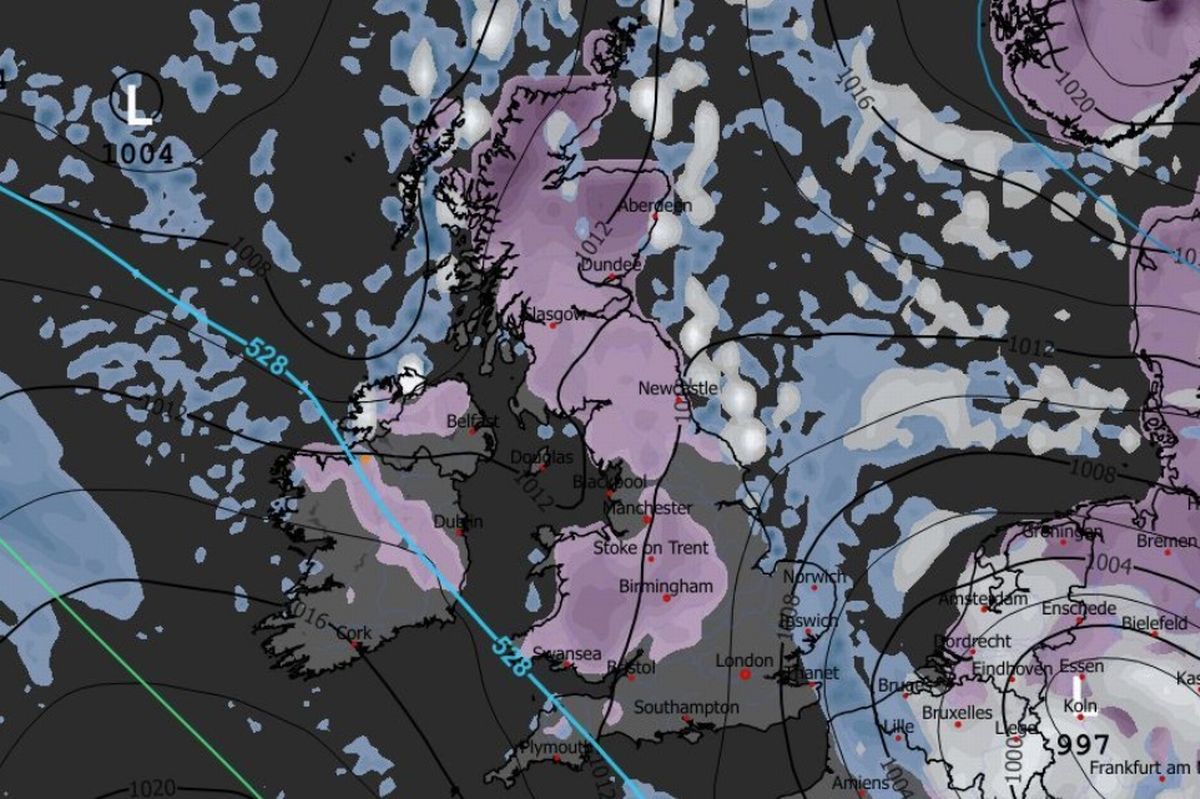
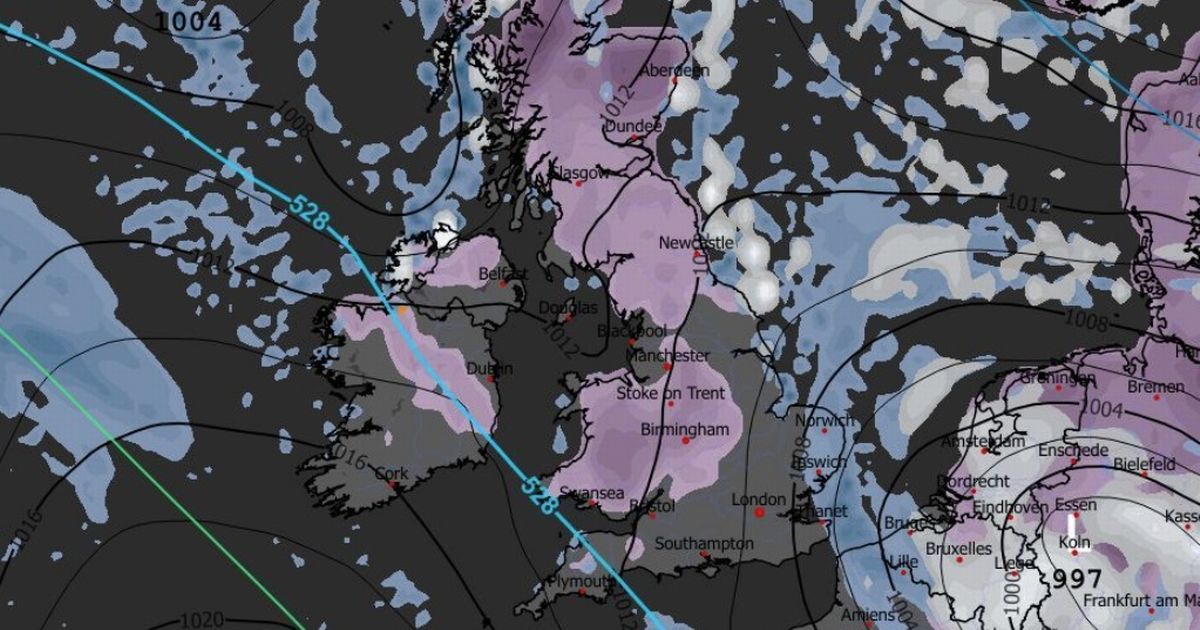
This weather map from WXCharts.com shows some snowfall across parts of Ireland this weekend. (Image: WXCharts.com)
Met Eireann has weighed in on the rumoured return of the notorious ‘Beast from the East’ in 2026.
The beginning of the new year brought wintry conditions to many parts of Ireland. Schools across the island were forced to close as a result of snowfall, ice and dangerous driving conditions.
The north of Ireland is set for more wintry showers this weekend with all six counties observing a 18 hour long Status Yellow weather warning for snow and ice from 5pm on Friday.
The persistency of the Arctic blast has many weather experts and hobbyists alike ruminating over a possible return of the notorious ‘Beast from the East’ which visited havoc and chaos upon Ireland in 2018.
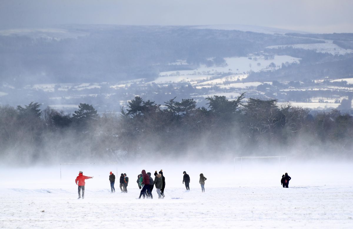
Enjoying the snow in the Phoenix Park, Dublin during the 2018 ‘The Beast of the East’.(Image: Colin Keegan, Collins)
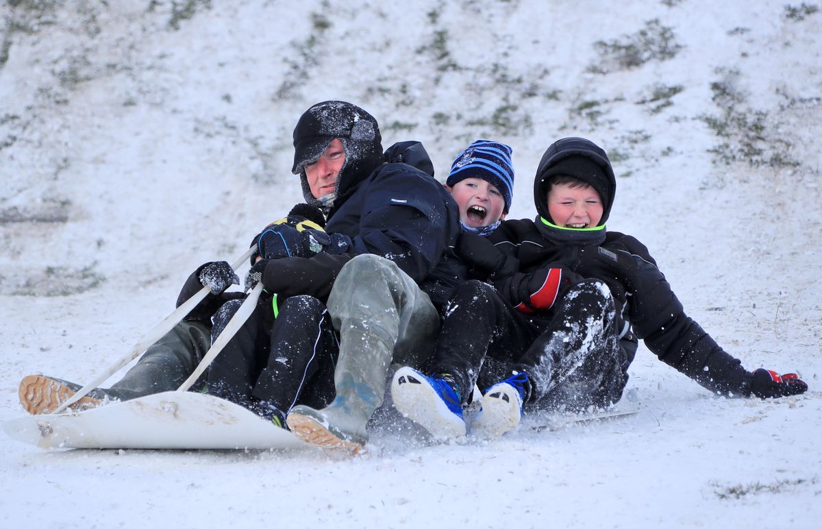
Children playing in the snow in the Dublin during ‘The Beast from the East’ in 2018. (Image: Colin Keegan, Collins)
The 2018 ‘Beast from the East’ unfolded at the end of February when the northern polar jet’s flow direction abruptly changed, drawing cold air towards Ireland from the east.
Some hobbyists believe there is potential for a somewhat similar event to unfold over the coming weeks but this very much flies in the face of what Met Eireann experts are saying.
While Met Eireann concedes there may be wintry conditions in some parts of the country over the comings days and weeks, no where does it suggest that the sub-zero drama of 2018 could return in early 2026.
From Monday January 12 to Sunday January 18 Met Eireann’s forecast is for “low pressure” and a return to “near normal” temperatures.
“There is a strong signal for low pressure to drive the weather pattern through week one.
“Temperatures are expected to recover to near normal for January, although this does not preclude the chance of night-time frosts. Rainfall is signalled to be a little above normal overall and given the time of year, some of this could be wintry at times,” said Met Eireann.
Met Eireann National Outlook:
Overview: Low pressure dominates, with spells of wet and sometimes windy conditions. Turning milder from Sunday.
Saturday night: Rain and drizzle in the west will extend eastwards, becoming widespread. Lowest temperatures of 0 to 2 degrees in the north and east initially, becoming milder with the rain with lowest temperatures generally of 3 to 7 degrees. Light to moderate southerly winds will increase fresh to strong.
Sunday: Windy with widespread outbreaks of rain continuing, turning heavy in places with a chance of hail. Milder with highest temperatures of 8 to 12 degrees. Southerly winds will be fresh to strong reaching near gale force at times.
Sunday night: Outbreaks of rain will gradually clear northeastwards with showers and clear spells following. Lowest temperatures of 5 to 8 degrees, with southwesterly winds easing moderate to fresh.
Monday: A mix of sunshine and showers, merging to longer spells of rain at times. Highest temperatures of 8 to 11 degrees, with moderate to fresh southwesterly winds.
Tuesday: There is uncertainty in the details, but likely a wet start with widespread outbreaks of rain, clearing to bright spells and showers. Highest temperatures of 7 to 10 degrees with light to moderate southwesterly winds.
Further outlook: Current indications show a continuation of unsettled conditions.
Subscribe to our newsletter for the latest news from the Irish Mirror direct to your inbox: Sign up here.