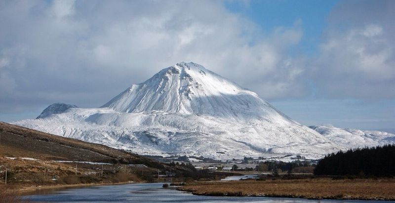
Main pic: A snowy Errigal, beautifully captured this week by Marcella Crossan/Marcella’s Photography.
It will be cold to start this morning across Ulster, with frost and icy patches slow to clear.
However, it will be a bright day overall with spells of sunshine and scattered showers. The showers will be a wintry mix of rain, hail and sleet, with a little snow possible over higher ground and a chance of isolated thunderstorms. Highest temperatures of 3 to 6 degrees, with mostly light westerly winds.
Tonight will also be cold and mostly dry, with scattered wintry showers continuing. Lowest temperatures of -3 to 0 degrees, with frost and ice patches developing. Light westerly breezes will allow patches of fog or freezing fog to form in places.
It will also start cold tomorrow morning with frost, ice and fog slow to clear. Dry and bright for most with isolated showers. Cloud will build from the west through the afternoon with outbreaks of rain and drizzle moving in later. Highest temperatures of 3 to 7 degrees with mostly light southwesterly breezes, backing southerly tomorrow evening.
Cold day in store with risk of snow on higher ground – Met Éireann was last modified: January 9th, 2026 by Staff Writer
Tags: