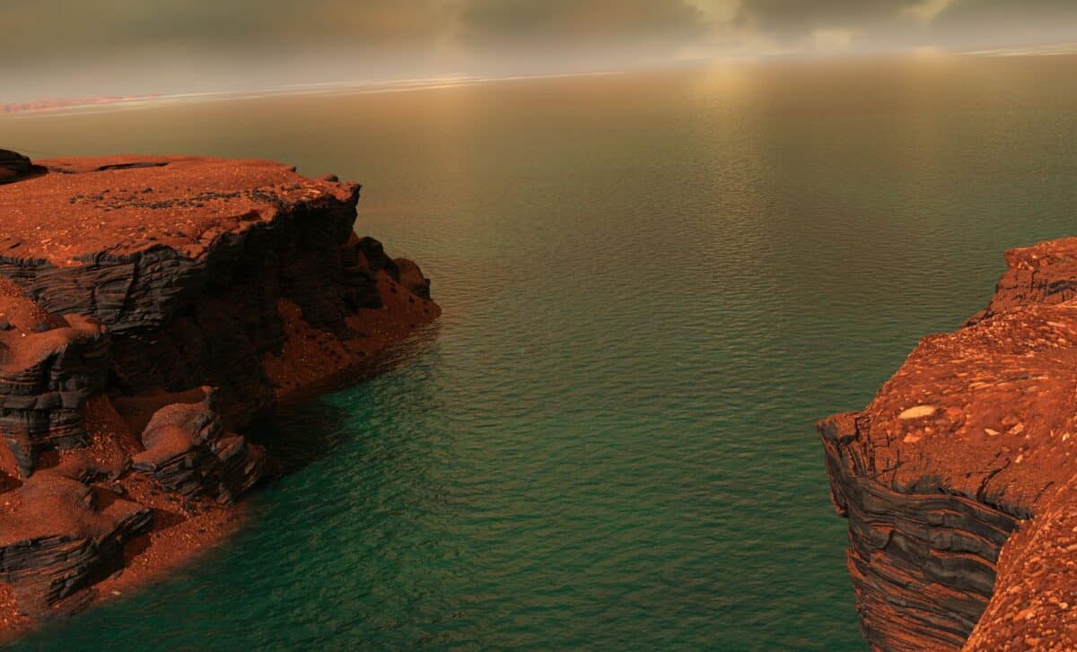
Long thought of as a dry, barren world, Mars may once have shimmered with shades of blue. A new study reveals the discovery of ancient river deltas on the Red Planet, offering the clearest evidence yet of a massive ocean that covered much of its northern hemisphere some 3 billion years ago.
The presence of liquid water on Mars has long been a subject of interest in planetary science, closely tied to the question of habitability. Earlier studies hinted at ancient rivers and oceans, but direct evidence remained elusive. This new research changes that, offering what scientists describe as unmistakable signs of a Martian coastline.
Delta-like Features in Mars Canyon
According to findings published in npj Space Exploration, researchers mapped out delta-like structures in the southeastern region of Coprates Chasma, a branch of the sprawling Valles Marineris. These structures, described as “scarp-fronted deposits,” align closely with the geomorphology of fan deltas on Earth.
“The structures that we were able to identify in the images are clearly the mouth of a river into an ocean,” said Fritz Schlunegger, professor at the University of Bern.
The mapping work was led by Ignatius Argadestya, a doctoral student supported by the Swiss Government Excellence Scholarship, who said he was especially struck by the resemblance between Martian mountains and valleys and Earth’s landscapes. His observations were grounded in images captured by the CaSSIS camera on ESA’s ESA – ExoMars, along with data from the Mars Express and Mars Reconnaissance Orbiter missions.
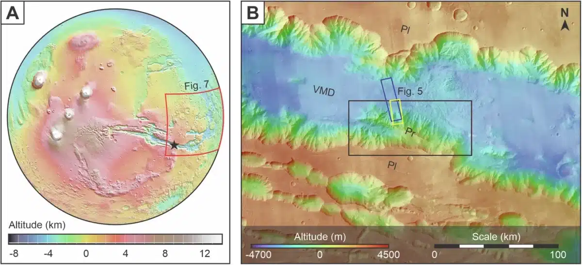 Martian topography showcasing the location of the research site. Credit: npj Space Exploration
High-Resolution Images Confirm Ancient Mars Coastlines
The breakthrough was made possible by advances in planetary imaging. The CaSSIS instrument, developed at the University of Bern, has been providing detailed color imagery of the Martian surface since 2018. Professor Nicolas Thomas, who oversaw its development, noted the camera’s critical role:
“The images are regularly used in scientific studies. I am personally very pleased that the images have now also been used in a geomorphological study by the Institute of Geological Sciences.”
The team used these tools to reconstruct what appears to be a vast ancient shoreline, tracing where rivers once fed into an ocean. The sedimentary features observed were not just similar to those on Earth, they matched them in form and structure, strongly suggesting the presence of a stable, long-term body of water.
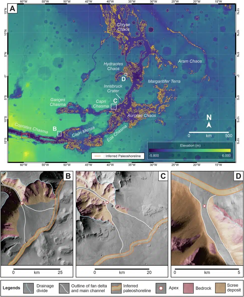 Distribution of scarp-fronted deposits across Valles Marineris. Credit: npj Space Exploration
Mars May Have Hosted an Arctic-Sized Sea
The scale of the ocean described in the study is striking. The researchers estimate that it covered a region comparable in size to Earth’s Arctic Ocean, extending across the planet’s northern hemisphere. This claim builds upon earlier theories about Martian oceans but strengthens them with more precise imaging and topographic analysis. While previous models were often speculative or based on indirect evidence, the new study relies on observable geomorphological features.
“Earlier claims were based on less precise data,” said Schlunegger. “Our reconstruction of the sea level is based on clear evidence for such a coastline.”
Even though wind-driven erosion has reshaped the Martian surface over time, the original shape of the delta structures remains visible beneath the dunes that now cover them.
The team’s next objective is to explore the mineral composition of the ancient soils in these regions. As Argadestya noted, the study opens a new chapter in Martian geology, enabling researchers to apply Earth-based techniques to reconstruct Mars’ environmental history.