Storm Ingrid was named by the Portuguese Met Service (IPMA) earlier this week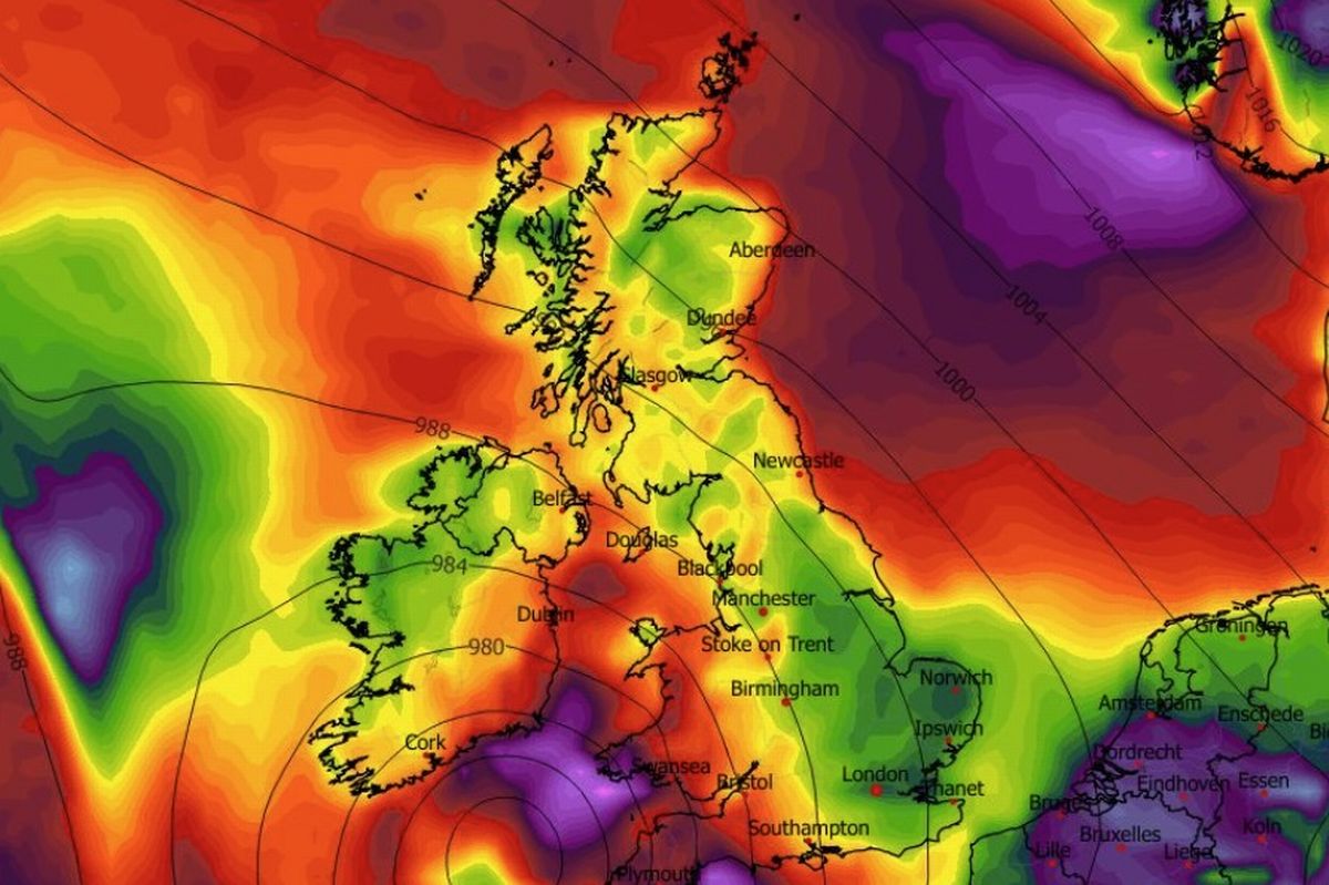
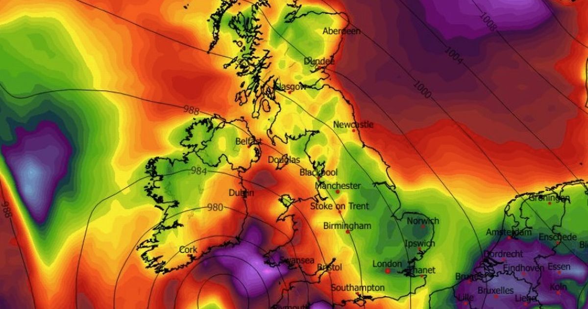
The remnants of Storm Ingrid are expected to hit Ireland in the next 48 hours. (Image: WXCharts.com )
Storm Ingrid is set to impact Ireland over the next 48 hours.
The storm was named by the Portuguese Met Service (IPMA) and is set to strike Ireland over the weekend.
One Irish weather said that despite the fact the storm will have significantly weakened by the time it arrives in Ireland it will still bring with it strong winds and the risk of flooding.
“For those asking about #StormIngrid which is impacting France today, thankfully the storm will weaken as it moves up towards Ireland over next 36 hours but it will bring us a wet and windy Saturday with strongest winds into Southeast and East. Plenty more rain too sadly with risk of flooding increasing,” wrote Carlow Weather’s Alan O’Reilly on X.
Echoing Carlow Weather’s analysis was Meteorologist Cathal Noonan of Ireland’s Weather Channel who Facebook. Cathal says Storm Ingrid could bring with it gale force winds along the Irish coast and even said that there was the possibility of snow next week.
“It is expected over the next couple of days we will further outbreaks of rain, some gusty winds at times in the south and southeast – that’s in relation to Storm Ingrid,” said Cathal.
“Named by the Portuguese Meteorological Society, it’s not expected to land any significant blows across Ireland other than bringing further spells of heavy rain, which of course you could say is significant given the rain we have seen over the last couple of days and we are likely to see next week but the remnants of Storm Ingrid will be most felt across the south and southeast of the country.”
Cathal continued: “Heavy rain here and the possibility of some gale force winds tomorrow (Friday) along coastal areas. Saturday itself is another mixed day. That low pressure weakens and sits across the middle of the country and brings with it plenty of heavy showers or showery outbreaks of rain.
“On Sunday, the signal is for pretty mixed weather – we see areas of low pressure moving in from the west once again through the start and the middle of next week with the possibility of some wintry hazards on the northern flanks of these systems depending on how north or south the jet stream sits itself and where those areas of low pressure track exactly.”
He added: “It looks like some parts of Ulster could see a little bit of snow, maybe into Monday night Tuesday, that’s one to keep an eye on but for the majority of people it is going to be cold rain unfortunately but a lot can change at his short notice. Cold air is pretty close by it wouldn’t take a lot for those wintry hazards to become more widespread but it’s not something I am overly concerned about at the moment.”
Met Eireann National Outlook:
Overview: Low pressure continuing to dominate, bringing spells of wet and often breezy weather and with just limited bright spells.Saturday Night: Mostly cloudy with outbreaks of rain and drizzle. Lowest temperatures of 3 to 6 degrees, with moderate to fresh, even strong at times, easterly winds becoming cyclonic variable through the night.Sunday: Starting off generally cloudy with widespread outbreaks of rain and drizzle. These outbreaks will become less frequent and widespread through the day with some sunny spells developing in places. Highest temperatures of 5 to 9 degrees, with moderate to fresh cyclonic variable winds becoming mostly easterly and easing.Sunday night: Sunday night will be mostly dry apart from a few light outbreaks of rain or drizzle. While there will be clear spells at first, cloud will begin to build from the southwest through the second half of the night, with more persistent rain following into the southwest towards morning. Lowest temperatures of 2 to 6 degrees, with light to moderate east to southeast winds.Monday: Cloudy, breezy, and wet with rain, heavy at times, spreading northeastwards across the country. Highest temperatures of 5 to 9 degrees, with moderate to fresh southeasterly winds, stronger on eastern and southeastern coasts.Tuesday: Some uncertainty in the detail but current indications are that conditions will be cloudier and wetter further east, and drier with the best of any bright spells further west. Highest temperatures of 4 to 8 degrees, with light to moderate northwesterly or variable winds.Further outlook: Low pressure continuing to dominate, bringing further unsettled and mixed conditions.
Subscribe to our newsletter for the latest news from the Irish Mirror direct to your inbox: Sign up here.