There are many issues around how flood warnings are currently managed and distributed in Ireland
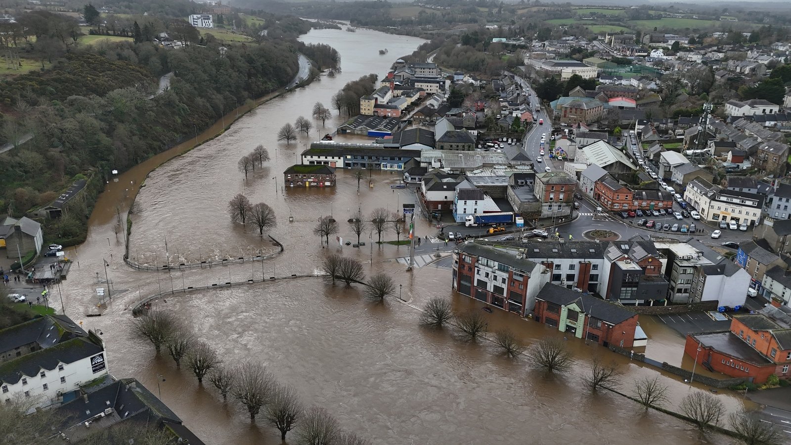
Many of those badly affected by the floods caused by Storm Chandra have talked about how they were taken by surprise by what happened, so is the current warning system up to the job? Dr Nick Scroxton from the ICARUS Climate Research Centre at Maynooth University discussed the current method of flood forecasting with Rachael English on RTÉ Radio 1’s News At One. (This piece includes excerpts from the conversation which have been edited for length and clarity – you can hear the discussion in full above).
“Currently we have an early warning system which works in the days ahead”, Scroxton explains. “Met Éireann is largely responsible for preparing that warning system, but there are major issues with that. The first is that Met Éireann doesn’t take ground conditions into account.
“With Storm Chandra, the rainfall was pretty heavy, but it wasn’t very extreme. It has been raining pretty much since January 19th so the very wet ground from previous rain events means that new rain doesn’t soak in and instead runs into the rivers.
We need your consent to load this rte-player contentWe use rte-player to manage extra content that can set cookies on your device and collect data about your activity. Please review their details and accept them to load the content.Manage Preferences
From RTÉ Radio 1’s Morning Ireland, Storm Chandra leaves devastation in its wake
“The second issue is the rainfall and flooding are very highly localised. These floods are often only hundreds of metres in scale, which means that it’s very difficult to predict them days in advance.”
One of the big issues is around distribution and dissemination of this information, explains Scroxton. “Met Éireann doesn’t believe it’s their remit to provide public flood warnings. Instead, the Flood Forecasting Centre provides guidance and advice to the emergency management and to local authorities.
“It’s the council’s responsibility based on this data, OPW flood maps and rainfall forecasts to provide flood warnings. To be honest, whenever you hear about a rainfall event or a storm coming, no one’s going to a council website to check to see if there’s a flood warning.”
From RTÉ News, Bunclody residents ‘devastated’ by Storm Chandra flooding
According to Scroxton, the situation is much different elsewhere. “Plenty of other countries have a second early warning system that operates in the hours to minutes ahead of flooding. In the US, for example, you can get early warning systems and push notifications for hail, tornadoes and flash flooding. They’re just sent out straight to everybody’s mobile phone in a certain area based on proximity to mobile phone masts when there’s a risk of that happening. You’re always going to give more people a warning than people who will be affected by the flooding.”
How precise is the information available to local authorities? “We really don’t have the data at the scale and resolution to pick up and predict flooding”, says Scroxton. “With rainfall during storms, we’re very good at predicting that over tens of kilometres, hundreds of kilometres, but often the heaviest bursts of rainfall that cause flash flooding occurs at a kilometre scale and we cannot predict this in advance.
“Based on ground conditions and the localised rainfall, we’re only getting flooding events in areas of a few hundred metres and obviously that’s very damaging to those areas. We really cannot predict exactly where flash flooding will occur and can only say roughly ‘the flash flooding will occur in a broader area’.”
Scroxton believes there are options to consider. “A rapid response Early Warning System for flash floods would use Ireland’s hydrometric network. 1,040 active sensors across Ireland’s rivers monitor river height and flow rate at 15 minute intervals.
“When rivers rise above a certain height or speed, an automatic alert could be triggered. For example, at Enniscorthy, a hydrometric station linked alert when waters rose above 3 metres would have been triggered at 2am, a good 12 hours before the river reached over 4.5 metres.
“While not perfect, such an alert could have alerted property owners near the river, potentially preventing thousands of euro of damage. With the hydrometric network available and push notification systems well tested in other countries, such a system is not beyond reach. A larger hydrometric network would protect more and more communities.”
Follow RTÉ Brainstorm on WhatsApp and Instagram for more stories and updates
The views expressed here are those of the author and do not represent or reflect the views of RTÉ