
Monday, 15 September 2025, 08:30
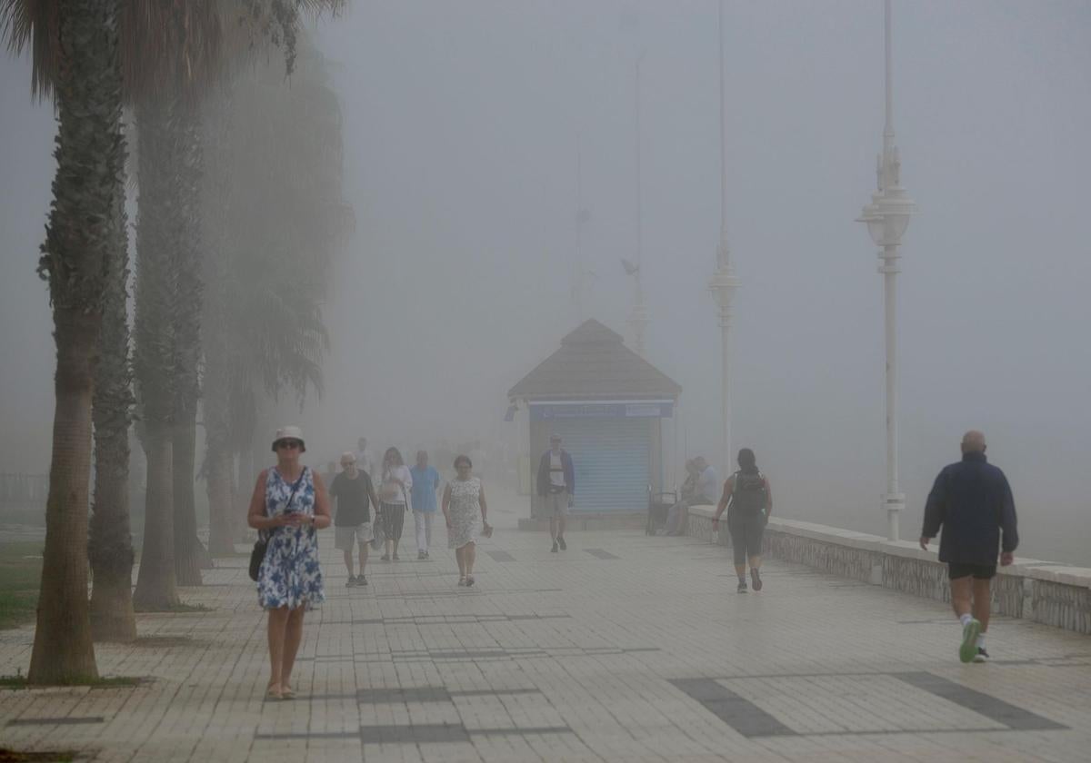
Those who were hoping to enjoy a day at the beach on the Costa de Sol yesterday came up against an autumnal weather phenomenon along many parts of the coastline of Malaga province that upset their plans and even forced the raising of the red flag on the beaches due to the lack of visibility. Thick ‘taró’ fog banks were present throughout the day in many coastal areas, and were accompanied by a drop in temperatures despite the terrestrial conditions.
Will the situation repeat itself again at the start of this week? The forecast for this Monday in Malaga from Spain’s state meteorological agency (Aemet) predicts slightly cloudy or clear skies in inland areas and again intervals of low clouds on the coast, with mist or fog banks. Winds will blow lightly from the east, with moderate intervals from the south inland in the afternoon.
Temperatures will drop slightly across the board, so in Malaga city the temperature is not expected to rise above 30C. In fact, according to forecasts, the thermometer will remain at 28 degrees, while the minimum will rise slightly to 21C (compared to 19 on Sunday).
Forecast for rest of Spain
Across the rest of Spain, the weather will remain stable on 15 September, with slighty cloudy or clear skies and no significant changes in temperature in most of the country, according to the Aemet forecast. However, the passage of an Atlantic front will leave cloudy and overcast skies in Galicia, Cantabrian and Pyrenees, with light rain moving from west to east and a tendency to clear in Galicia.
Likewise, abundant cloudiness in the eastern third will leave showers and thunderstorms that may be locally heavy in the eastern end of the Pyrenees and the Iberian system. Cloudy intervals are also expected in other mountains in the centre of the Spanish mainland, the Strait of Gibraltar, Alborán sea area and the western Canary Islands.
As for temperatures, maximum highs will not experience many changes in most of the country. However, in coastal Huelva, Alborán sea areas in the south of Spain, the Strait of Gibraltar, Galicia, the upper Ebro and the Cantabrian Sea there will be a drop. There will be an increase in Catalonia, the Canary Islands and Extremadura, where it will reach 38C in Badajoz. Temperatures are expected to exceed 34C in depressions in the southwest of the Spanish mainland and parts of the Canary Islands, reaching 36C in the Guadalquivir. Minimum temperatures will increase in most of the country, although decreases are expected in the northwest, and little change in the Canary Islands, the Mediterranean area and the southern third of the mainland. They will not fall below 20 degrees in the Mediterranean area and areas of the southwest.
More fog
In the morning, fog banks are expected in the northern and eastern thirds of the Iberian Peninsula and the Balearic Islands, more persistent in the Cantabrian Sea as the front passes and possible coastal mist in Alboran and high light haze in the Canary Islands.
As for the wind, in the Canary Islands the trade wind will blow with strong intervals and very strong gusts, as well as east and south components in high areas. As a result, north-easterly winds are expected on the south-eastern coasts of the Spanish mainland, easterly winds becoming northerly in Alborán and easterly winds with strong intervals in the Strait of Gibraltar. In the Cantabrian Sea and north in Galicia, northwest is forecast with strong intervals in Rías Baixas. In the rest of the country, light winds, predominantly east and south in the Balearic Islands and the eastern third of the peninsula, and west in the rest, with the north component increasing in the north of the mainland towards the end.