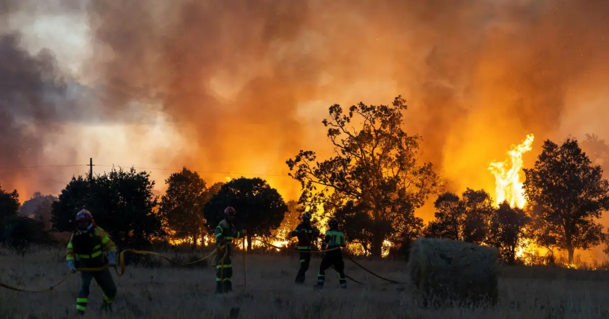
The heat will intensify today in the Balearics and in the east and south of the mainland, with maximum temperatures of up to 42 degrees and readings above 40 in the Ebro, Tagus, Guadiana and Guadalquivir valleys; these very high temperatures will raise the risk of wildfires to ‘very high or extreme’ levels across much of the country.
France, Spain and Greece battled major wildfires on Thursday as soaring temperatures, parched vegetation and powerful winds extended a summer of deadly fires, mass evacuations and mounting disruption across Europe.
The highest temperatures will be recorded today in Zaragoza, with a forecast high of 42 degrees, followed by Ciudad Real, Córdoba, Granada and Teruel, where thermometers will reach 41 degrees, according to the forecast by the State Meteorological Agency (Aemet).
Temperatures will also reach 40 degrees in Jaén, Lleida, Pamplona and Toledo, whilst Albacete, Huesca and Seville will reach 39 degrees. In Madrid, Cáceres, Cuenca, Girona, Logroño, Murcia and Badajoz, maximum temperatures of between 37 and 38 degrees are expected.
This second day of the summer’s fourth heatwave will continue into the night, with minimum temperatures not falling below 25 degrees in Jaén and Melilla, and 24 degrees in Alicante, Barcelona and Madrid. Almería, Castellón, Ceuta, Huesca, Málaga, Tarragona, Valencia, Zaragoza and the two Canary Islands’ capital cities will see minimum temperatures of 23 degrees.
The Canary Islands will also be affected by the heatwave, with temperatures exceeding 34–36 degrees across large areas throughout the week and very warm nights. In the mid-altitude areas of Gran Canaria, minimum temperatures could remain above 28 degrees.
In addition to the high temperatures and low humidity, there will be wind, which will be light during the night and in the morning but will pick up from midday onwards in the interior of the mainland, blowing from the south and south-west with gusts that could exceed 30 or 35 kilometres per hour – and may even be locally stronger – which will hamper efforts to extinguish forest fires.
In addition to the heat, airborne dust is expected, causing haze in the east and south of the peninsula, the Balearics and the Canary Islands – particularly the eastern islands – which will worsen air quality and increase smoke levels in areas near the forest fires.
On Friday and over the weekend, temperatures are most likely to fall again along the Cantabrian coast and remain unchanged in the rest of the country, where the intense heat will continue; furthermore, locally heavy showers and thunderstorms could develop in the Iberian System, the Pyrenees and surrounding areas.
Looking at provincial capitals, on this day – the last of July – the heat will continue, with Córdoba being the hottest capital, reaching 42 degrees. Granada, Teruel and Zaragoza will reach 41 degrees, whilst Ciudad Real, Jaén and Toledo will record highs of 40 degrees.
Temperatures will reach 39 degrees in Albacete, Badajoz, Murcia and Seville; 38 in Cuenca, Guadalajara and Lleida; and 37 in Cáceres, Girona, Huesca and Madrid. Night-time temperatures will also be high: Jaén will have the highest minimum, at 26 degrees, followed by Melilla, at 25, whilst Alicante, Ciudad Real, Madrid and Tarragona will not drop below 24 degrees.
Over the weekend – the first of August – the intense heat will persist, with maximum temperatures exceeding 37–39 degrees across much of the mainland interior and the Balearics; thermometers will reach between 39 and 41 degrees in the interior of the southern half of the mainland and between 38 and 40 degrees in the Ebro Valley and the north-eastern lowlands.
In the Canary Islands, temperatures will rise further, reaching 37–38 degrees in Gran Canaria and in inland areas of Fuerteventura, whilst highs of 39–40 degrees could be recorded in the mid-altitude areas on the southern slopes of Gran Canaria. From Monday onwards, although there is still a high degree of uncertainty, a trough is expected to arrive from the Atlantic, accompanied by a mass of cooler air, meaning the heat should begin to ease, bringing the heatwave to an end.