Areas of the coastline are at risk of flooding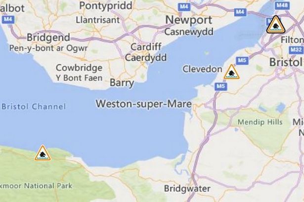 Flood alerts issued in the South West.(Image: Environment Agency)
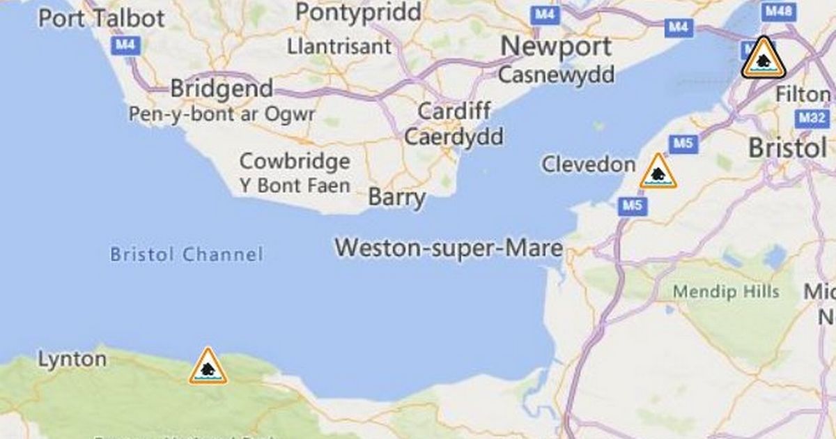
Flood alerts have been issued near Bristol for the next 24 hours due to high tides.
As some parts of the region were affected by rainfall, two alerts were issued near the city, and a third issued further down the coast, which has some areas of the coastline at risk.
A flood alert was issued north of Bristol, affecting the Severn Estuary at Severn Beach.
A large tidal surge is expected and there may be “overtopping and onshore flooding” as a result of the high water levels, according to the Environment Agency (EA).
The first forecast of the high water is at 7.15pm tonight (Tuesday, May 27).
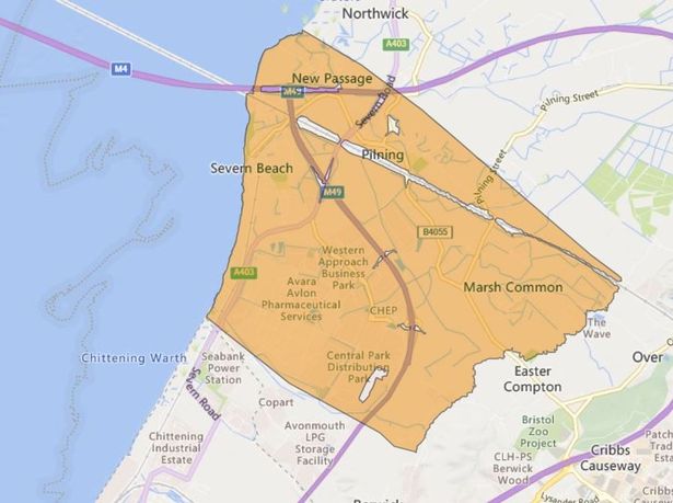 Flooding could affect the Severn Beach area.(Image: Environment Agency)
The forecast tide level is 7.13 mAOD with westerly force seven winds.
The areas most at risk include the Severn Estuary at Severn Beach. This includes New Passage and Pilning.
EA said: “A large tidal surge is expected with possible overtopping and onshore flooding as a result of high water levels.”
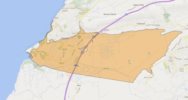 Flooding could affect a wide area of Clevedon.(Image: Environment Agency)
A second flood alert has been issued for the coast at Clevedon.
The EA posted that part of the town, stretching past Tickenham, may be affected by flooding tonight.
High tide is expected at 7.15pm with flooding possible between 5.15pm and 9.15pm.
The flood alert area is between Gullhouse Point and Marine Parade.
The tidal forecast said the peak level is expected at Avonmouth at 7.15pm, reaching 7.14 mAODN, with westerly force seven winds.
There is no property flooding expected.
EA said: “After the high tide this evening, the weather is more settled and no flooding is expected. We are closely monitoring the situation and checking flood defences.
“Be careful along beaches, promenades, coastal footpaths and roads as large waves and sea spray could be dangerous.”
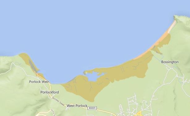 Flooding could affect the coastline at Porlock Weir tomorrow morning.(Image: Environment Agency)
Further down into Somerset, a third flood alert is in force for tomorrow morning as high tides at Porlock Weir may result in flooding.
The high tide is expected at 7.15am.
There is a risk of roads and low lying land being flooded, however, flooding of properties is not expected.
The tidal forecast said the peak level is expected at Hinkley at 7.15am, reaching 6.11 mAODN, with westerly force six winds.
The areas most at risk include the coastline between Gore Point and Hurlstone Point, including Porlock Weir.
EA said: “After the high tide tomorrow morning, the weather is more settled and no flooding is expected. We are checking flood defences and closing flood gates.
“Be careful along beaches, promenades, coastal footpaths and roads as large waves and sea spray could be dangerous.”