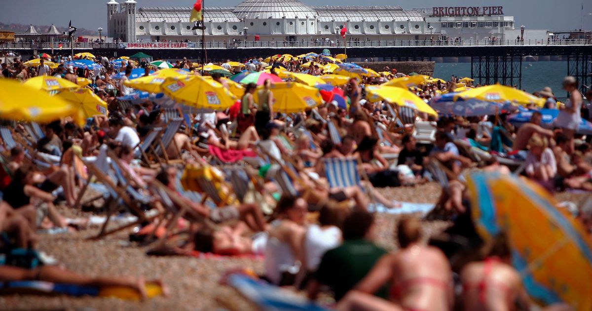
Forecasters are predicting hot weather to develop in the second half of next week with weather charts turning red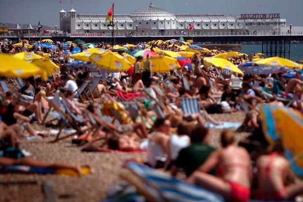 Temperatures are set to reach 30C this month(Image: Getty Images)
Get the sun cream and shades out because weather forecasters are predicting sweltering temperatures to arrive in a matter of days.
The Met Office says there is potential for some “warm or hot weather to develop” in the second half of next week – particularly in the south and east.
At the same time, weather maps from WX Charts have predicted heatwave-like temperatures to arrive in a week’s time on Friday, June 13.
READ MORE: I flew with easyJet from Birmingham Airport and got extra legroom without asking
Get breaking news on BirminghamLive WhatsApp, click the link to join
Kent could swelter in 30C while the Greater London area could experience temperatures of 29C, according to wxcharts.com.
Counties such as Hampshire, Surrey, West Sussex and Berkshire could experience temperatures of 28C.
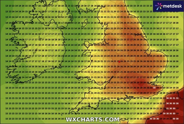 Weather maps predict temperatures of 30C to arrive(Image: WX Charts)
While the likes of Oxfordshire, Buckinghamshire and Hertfordshire, alongside South Yorkshire in the north, are set to be hit with 27C temperatures.
The heatwave threshold in England typically ranges from between 25C to 28C.
In order to be classed as a heatwave, the temperature must reach this average over three days – meaning June 13 could be a mini heatwave.
Twenty three other counties could see the mercury rise to at least 25C on June 13, with Birmingham and the West Midlands set for 26C.
In its long range weather forecast from Tuesday, June 10, to Thursday, June 19, the Met Office said: “Changeable weather across the UK at the start of this period with showers or some longer spells of rain spreading in from the Atlantic.
“The heaviest and most prolonged rain will probably be across parts of the north and northwest, with the southeast likely driest.
“Temperatures are expected to be near normal or slightly above.
“Into the second half of next week, there is potential for some warm or hot weather to develop, particularly in the south and east, although this may be accompanied by heavy showers and thunderstorms.
“Into the middle of June, high pressure may become more dominant.
“This could bring periods of fine and dry weather, especially in south and temperatures rising above normal, although some thundery outbreaks remain possible.”