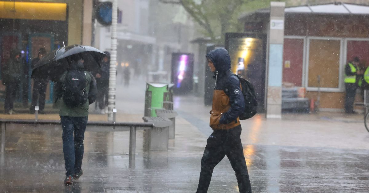
The region is set to be battered by rain today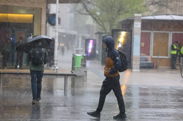 Heavy rain in Bristol(Image: PAUL GILLIS / Reach PLC)
The South West is braced for heavy rain and thunder as the Met Office issued a yellow weather warning for today, Saturday, June 7.
The thunderstorm warning is in place from 9am to 6pm and covers Bristol, Gloucestershire, Somerset, Devon, Cornwall and Plymouth as well as parts of the Midlands, Wales, London and the South East of England.
Heavy showers are expected with up to 15mm of rain forecast to fall in less than an hour. Some areas may see up to 40mm of rain over several hours.
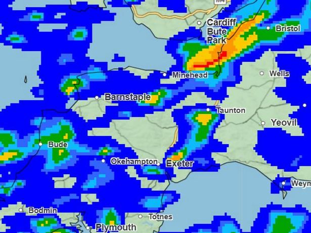
Current Met Office maps forecasts the wall of rain will hit the region around 9am. While most of Devon and Cornwall will be hit with rain from 7am, the worst will arrive mid-morning.
Widespread and heavy showers will begin around 9am, with Devon, Cornwall and parts of Somerset hit first.
The wall of rain will intensify at 12.15pm, as Falmouth in Cornwall and Weston-super-Mare and Bristol will see intense showers.
 Met Office weather map(Image: Met Office )
The worst is forecast around midday, as a heavy band of rain, bringing up to 32mm of rain, will move across Bristol and into Somerset.
Bude and Plymouth will also see heavy showers, although not as bad, around 1.30pm.
At 2.30pm, Exeter will be hit with another downpour, where up to 32mm of rain is expected.
At 3.30pm, another heavy shower is expected to hit Bristol and Yeovil.
Moving into the evening, much of the rain is expected to begin to clear, with a few localised heavy showers.
By 7pm, much of the region will be clear as the weather front moves to the South East.
Forecasters at the Met Office warn there will likely also be frequent lightning, hail and strong winds creating additional hazards.
There is likely going to be delays with transport as roads and driving conditions are affected by standing water and hail.
The Met Office also warns there may be some damage to properties from lightning strikes.
Some people may see a loss of power and other services through the storm as well.
At the time of reporting, there are no flood warnings or alerts in place, but the Environment Agency (EA) warns river and sea levels are high.
The Met Office said: “Consider if your location is at risk of flash flooding, if so, consider preparing a flood plan and an emergency flood kit.
“Give yourself the best chance of avoiding delays by checking road conditions if driving, or bus and train timetables, amending your travel plans if necessary.”
South West weather forecast:
Today: Often wet with heavy showers, these most frequent through the morning with thunder possible in places. Sunny periods and fewer showers later in the day. Breezy with gusty winds. Cool. Maximum temperature 17 °C.
Tonight: Showers becoming increasingly isolated this evening, although a few continuing into the early hours. Turning rather chilly and even cold enough for a local grass frost in prone rural spots. Minimum temperature 5 °C.
Sunday: A drier day than on Saturday with all areas seeing some sunshine at times. Scattered showers are likely but some places will remain dry. Breezy but feeling a little warmer. Maximum temperature 18 °C.
Outlook for Monday to Wednesday: Mainly dry early next week with a mixture of cloud and periods of strong sunshine. Lighter winds than of late and turning warmer.