Just 90 minutes from Bristol is one of the most well-preserved Roman roads in Britain that traverses an entire country from north to south – and is steeped in history
13:52, 09 Jun 2025Updated 13:53, 09 Jun 2025
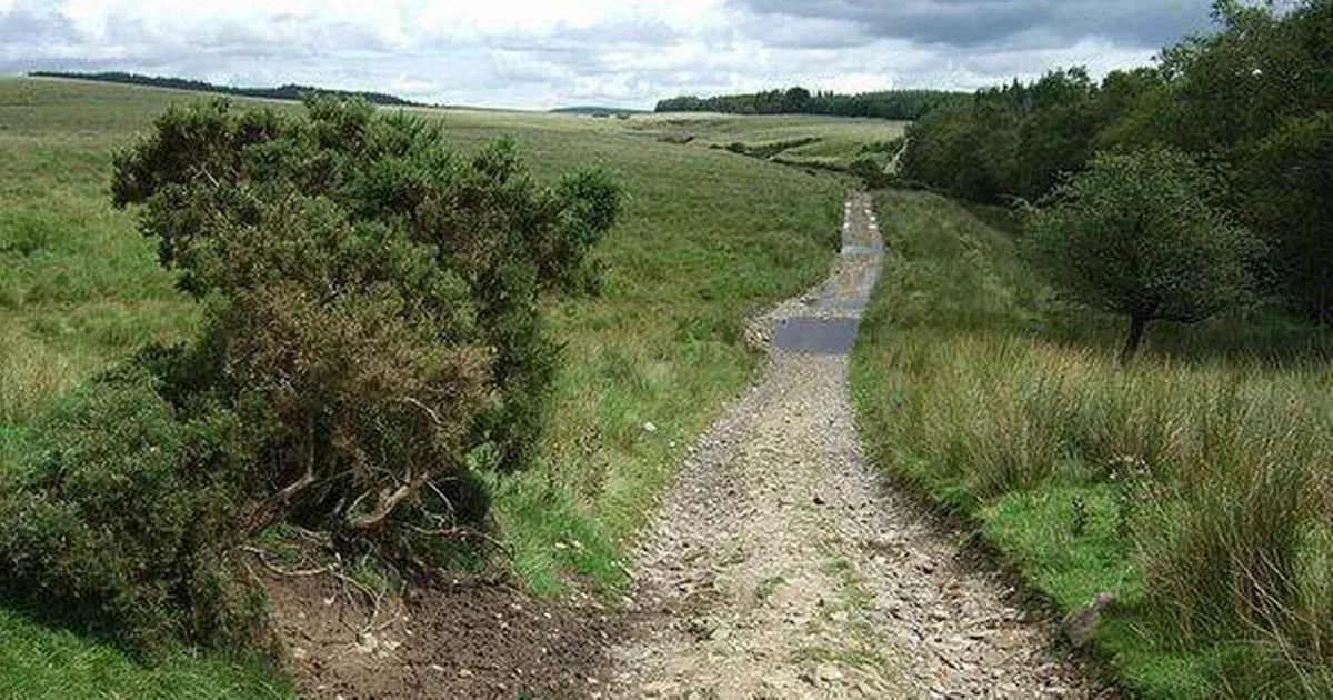
 This amazing piece of UK history is still visible 2,000 years after it was built(Image: Kev Griffin/CC BY-SA 2.0 DEED)
One of Britain’s best-kept secrets just 90 minutes from Bristol is hidden beneath our feet, a living piece of history that even locals are unaware of. This ancient Roman road, known as Sarn Helen, stretches from Neath on the south coast of Wales – which is about an 80 mile, 90-minute drive from Bristol via the M4 – to Conwy on the north coast and is a unique, semi-hidden wonder.
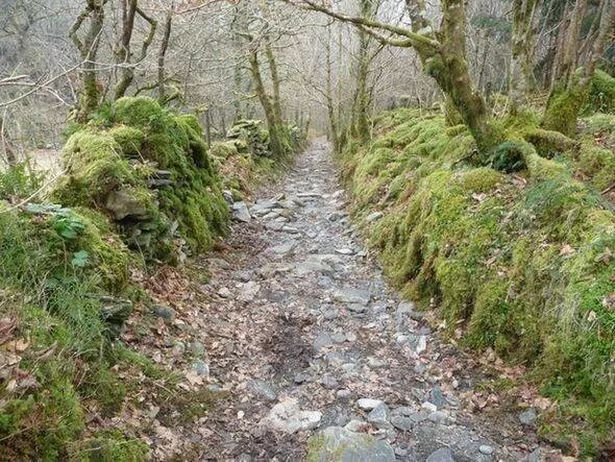
Sarn Helen, one of the most well-preserved Roman roads in Britain, reveals its cobbled stone in many places, still exposed to the elements in some of the wildest parts of Wales.
A favourite among walkers, some of whom suggest you can almost hear the echoes of Roman boots that once marched along it, Sarn Helen was constructed nearly 2,000 years ago.
It’s believed to be named after Celtic princess Elen Lwy-ddawg – or Saint Elen, an early founder of churches in Wales – who was wedded to Magnus Maximus, the formidable Roman emperor who landed in Britain around 368AD.
 The road is a living link to the Roman legions that travelled it centuries ago(Image: Richard Thompson/CC BY-SA 2.0)
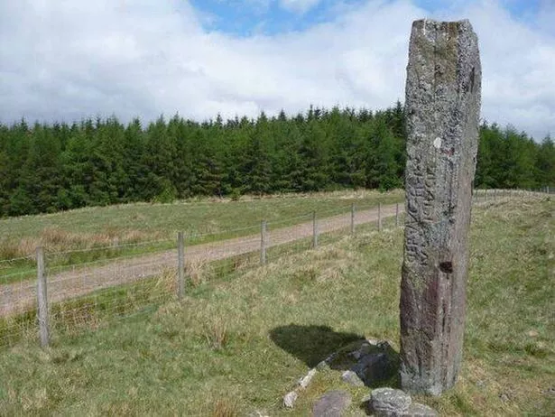
As the daughter of the Romano-British ruler Octavius, it’s thought she convinced her husband to construct roads across the nation for his soldiers to defend it more effectively against invaders. Large standing stones, some towering at 13ft high and significantly predating the Roman occupation of Britain, are scattered along specific sections of the road, reports the Express.
One stone, known as Maen Madoc, still carries an ancient Latin inscription that reads: ‘Dervacus, son of Justus. Here he lies’.
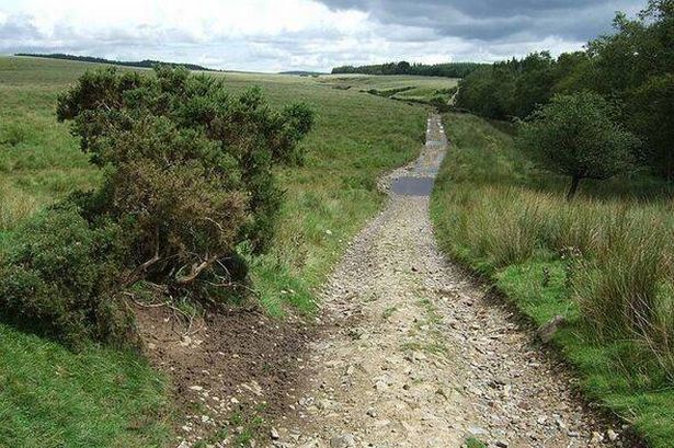
 Sarn Helen near Fan Nedd, between Neath and Brecon(Image: Gareth James/CC BY-SA 2.0 DEED)
Tucked away in the Bannau Brycheiniog (Brecon Beacons) National Park, it perfectly aligns with the area’s largest standing stone, Maen Llia, situated at the head of the Llia Valley.
Indeed, if not for the intervening forestry, one could easily spot one stone from the other despite a distance of two miles.
Maen Llia is believed to have been erected during the Bronze Age, and considering that a quarter of the stone is buried deep in the ground, the effort to position this massive stone would have been monumental. The purpose of these stones continues to be a topic of debate among scholars, with theories ranging from primitive route markers to Stone Age territorial signs to gravestones marking burial caverns of those who died by the roadside.
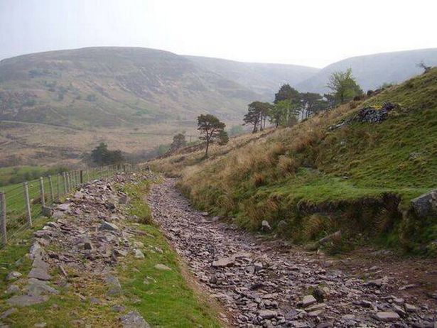
 A section of the Sarn Helen Roman road near Betws-y-Coed(Image: Jeremy Bolwell/CC BY-SA 2.0)
However, while the theories about them are as well-trodden as Sarn Helen itself, the truth will likely always remain just beneath the surface, tantalisingly out of reach.
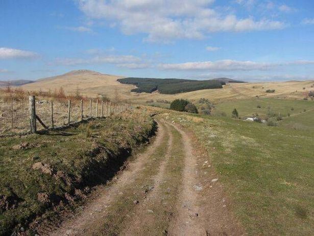
In 2020, author Tom Bullough embarked on a journey to traverse the entirety of Sarn Helen, beginning his trek in Neath. Today, a housing development named Roman Way marks what was once the starting point of this historic route.
However, when Bullough conversed with the residents, he discovered that many were unaware of the historical significance of their neighbourhood.
 The enigmatic Maen Madoc standing stone which still carries an ancient Latin inscription(Image: Jeremy Bolwell/CC BY-SA 2.0)
Beside the road lies a modest fragment of a stone wall encased in railings, the sole remnant of the ancient Roman fort that stood there many centuries prior.
In his evocative book Sarn Helen, Bullough recounts his experiences along the way, stating: “It is not until you reach Hirfynydd, the hill running north-east away from Neath, that you first encounter Sarn Helen.”
There, he describes a scene of a worn, grass-stripped track framed by broken walls, following the ridge through puddles and swamps. He notes that the track features occasional passages of stone once laid down by Roman legionaries, some of which still have a distinct surface with neat kerbs on either side.
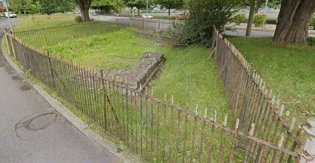 The small section of wall that used to be a Roman fort, now in a residential area of a Welsh town(Image: Google)
Bullough highlights the historical significance of the path: “This track climbing gently among meadow pipits and lately shorn ewes belongs to the early years of the Roman occupation. South Wales did not fall lightly, the Silures resisted for 30 years, even defeating the second legion, but the Romans built their fort in Neath, probably in AD74, so the road must date from around this time. It is straight in stretches, sometimes rutted by bicycles and off-road vehicles.”
In the final stages of his journey, 150 miles from Neath at the Conwy estuary, Bullough conveys the essence of the ancient atmosphere, revealing: “Here, 1,900 years ago, the Roman galleys would ride the tides to land or collect their supplies and men. Here it was that Sarn Helen ended and the rest of the world began.”