After a lovely spring and start to the summer, Wales is in for a wet and thundery few days
16:55, 12 Jun 2025Updated 20:44, 12 Jun 2025
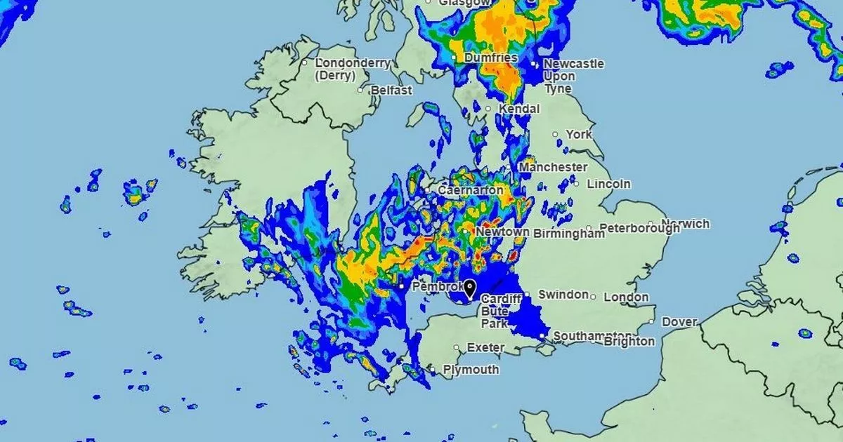
 How will Wales will look first thing on Saturday(Image: Met Office)
Well, it was a lovely spring anyway, and a decent start to the summer too…..but torrential rain has arrived in Wales and things are not set to improve for at least a few days.
The Met Office issued a yellow weather warning for thunderstorms for the early part of Thursday, and then extended it to cover the period up until 7pm. Two other yellow warnings have now been issued. The first one will come into force from 6pm on Friday until 12am on Saturday, affecting many parts of Wales.
The counties affected are Blaenau Gwent, Bridgend, Caerphilly, Cardiff, Carmarthenshire, Ceredigion, Conwy, Denbighshire, Gwynedd, Merthyr Tydfil, Monmouthshire, Neath Port Talbot, Newport, Pembrokeshire, Powys, Rhondda Cynon Taf, Swansea, Torfaen, Vale of Glamorgan, and Wrexham. For the latest restaurant news and reviews, sign up to our food and drink newsletter here.
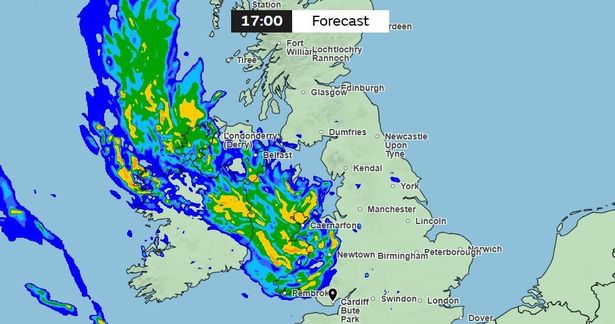 The Met Office weather for map for Wales at 5pm on Thursday(Image: Met Office)
From 12am on Saturday, another warning comes into affect, running until 6pm later that day. This one covers 22 counties. These include Blaenau Gwent, Bridgend, Caerphilly, Cardiff, Carmarthenshire, Ceredigion, Conwy, Denbighshire, Flintshire, Gwynedd, Isle of Anglesey, Merthyr Tydfil, Monmouthshire, Neath Port Talbot, Newport, Pembrokeshire, Powys, Rhondda Cynon Taf, Swansea, Torfaen, Vale of Glamorgan, and Wrexham.
With each of the warnings, the Met Office is warning of a risk of “thunder, perhaps leading to some travel disruption in a few places”. The forecaster also warns of potential difficult driving conditions, delays and some cancellations to train and bus services, power cuts, and flooding.
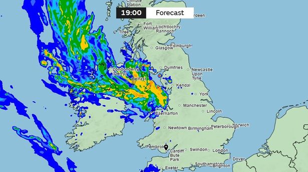 The Met Office weather for map for Wales at 7pm on Thursday(Image: Met Office)
Looking at the forecast, we’re set for heavy rain and some thunderstorms across Wales over the next couple of days, particularly in southern parts, with Thursday and Saturday being the worst hit, before things hopefully begin to brighten on Sunday and into next week.
According to the Met Office forecast for Thursday evening: “Any thunderstorms clearing northwards this evening. Turning drier for a time overnight then cloud increasing with some patchy rain and drizzle through the early hours. Remaining warm, muggy and breezy. Minimum temperature 9 °C.”
As for Friday, the forecaster says: “Largely dry by day with occasional brighter spells and some drizzle, mainly over the hills first thing followed by showers. Heavier, thundery rain arriving later. Remaining warm and humid. Maximum temperature 22 °C.”
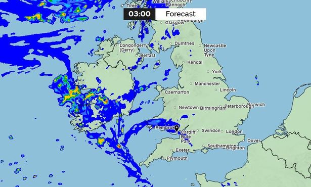 The Met Office weather map for Wales at 3am on Friday(Image: Met Office)
The outlook for Saturday looks bleak, before things improve on Sunday, with the Met Office predicting: “Heavy rain and thunderstorms on Saturday with hail and gusty winds. These easing on Sunday to leave a largely dry day with bright spells on Monday. Feeling slightly fresher.”
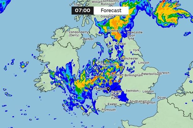
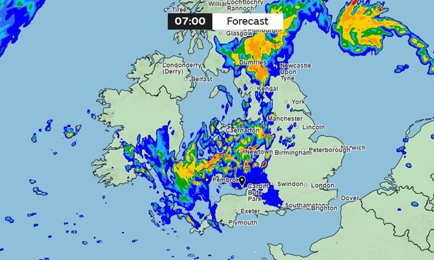 The Met Office weather map for Wales at 7am on Saturday(Image: Met Office)
Looking ahead to next week, the weather should be “predominantly fine and dry” as summer starts to return to Wales. From next Tuesday, the Met Office says there will be a “broad north to south split in the weather across the UK during this period”.
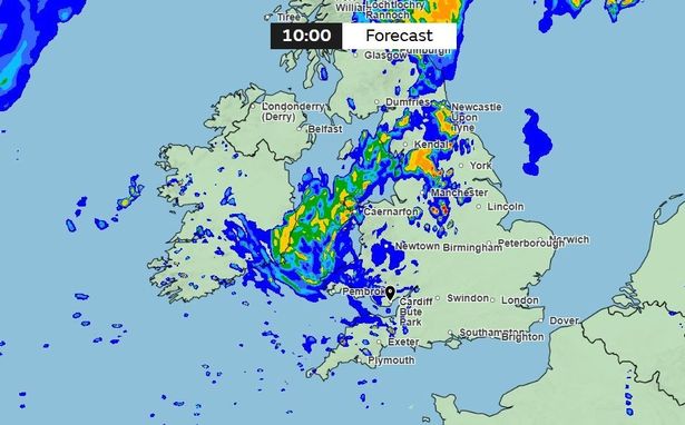 The Met Office weather map for Wales at 10am on Saturday(Image: Met Office)
The forecaster added: “In the south it expected to be predominantly fine and dry, with spells of sunshine by day and clear spells overnight.
“Any rainfall that does occur will probably be light and patchy, with most places staying dry. Temperatures will likely be above normal for the time of year and it could be hot at times in the southeast.”