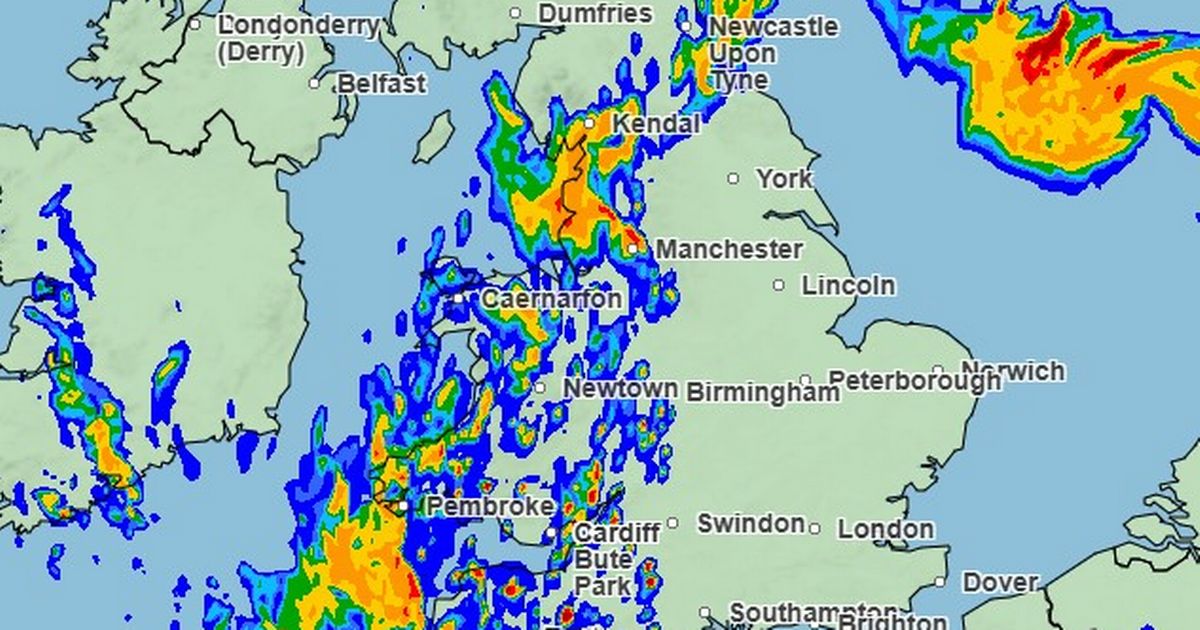
The national forecaster issued three weather warnings on Wednesday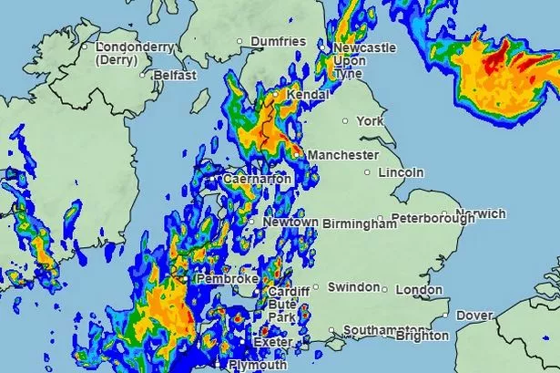 The Met Office rainfall radar map which shows a heavy thunderstorm making its way over Manchester in the early hours of Saturday morning.
The latest Met Office weather map shows the exact time heavy thunderstorms will hit Greater Manchester this weekend.
The national forecaster issued three weather warnings on Wednesday, as an initial bout of extreme weather is set to hit parts of the country on Thursday before heavy rain and thunderstorms follow suit on Friday night and into Saturday morning.
On the radar map, a blue and orange shadow can be seen moving through Wales shortly before 3am on Saturday morning, before covering Greater Manchester around an hour later at 4am.
These conditions seem to remain in place over Manchester until at least 3pm on Saturday afternoon.
According to the Met Office, the yellow warning remains in place for Manchester from midnight on Friday night through until 6pm on Saturday evening.
They warn that spray and sudden flooding could lead to difficult driving conditions and some road closures, while there is a small chance that some communities could become cut off by flooded roads.
 The Met Office radar map showing conditions at 12pm on Saturday.(Image: Met Office)
Power cuts could occur and other services to some homes and businesses could be lost as a result of the extreme conditions.
Where flooding or lightning strikes occur, there is a chance of delays and some cancellations to train and bus services.
They add that rainfall could reach 60-80 mm in some locations.
Strong gusts and hail may also accompany some of the thunderstorms.
The thunderstorms are being triggered by a plume of warm air moving in from Iberia and France.
Deputy Chief Meteorologist Tony Wisson said: “By Friday afternoon and evening, heavy and thundery showers are likely to spread across southeastern England and East Anglia, tracking north-eastwards overnight.
“There is currently some uncertainty around the exact location and intensity of the thunderstorms, but there is a risk that some areas could see 30 to 50mm of rain, with a risk of even larger accumulations possible.”
He continued: “With much of the rain falling in a short space of time there is a risk of impacts such as surface water flooding.
“Frequent lightning, gusty winds and hail could pose additional hazards. Updates to this warning are expected as confidence increases on the exact location of the greatest risk of the heaviest downpours.”