We could see lightning and hailstormsAlex Driscoll Breaking news reporter and Jessica Coates and Ted Hennessey PA
08:29, 13 Jun 2025Updated 08:58, 13 Jun 2025
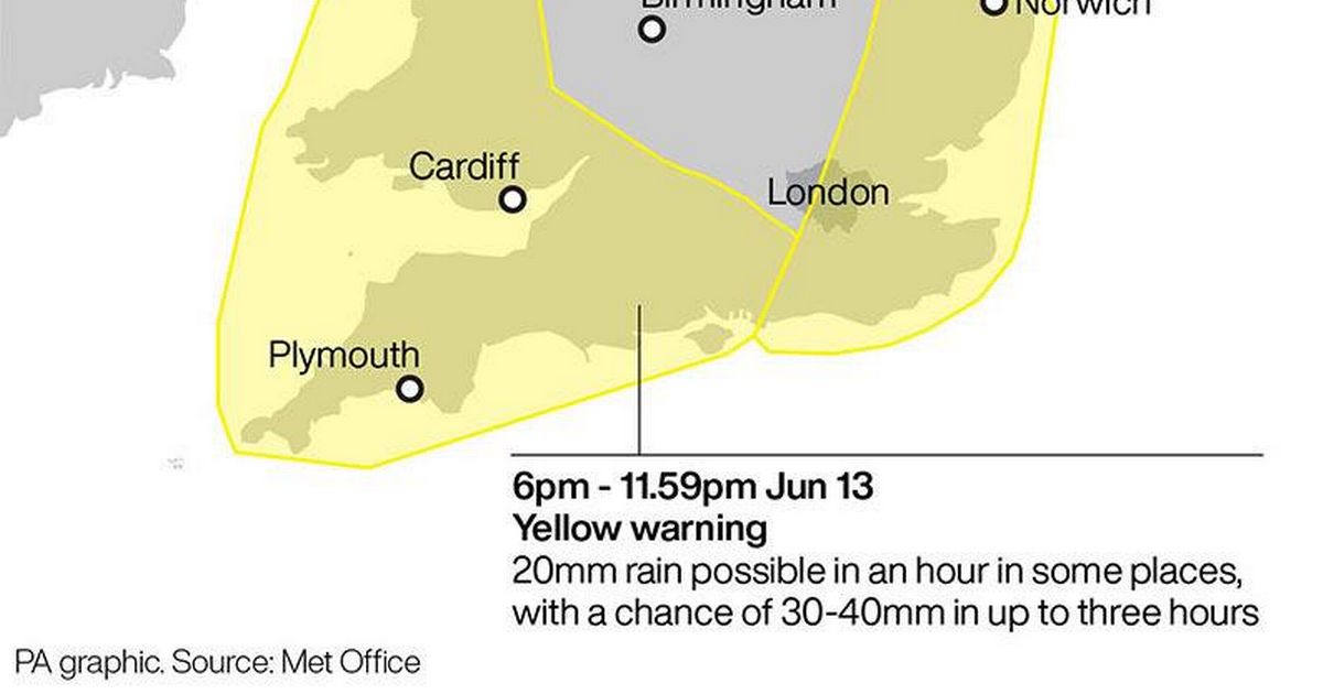
 Yellow weather warnings for thunderstorms(Image: PA Graphics/Press Association Images)
Heavy rain and thunderstorms are set to hit the West Country this afternoon as the region will be battered by a second day of bad weather amid Met Office warnings for thunderstorms.
Two new weather warnings were issued yesterday as the first of these will take effect from 6pm, lasting until the end of the day.
The thunderstorms and rainfall is set to continue through until 6pm tomorrow as a third day of disruption is forecast.
The warning is in place for the entire South West, from Cornwall, Devon and Plymouth up to Somerset, Bristol and Gloucestershire, as well as a large part of Wales, London and South East England.
Somerset will be hit by the thunderstorms and rainfall at around 3.30pm this afternoon, whilst in Bristol, the rainfall is set to hit at around 5.15pm.
However, heavier rain is expected at around 10pm in Somerset, arriving in Bristol and Gloucestershire shortly afterwards.
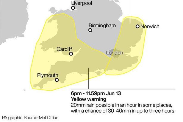
How will the weather affect the region?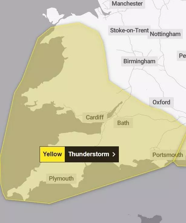 A thunderstorm weather warning was issued for today.(Image: Met Office)
Heavy rain and thunderstorms are likely to move northwards on Friday evening as some areas may be subject to 20mm of rain in an hour and 30 to 50mm to fall in less than three hours.
The Met Office said that there is a small chance of frequent lightning and hail.
READ MORE: Lightweight Roman raincoat ‘so useful’ for unpredictable British summer weather
Spray from the roads and sudden flooding could lead to some road closures and difficult driving conditions, with the Met Office warning that some communities may be cut off by flooding.
Transport services may be disrupted, power cuts could occur and some homes and properties may be flooded.
How about the rest of the UK?
Parts of eastern England may reach up to 30C on Friday, but the Met Office has warned of thunderstorms later that evening.
Cambridge is forecast to reach 29C, while temperatures are expected to reach 27C in Canterbury and 25C in Nottingham and Durham.
In Scotland, Aviemore could hit 24C as Met Office meteorologist Alex Deakin said much of Friday would be “hot and humid” with a “small chance” temperatures could reach 30C.
Temperatures of 30C would make it the hottest day of 2025, surpassing the 29.3C recorded at Kew Gardens in west London on May 1.
It means the parts of the UK could be hotter than Ibiza, Mykonos and Los Angeles.
“A good chunk of England and southern Scotland will be dry for most of Friday,” said Mr Deakin.
What about the weather warning on Saturday? This weather warning will be in place tomorrow.(Image: Met Office)
Mr Deakin said there was “a bit of uncertainty” over Saturday, but predicted “heavy rain” in the north of England’s, Northern Ireland and parts of Scotland as well as afternoon thunderstorms further south.
Further heavy showers and thunderstorms are likely to break out and some areas could get 80mm of rainfall across the day.
The weather warning will affect the whole of the South West and Wales, but also includes the Midlands, Yorkshire, the North East and North West of England and South West Scotland.
Yellow heat-health alert issued for first time in 2025
The UK Health Security Agency (UKHSA) has issued its first yellow heat-health alert of the year, running until 8am on Sunday in the east of England, East Midlands, London, and the south east.
Under UKHSA and the Met Office’s Weather-Health alerting system, a yellow alert means there could be an increased use of healthcare services by vulnerable people.
It may lead to an increase in risk to health for individuals aged over 65 or those with pre-existing health conditions, including respiratory and cardiovascular diseases.