Britain is set to be battered by violent lightning storms as the sweltering 35C hot weather gives way this week, according to new weather maps. New forecast maps show that from Monday night through to Wednesday, downpours and thunderstorms could rock the nation, bringing some welcome relief from the hot stick temperatures.
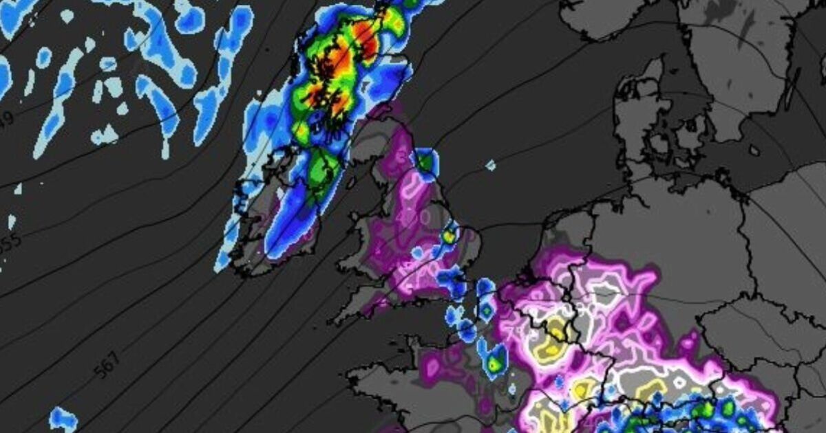
Tomorrow (Monday) is expected to be one of the hottest days of the year so far, with the Met Office predicting temperatures widely exceeding 30°C in central and eastern England, possibly reaching 35C in London and towards Cambridge. But breaking forecast maps from WXCharts show a huge band of thunder and lightning storms is on the other side of the heatwave, with downpours expected to hit Scotland and northern England from 6pm on Monday.
Looking further ahead to Wednesday and another mass of angry storms and lightning looks set to arrive around 3pm onwards, with storms predicted to ravage most of the United Kingdom, as well as parts France, Belgium and the Netherlands.
The UK Health Security Agency (UKHSA) has issued an amber alert for high temperatures this weekend (starting on Friday) covering London, the East Midlands, South East, South West and East of England. The warning will last until 6pm on Tuesday.
The UKHSA told UK households to keep cool by closing windows and curtains in rooms that face the sun.
The UKHSA also issued a yellow alert for Yorkshire and Humber and the West Midlands for the same time period, with the agency warning of significant impacts across health and social care services. Temperatures could reach 34C on Monday, which if it did, would only be the fourth time in June since the 1930s.
The June record, which could be surpassed, stands at 35.6C, recorded at Southampton Mayflower Park on June 28 1976 and again at Camden Square, north London, on June 29 1957.
An amber alert was previously issued for all regions in England on June 19, the first time it had been used since September 2023.
On the same day, temperatures reached 32.2C in Kew, west London, before heatwaves were declared across England and Wales.
An official heatwave is recorded when areas reach a certain temperature for three consecutive days, with thresholds varying from 25C to 28C in different parts of the UK.
Today:
Cloud in the south gradually lifting and clearing this morning, then very warm with plenty of sunny spells. Fresher in the north with brisk winds and some sunshine. Showery rain at times across Northern Ireland and western Scotland.
Tonight:
Cloudy tonight across Northern Ireland and Scotland with outbreaks of drizzle at times. Dry elsewhere with clear skies and staying rather warm through the night.
Monday:
Sunny and hot for England and Wales with a few thunderstorms possible in the afternoon, particularly in northern England. Fresher in the northwest with some heavy rain moving in.
Outlook for Tuesday to Thursday:
Hot again in the southeast on Tuesday, but turning fresher from the west. Temperatures closer to average on Wednesday and Thursday. Heavy rain possible in the south on Thursday.