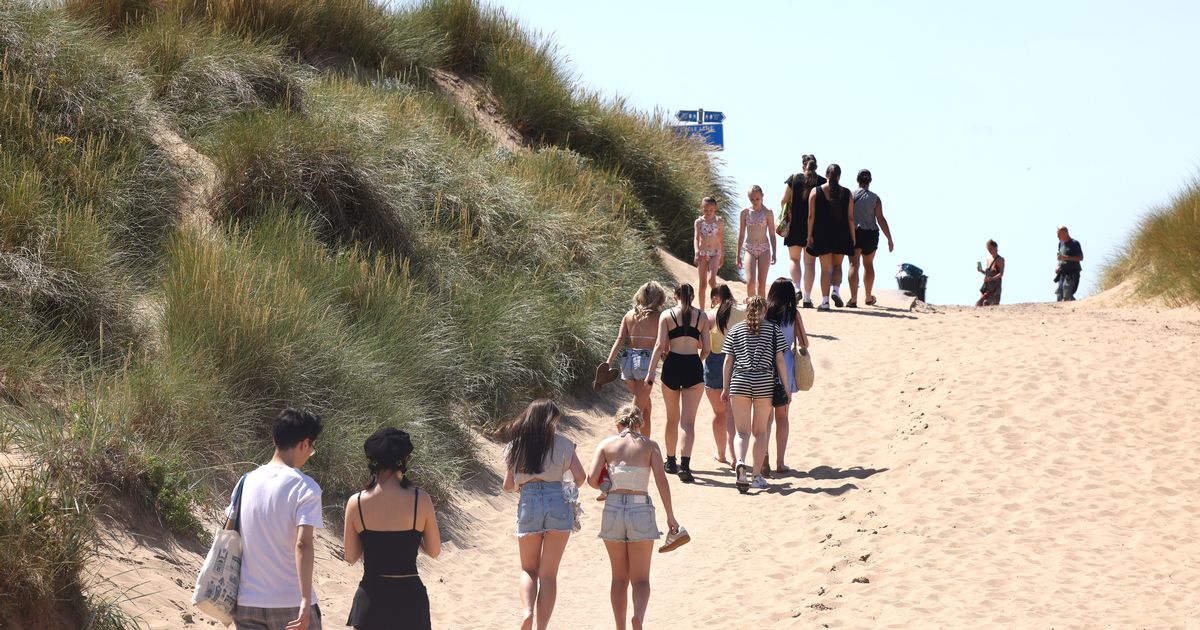
Liverpool was hotter than Barcelona on Saturday but a change in the weather will come this week Crowds walk to Crosby beach to enjoy the hot weather(Image: Liverpool ECHO)
After most of the UK experienced the third heatwave of the year over the weekend, temperatures will drop considerably today (Monday) and as the week progresses. Temperatures in some regions exceeded 30C, in Liverpool people basked in highs of 32C on Saturday afternoon.
This was hotter than Barcelona, which had a high of 27C. Amber and yellow heat health alerts which have been in place across England – warning of the potential for a rise in deaths, particularly among those aged 65 and over or with health conditions – are due to lift at 9am.
Met Office meteorologist Greg Dewhurst said: “The heatwave is starting to come to an end as low pressure starts to move in from the Atlantic.
“We say goodbye to high pressure as this area of low pressure takes over, bringing bands of heavy rain, some thundery downpours, but also bringing in some fresher conditions across many parts.” Although the hot weather continued on Sunday, temperatures did drop slightly as forecast.
Fire chiefs urged people to stay safe as they warned of the increased risk of wildfires and drowning, with the National Fire Chiefs Council asking people not to enter water to try to cool down and urging parents and carers to ensure children are supervised around water at all times.
In Liverpool, the high temperature forecast for today (Monday) is 24C and a low of 14C. The Met Office says there will be “Sunny intervals changing to overcast by late morning.”
The UV levels remain high and the pollen levels also remain high, it is important to keep on top of topping up sun cream to protect you from the damaging rays of the Sun.
Here is an hour-by-hour forecast for today as the temperatures drop from the weekend:
- 8am – 19C
- 9am – 20C
- 10am – 22C
- 11am – 22C
- 12pm – 22C
- 1pm – 22C
- 2pm – 22
- 3pm – 22C
- 4pm – 22C
- 5pm – 21C
- 6pm – 20C
- 7pm – 19C
- 8pm – 19C
- 9pm – 18C
- 10pm – 17C
- 11pm – 16C
The BBC’s forecast for Merseyside reads: “Tomorrow morning will turn mostly cloudy, with some showers pushing in from the south-west, these locally heavy and possibly thundery. In the late afternoon, see plenty of sunshine appear.”
Record breaking and extreme weather has become increasingly commonplace in the UK as our climate has changed over the last few decades.
The latest assessment of the UK’s climate shows how baselines are shifting, records are becoming more frequent, and that temperature and rainfall extremes are becoming the norm.
The latest State of the UK Climate report, published by Wiley in the Royal Meteorological Society’s ‘International Journal of Climatology’, provides insight into the UK’s changing climate.
The report highlights how the UK’s climate has warmed steadily from the 1980s onwards, albeit with individual cooler years, with the greatest implications from the increasing frequency and intensity of daily temperature extremes.
According to the Met Office: “The last three years have been in the UK’s top five warmest on record, with 2024 the fourth warmest year in records dating back to 1884.
“In 2024 specifically, we saw the UK’s second warmest February, warmest May, fifth warmest December, fifth warmest winter and warmest spring on record. Statistics like this are typical of recent years in the UK’s climate records and some of these have already been surpassed in 2025.”