Why Japanese Knotweed is a Problem
Japanese knotweed is considered one of the most invasive and destructive plants in the UK. Known for its rapid growth and aggressive root system, it can reach up to three metres underground and seven metres horizontally, often pushing through concrete, tarmac, driveways, drains and even cavity walls.
While it rarely causes structural damage directly, its presence can significantly reduce property value by around 5% on average and complicate the process of selling or securing a mortgage. Legal disputes between neighbours are not uncommon when the plant spreads across property boundaries.
Knotweed is legally classified as a controlled plant under the Wildlife and Countryside Act 1981. While having it on your land isn’t illegal, allowing it to spread especially into the wild or onto neighbouring properties can result in prosecution or enforcement action.
Using data from their interactive heatmap Exposed, the company revealed the locations across the UK with the most verified knotweed sightings and Wales is home to some of the highest concentrations.
In total, Newport city recorded 1,747 verified sightings, while Rogerstone alone saw 268 cases, making the area one of the most affected nationwide. The Vale of Glamorgan had 434 reports, and Pembrokeshire saw 1,943, with 0.46 sightings per square mile still higher than the average in England.
The invasive plant, which thrives in spring and summer, can cause serious structural issues if left unmanaged. While severe damage is rare, it can reduce a property’s value by around 5% and lead to disputes if it spreads between properties. Environet’s data shows Wales has 3.9 knotweed sightings per square mile, compared to 1.1 in England.
Emily Grant, director at Environet, said:
“By mapping verified sightings, we’re helping people understand the level of risk in their local area and encouraging early identification and treatment.”
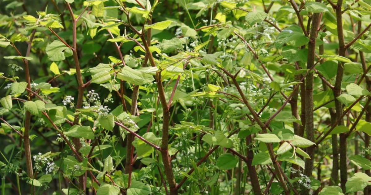
She added that this time of year makes knotweed easy to spot, with its heart-shaped leaves and bamboo-like stems. The company offers free identification if members of the public email a photograph to their experts.
The heatmap, which draws from over 100,000 verified cases, allows users to enter their postcode to check local infestations, and even add new sightings with photos to aid nationwide awareness and treatment.
Other Welsh areas in the top 10 include:
-
Cardiff: 949
-
Swansea: 936
-
Llanelli: 693
-
Neath: 396
More rural counties such as Ceredigion, Gwynedd and Carmarthenshire also saw hundreds of sightings.