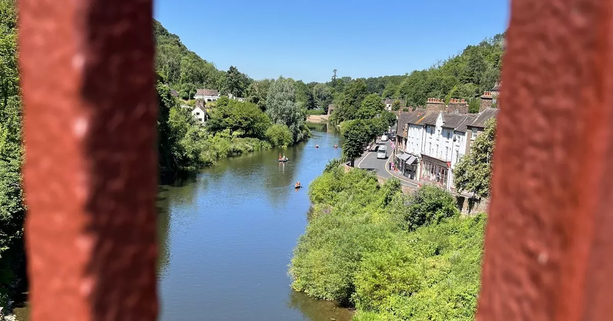
Eight counties could be hit by a heatwave in a matter of weeks as weather maps turn red Eight counties in England could be set for a heatwave including Shropshire (pictured)
It’s already been a hot and dry summer in England, with three heatwaves so far declared in 2025.
So far, there’s been hosepipe bans, while the West Midlands was recently placed in drought status.
Temperatures are set to cool off a little heading through July, hovering more so around the 20s.
READ MORE: European city with £136 weekends away where pints cost £1.64
Get breaking news on BirminghamLive WhatsApp, click the link to join
But once August arrives, the mercury could crank up again pushing temperatures into the 30s.
According to wxcharts.com, eight counties in England could roast in 30C and 31C temperatures on Saturday, August 2.
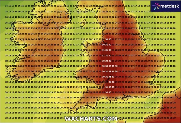 Eight counties in England could be hit with 30C and 31C temperatures (Image: WX Charts )
Weather charts from WX Charts show a strip of red going down the length of England and its border with Wales, taking in three counties in the Midlands along the way.
The following counties could be set for 30-31C temperatures arriving on that day: Merseyside, Cheshire, Shropshire, Worcestershire, Herefordshire, Gloucestershire, Somerset and Wiltshire.
It could see the arrival of a heatwave, with temperatures reaching the high-20s in six of the counties the previous day, and 30C in Gloucestershire and Somerset, on Friday, August 1.
While on Sunday, August 3, the temperature could range between 25C to 29C in these counties.
In order to be classed as an official heatwave in England, the temperature must reach 25C or above for three consecutive days for most parts of the country.
In its long-range forecast from August 1 to August 15, the Met Office said the start of August could see a mix of rain along with some drier, brighter spells.
The forecaster said: “The rather changeable pattern will likely continue through early August with spells of rain or showers mixed in with some drier, brighter days.
“Towards mid-August, there are tentative signs that high pressure may become rather more dominant, which could bring more in the way dry, settled weather more widely.
“Temperatures will likely continue to be above average overall, with the possibility of very warm or hot spells developing later in the period, especially further south and east.”