Much of Wales is set to be battered by stormy conditions – but they won’t last for long
09:40, 21 Jul 2025Updated 10:02, 21 Jul 2025
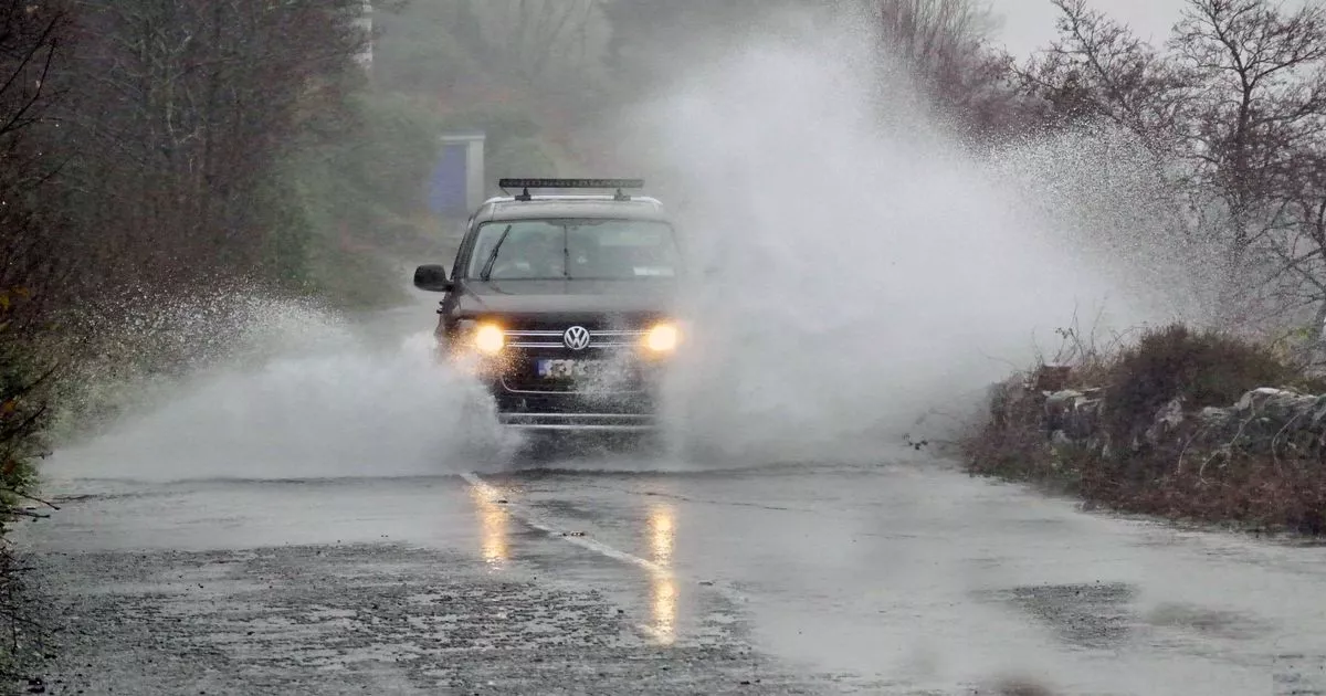
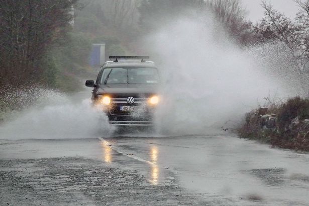 The Met Office has warned of potential flooding, as well as lightening strikes
A yellow warning for thunderstorms is in force across much of Wales from 11am on Monday morning, July 21. The Met Office has warned that heavy showers and scattered thunderstorms may cause some localised flooding and transport disruption.
This comes as the BBC forecaster Matt Taylor has confirmed that July has had the “wettest day on record.” On Monday’s BBC Breakfast, he said: “In the last couple of hours we have just recorded our wettest July day on record. It is all linked into a weather front that has been sitting over Northern Ireland.”
The weather warning, which covers a large portion of north and east Wales, was issued by the Met Office on Monday morning, and lasts until 9pm.
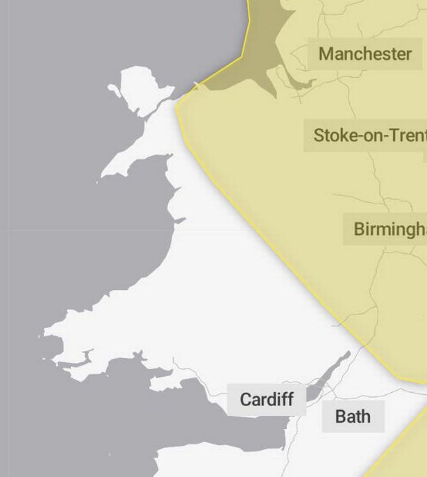 The weather warning affects most of North-east Wales, as well as much of England, Scotland and Northern Ireland.(Image: Met Office)
While the start of the week is going to see changeable weather, there is better news from Thursday, when dry conditions will return with “some warm sunny spells.”
The forecast for the end of the week in Wales says: “Wednesday will likely bring further heavy showers with a risk of thunder. However, Thursday should be dry with some warm sunny spells. Cloudier for a time on Friday, brighter later.”
“Very warm” weather has also been forecast to land in Wales by mid-August, with a high likelihood of temperatures to be above the average for that time of year.
The Met Office’s long-range forecast, predicts that from July 30 to August 13 the weather will be similar to what we have experienced in recent weeks, when we experienced highs in Wales of more than 33°C.
But first, places including Wrexham, Colwyn Bay, Newtown, Blaenau Ffestiniog, Welshpool, Bangor and Llangollen are set to be battered by the worst of the rain on Monday, alongside parts of England, Scotland and Northern Ireland.
Though the thunder and rain has already started causing disruptions to air travel, with flights delays including the morning flight from Belfast to Bristol.
A spokesperson for the Met Office said: “Scattered heavy showers and thunderstorms are expected on Monday. Rainfall amounts will vary from place to place but in some locations 20-40 mm is possible within a couple of hours.
“Heavy downpours of rain will be the primary hazard, but lightning strikes are also likely along with the potential for hail and gusty winds.
“You should expect spray and sudden flooding could lead to difficult driving conditions and some road closures.
“There is a small chance that homes and businesses could be flooded quickly, with damage to some buildings from floodwater or lightning strikes.
“There is a small chance that some communities become cut off by flooded road.
“Where flooding or lightning strikes occur, there is a chance of delays and some cancellations to train and bus services.
“There is a slight chance that power cuts could occur and other services to some homes and businesses could be lost.
“There is a small chance of fast flowing or deep floodwater causing danger to life.”
When a weather warning is issued, the Met Office recommends staying up to date with the weather forecast in your area. For further details see Met Office Warnings & Advice.