Heavy rain and strong wind is likely across Wales as Storm Floris hits the UK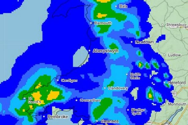 Wales will likely see terrible weather despite most of it not being covered by a Met Office weather warning(Image: Met Office )
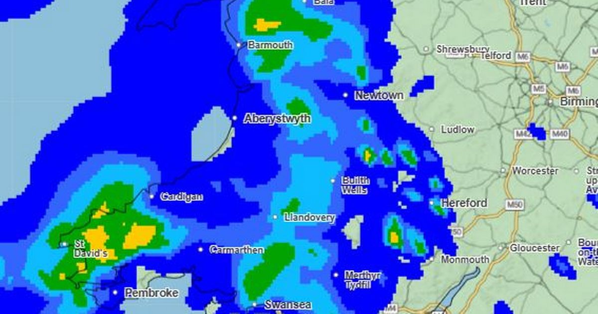
Met Office weather maps are set to turn dramatically blue over Wales as Storm Floris submerges the UK in heavy rain. The storm warning comes into force on Monday and is expected to “bring a spell of unseasonably strong and potentially disruptive winds” until Tuesday. A yellow warning for wind is in place from 6am on Monday, August 4 until 6am on Tuesday, August 5.
The warning covers a huge swathe of the UK, which includes north Wales, north England, Scotland and Northern Ireland. However the entirety of Wales is expected to see prolonged rainfall from 7am on Monday until Tuesday morning. This includes patches of moderate and heavy rainfall which is likely to be continuous. In addition, parts of Wales not included in the warning could still see winds of up to 25mph.
To help you prepare we have put together a list of weather maps showing where and when the worst of the weather is expected to hit Wales.
Here are a series of weather maps from 7am on Monday, August 4 until 7am on Tuesday, August 5:
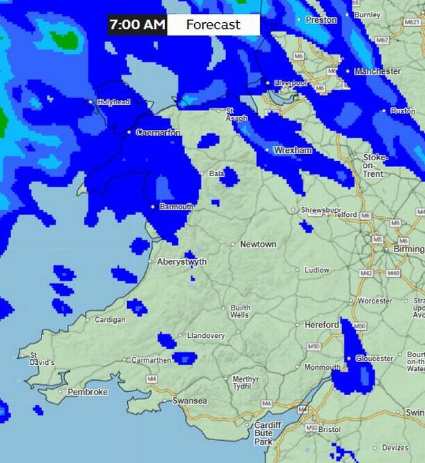
Monday 7am
Rain moves towards Wales from the north west, first affecting Holyhead, Anglesey, Bangor, Pwllheli, Caernarfon and surrounding areas.
According to the maps rainfall remains stable in these areas for some hours.
At around 10am rainfall remains concentrated in north west Wales with more patches developing in and around Wrexham, Aberystwyth, St David’s, Newtown and Merthyr Tydfil.
However at 10am much of Wales is expected to be dry.
 Monday 7am(Image: Met Office)Monday 1pm
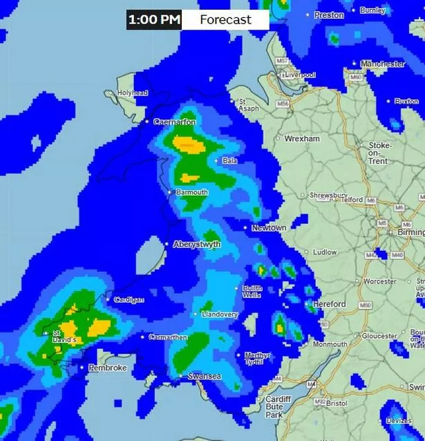
By the afternoon the rainfall is expected to have moved significantly eastwards.
Most of the country will be experiencing rainfall by 1pm, with some relief in Holyhead.
East Wales such as Newport and Chepstow may experience rainfall a few hours later.
The areas of light blue, green and yellow on the Met Office Map indicate the areas expected to see the heaviest rainfall.
Also at 1pm wind is expected to reach between 15mph and 25mph.
On the Windy.com map green areas indicate wind up to 20mph, with orange areas highlighting up to 30mph. Red areas show wind of more than 30mph.
 Monday 1pm – Met Office rain map(Image: Met Office)
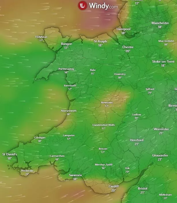 Monday 1pm – Windy.com map(Image: Windy.com )Monday 4pm
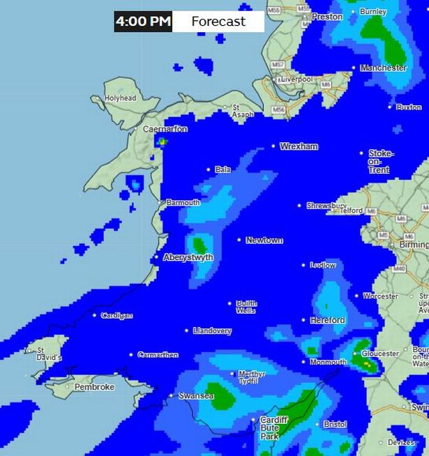
By 4pm weather maps show most of Wales covered in blue, indicating light to moderate rainfall.
By this time parts of south and east Wales are highlighted in green, which indicates heavier rain. This is also the case between Aberystwyth and Llanidloes.
Patches of relief in the north and south west of Wales widen slightly.
 Monday 4pm(Image: Met Office)Monday 7pm
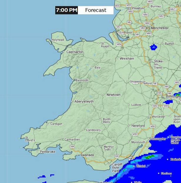
From 7pm Wales is expected to experience dry conditions.
There are no areas of rain highlighted on the map.
However a small patch of light to moderate rain does appear over Llanidloes at around 10pm.
Other areas may also experience showers throughout the evening, but it should remain dry for most of the country.
 Monday 7pm(Image: Met Office)Tuesday 7am
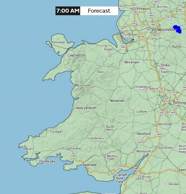 Tuesday 7am(Image: Met Office)
The weather warning will have lifted by 7am, also marking the end of the prolonged rainfall across Wales.
Get daily breaking news updates on your phone by joining our WhatsApp community here. We occasionally treat members to special offers, promotions and ads from us and our partners. See our Privacy Notice