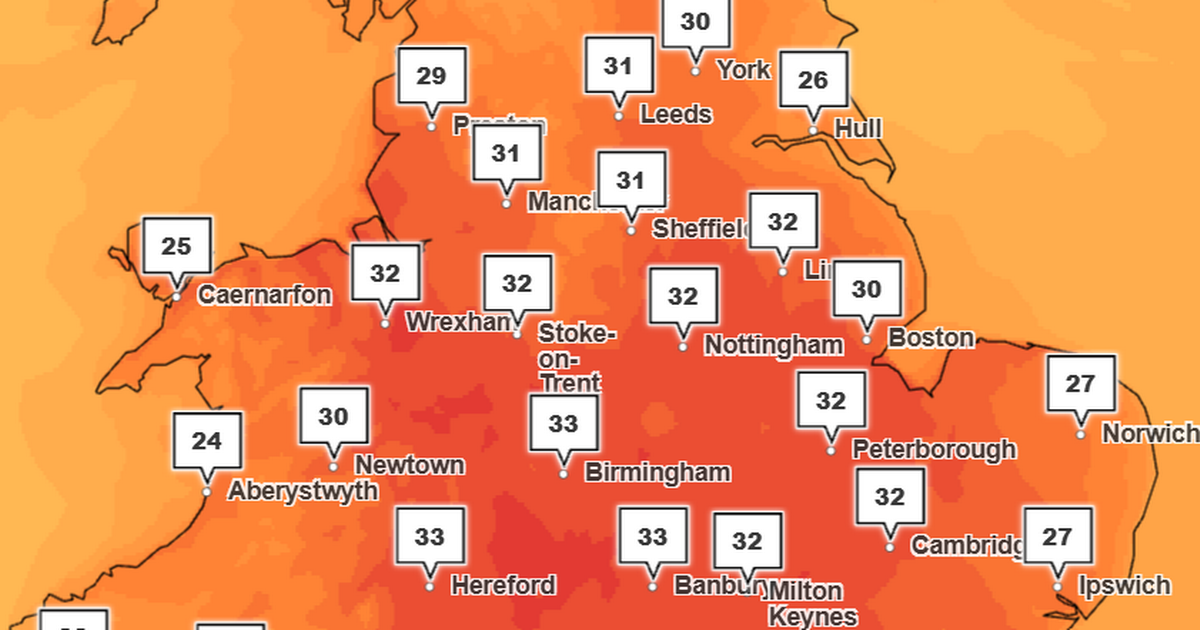
Met Office maps have revealed how high temperatures will soar in Greater Manchester next week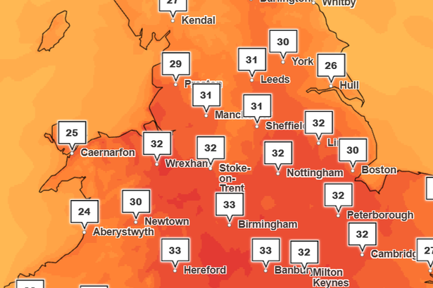 Highs of 33C are forecast in England next week(Image: The Met Office)
Temperatures are set to soar over 30C next week as the UK faces its fourth heatwave of 2025.
The Met Office has told parts of the UK to highs around the mid-30s next Tuesday (August 12) as health officials have issued heat health warnings across large parts of England.
The UK Health Security Agency (UKHSA) heat health alert comes into effect at 12pm on Monday (August 11) until 6pm on Wednesday (August 13). It covers seven UK regions, including Yorkshire and the Humber, East Midlands, West Midlands, East of England, London, the South East and South West.
The alert means significant impacts are possible across health and social care services due to the high temperatures. It warns of a rise in deaths among vulnerable groups, including those aged 65 and over or those with pre-existing health conditions.
The weather agency says temperatures will rise for much of England and Wales in the first half of the week, with highs well over 30C for some, peaking towards the mid-30s in the South East on Tuesday.
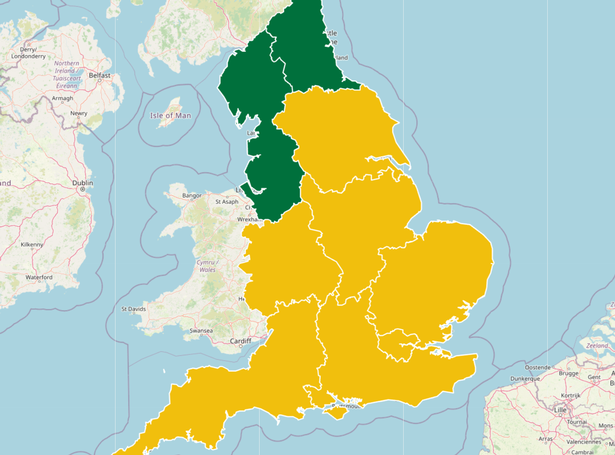 Yellow heat health alerts have been issued across England(Image: UKHSA)
Met Office Deputy Chief Meteorologist Tom Crabtree said: “Warmth is the focus in the forecast in the first half of this week, with temperatures likely to peak on Tuesday around the mid-30s, but remaining above average in the second half of the week, particularly further to the southeast.
“The exception to the widely warm conditions will be northwest Scotland on Monday, where showers will be more frequent. Warmth will develop there from Tuesday with temperatures peaking in the mid to high 20s.”
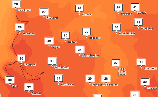
How hot will it get in Greater Manchester next week?
The Met Office forecast predicts highs of 27C on Monday (August 11), 31C on Tuesday and 27C on Wednesday. Temperatures are set to reach 24-25C next Thursday until Saturday.
 Weather maps show highs of 31C in Greater Manchester at 4pm on Tuesday, August 12(Image: The Met Office)
Temperature maps show highs of 29C-31C across Greater Manchester on Tuesday (August 12), with the highest temperatures forecast in Manchester City Centre.
Despite the soaring temperatures, there is currently no UKHSA heat health alert in place across the North West.
Will Greater Manchester see an official heatwave?
An official heatwave is declared when an area sees three consecutive days of temperatures above the “heatwave threshold”. For most of the UK this is 25C, but it’s 28C for London and the Home Counties.
The Met Office says much of central and southern England is likely to reach heatwave criteria by midweek.
Based on current forecasts, Greater Manchester is expected to record temperatures above 25C for three consecutive days, meaning an official heatwave is likely.
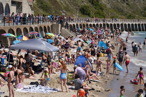 The UK is set to experience another heatwave next week(Image: PA)
With temperatures on the rise, the Met Office says there is a chance of thundery rain at times for some.
Crabtree said: “Outbreaks of rain, some of which could be thundery, are possible in southern and western areas for a time on Monday evening spreading north and east through the night, though this will be fairly hit-and-miss and for many the weather will be a dry and warm day.
!While there’s a fair degree of uncertainty at this range, the main signal for more frequent thundery showers arrives from the south late on Wednesday and into Thursday. The risk of showers spreads north and west on Thursday, potentially bringing some fairly wet weather to Scotland, northwest England and parts of Wales through the day.”