Your support helps us to tell the story
From reproductive rights to climate change to Big Tech, The Independent is on the ground when the story is developing. Whether it’s investigating the financials of Elon Musk’s pro-Trump PAC or producing our latest documentary, ‘The A Word’, which shines a light on the American women fighting for reproductive rights, we know how important it is to parse out the facts from the messaging.
At such a critical moment in US history, we need reporters on the ground. Your donation allows us to keep sending journalists to speak to both sides of the story.
The Independent is trusted by Americans across the entire political spectrum. And unlike many other quality news outlets, we choose not to lock Americans out of our reporting and analysis with paywalls. We believe quality journalism should be available to everyone, paid for by those who can afford it.
Your support makes all the difference.Read more
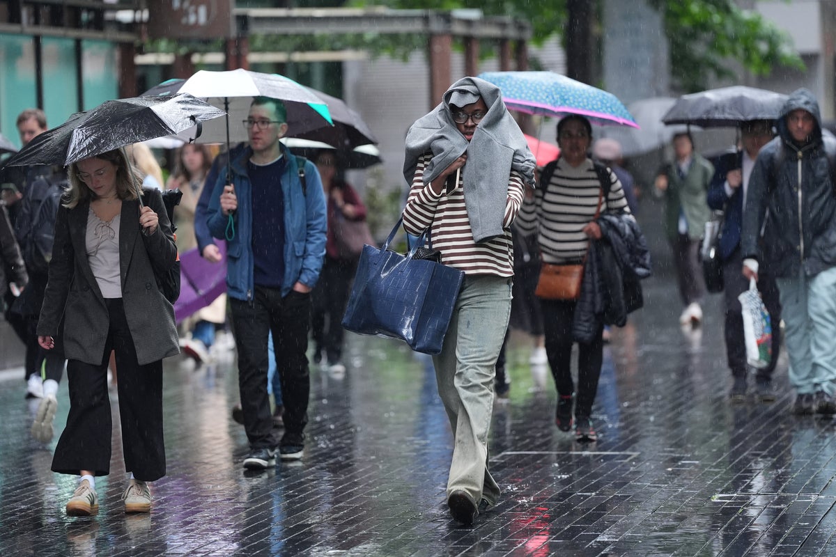
Yellow weather warnings for thunderstorms have been issued across parts of the UK in the aftermath of the fourth heatwave of the summer.
Forecasters say parts of Scotland and Northern Ireland could see “heavy showers and thunderstorms” on Wednesday evening and into Thursday. The Met Office is warning of potential disruption to roads and public transport during the wet weather, with as much as 50mm of rainfall possible in some areas.
It comes after scorching temperatures across the country on Monday and Tuesday, with some areas seeing the mercury climb above 33C in the hottest places.
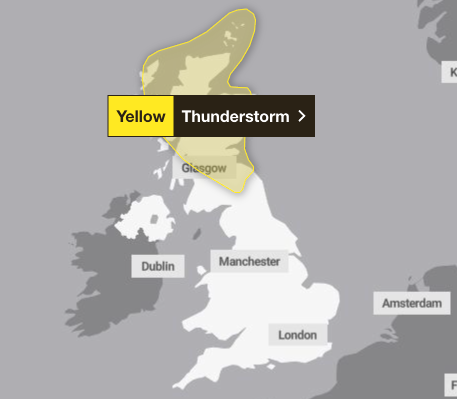
The yellow weather warning is in place from 2pm until midnight on Wednesday across swathes of Scotland, including Aberdeenshire, Dundee, Edinburgh, East Lothian, and Glasgow. A second thunderstorm follows immediately afterwards, covering much of central and eastern Northern Ireland, as well as Scotland, until 10pm on Thursday.
open image in gallery
A yellow weather warning is in place on Wednesday (Met Office)
Forecasters said those living in the affected areas should be prepared for heavy rainfall, warning hail and gusty winds are also possible. They added drivers should prepare for “difficult driving conditions” and some road closures due to the storms.
Heat health alerts have been extended into next week for much of England after the fourth heatwave of the summer brought thunderstorms and showers.
The UK Health Security Agency said yellow warnings will now be in place in Yorkshire and Humber, the East and West Midlands, London, the South East and South West and East of England until 6pm on August 18.
The warnings mean significant impacts on health and social care services are possible due to high temperatures, including a potential rise in deaths among the elderly or those with pre-existing health conditions.
Alerts were previously due to end at 6pm on Wednesday.
People have also been warned communities could become cut off by flooded roads, with those in areas prone to flash flooding advised to prepare a flood plan and emergency flood kit.
The Met Office said: “Whilst most areas will remain dry, a few isolated to well-scattered heavy showers and thunderstorms could develop on Wednesday afternoon and evening. Where these occur, some places could receive 20mm to 30 mm in less than an hour, with very localised totals in excess of 50mm possible if storms repeatedly affect the same areas.
“The most intense thunderstorms could produce large hail and gusty winds. Showers and thunderstorms will tend to ease mid to late evening, but may linger over Orkney and the far north of mainland Scotland into the first part of the night.”
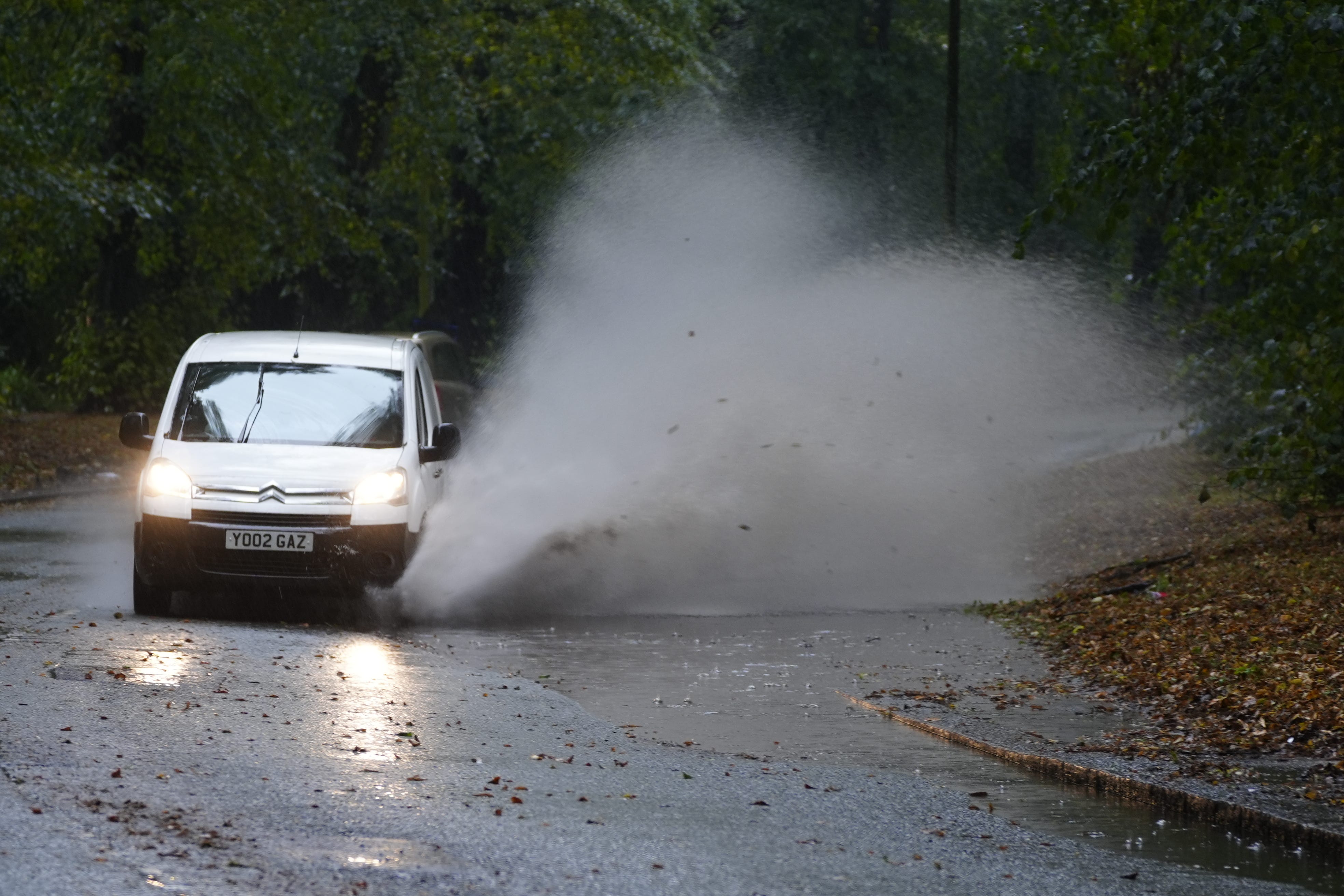
open image in gallery
Thunderstorms and heavy rain may cause travel disruption across parts of Scotland and Northern Ireland on Thursday, the Met Office has warned (PA)
Forecasters said there was a “slight chance” of power cuts causing loss of service to some homes and businesses. To prepare, they said people should “consider gathering torches and batteries, a mobile phone power pack and other essential items”.
People have also been warned of a potential “danger to life” caused by a “small chance of fast-flowing or deep floodwater”.
The Met Office said heavy showers and thunderstorms were also expected to develop on Thursday morning.
“Further scattered heavy showers and thunderstorms are then likely to develop on Thursday afternoon and evening across portions of central and eastern Scotland in particular,” the forecaster said. “These will be rather slow-moving, potentially giving isolated accumulations of 40 to 60 mm in an hour, with a higher likelihood of some impacts from surface water flooding.
“Showers and thunderstorms should slowly decay during the mid to late evening.”
Warm and sunny weather is forecast across much of the UK in the run-up to the weekend, with London set to see highs of 29C on Wednesday and Thursday.
Sunny and dry conditions are expected to last into next week in the south of England, with skies turning greyer from Monday further north.