
A deadly storm over the Atlantic could have major repercussions in the UK
Steven White and Maxine Denton Senior Reporter
13:15, 17 Aug 2025
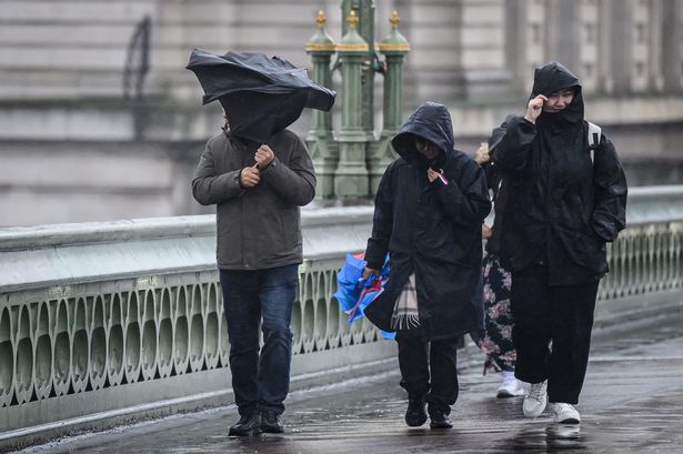 A group of people are battered by strong winds(Image: Leon Neal/Getty Images)
The UK could be bracing for unusual weather conditions due to a tropical storm currently making its way across the Atlantic.
Storm Erin has already battered Cape Verde, prompting authorities to declare a state of emergency on São Vicente and Santo Antão islands which lie off the west coast of Africa.
It comes after nine people were killed and around 1,500 were forced to evacuate their homes.
The National Hurricane Centre has warned people to be ready for the westward-moving winds that could reach the Leeward Islands, Bermuda or the east coast of the US and the Met Office has spoken of how and when the storm could affect the UK.
The Met Office has suggested that the deadly storm could have a big say on weather conditions for us in the latter part of August. It comes as the Met Office tells Brits in 38 areas to prepare ’emergency’ kit with three items.
According to the forecaster’s long-range predictions between Tuesday, August 19, and Thursday, August 28, there is the likelihood of increased wind and rain on the horizon. This could turn thundery for southern and western parts of the UK.
The Met Office explained: “The details during this period carry low confidence. High pressure will probably be increasingly displaced to the north through the first part of this period, allowing areas of low pressure to potentially make inroads from the Atlantic. This brings an increasing possibility of stronger winds and rain, some of which could be heavy and thundery, especially for southern and western areas, but this perhaps becoming more widespread with time.
“Overall, temperatures look to remain above average, with the potential for some further hot spells, especially in the south. One of the determining factors of the forecast through this period will be the behaviour of what is currently Tropical Storm Erin as it progresses into the North Atlantic; this being a quite typical source of uncertainty in late summer.”
How tropical Storm Erin could influence UK weather
The forecaster further said in its blog posted today that weather predictions will become more vague from Monday due to what’s happening across the Atlantic. It wrote: “Beyond Monday, the forecast becomes more uncertain, largely due to developments in the Atlantic. Tropical storm Erin is currently moving towards the United States, and its eventual path could influence UK weather.
“It’s not uncommon for tropical systems at this time of year to be picked up by the jet stream. Recent examples include Storm Floris and ex-tropical storm Dexter. The impact on the UK depends on where these systems sit relative to the jet stream, on the cooler, low-pressure side.
“They can bring wet and windy weather; on the warmer, high-pressure side, they may remain offshore and contribute to warmer conditions. Sometimes the jet stream flows in a relatively straight path, much like a fast-moving river.
“At other times, it meanders and loops, slowing down the movement of weather systems and making their paths less predictable. These meanders can lead to prolonged periods of wet or dry weather, depending on where the jet stream is positioned.”