NASA and ESA have published satellite images showing the Iberian Peninsula. They reveal numerous forest fires raging across Spain and Portugal.
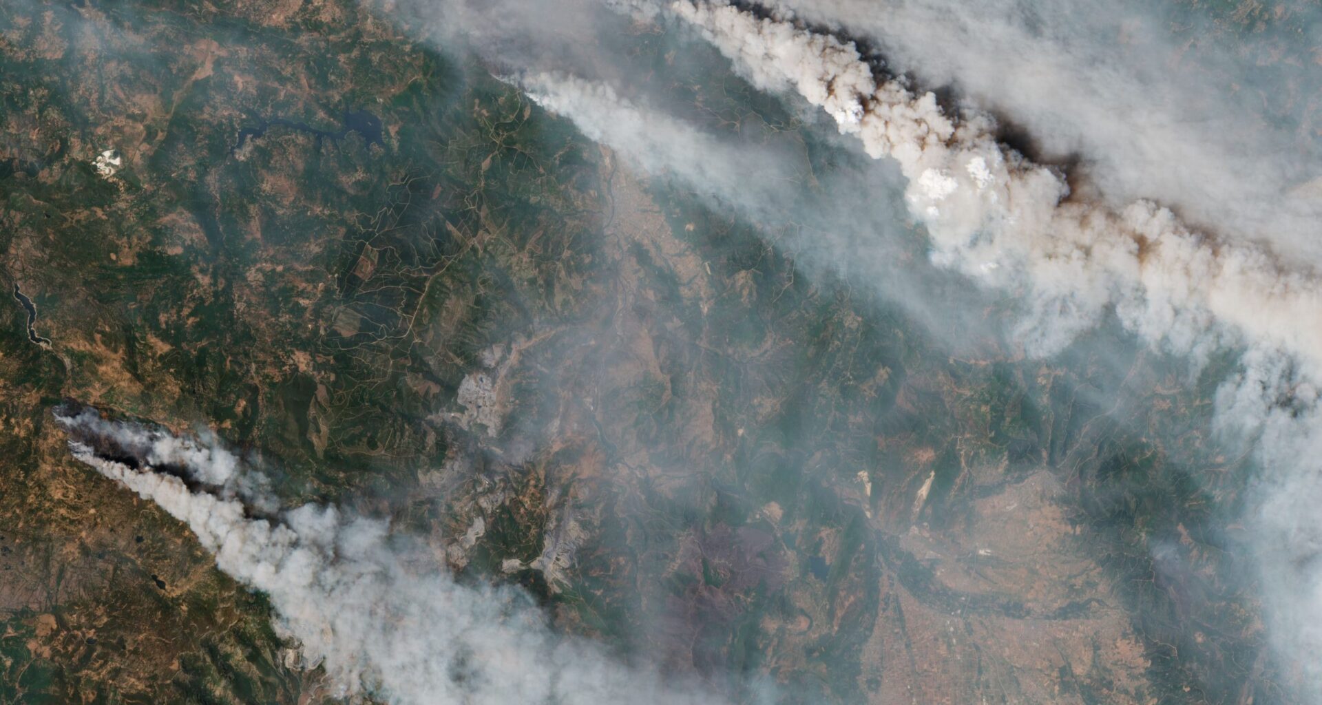
 Forest fires in Spain captured by the Sentinel-3 satellite. Source: contains Copernicus Sentinel data (2025), processed by ESA
The record heatwave that hit southern Europe this summer and the lack of rainfall led to a burst of forest fires. Spain and Portugal were hit the hardest. According to data from the European Forest Fire Information System (EFFIS), which includes data on active fires from NASA’s FIRMS system, as of August 19, more than 382,000 hectares have burned in Spain since the beginning of the year. This area exceeds the area burned in any other year recorded in EFFIS logs, which have been kept since 2006.
According to media reports, as of August 17, thousands of Spanish firefighters were battling approximately 20 major fires across the country, forcing tens of thousands of people to leave their homes. Among the affected infrastructure was the high-speed train between Madrid and Galicia, which was halted for nearly a week.
As for Portugal, from the beginning of the year until August 19, fires burned more than 347,000 hectares, which, according to the EFFIS database, is second only to 2017. According to a report by the European Commission’s Emergency Response Coordination Center, there were 10 major fires raging in the country on that day. The largest of them, in Trancoso, destroyed more than 39,000 hectares.
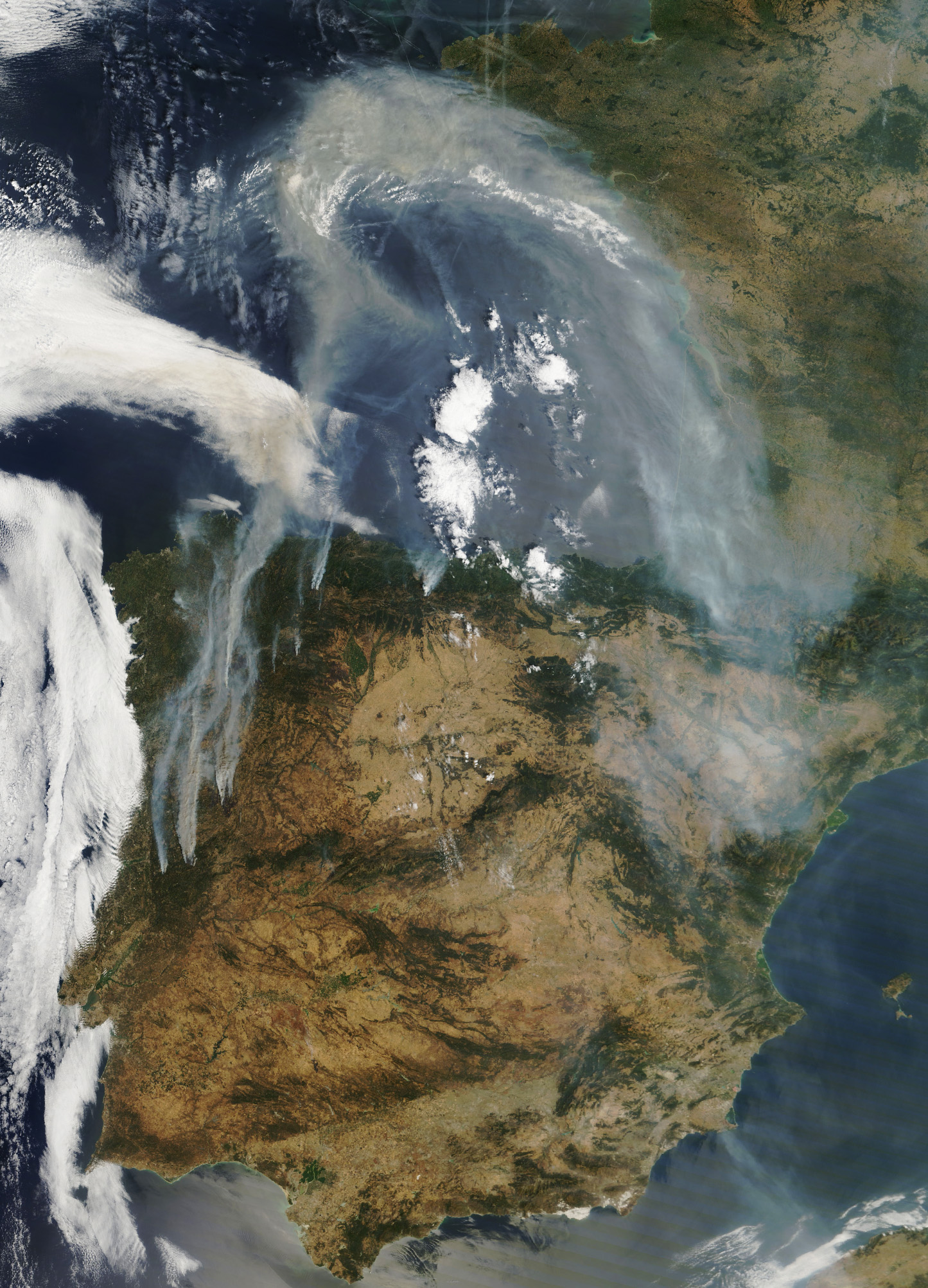 The Iberian Peninsula shrouded in smoke from forest fires. The image was taken on August 15, 2025, by the Terra satellite. Source: NASA
Satellite images demonstrate the scale of the disaster that has engulfed these countries. One of them was taken on August 15 by NASA’s Terra satellite. It shows thick smoke over France, Spain, and Portugal, rising from fires in the northern part of the Iberian Peninsula. A more recent image was taken by the European Sentinel-3 mission on August 17, 2025. It demonstrates that the situation has not improved at all over the past few days.
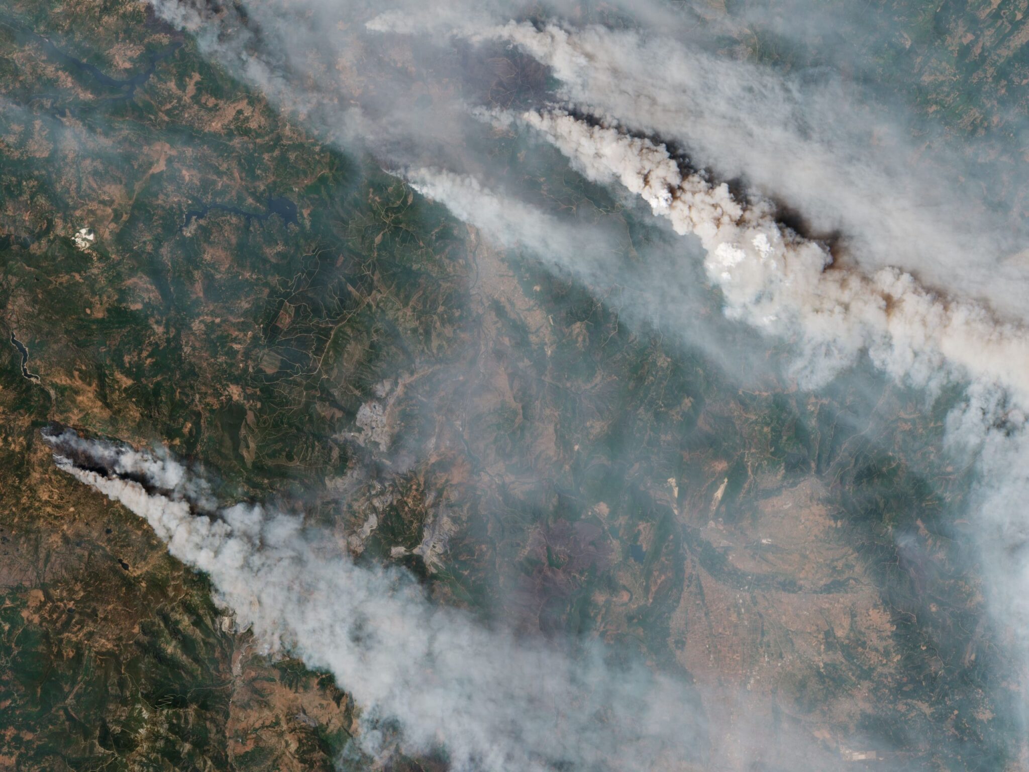
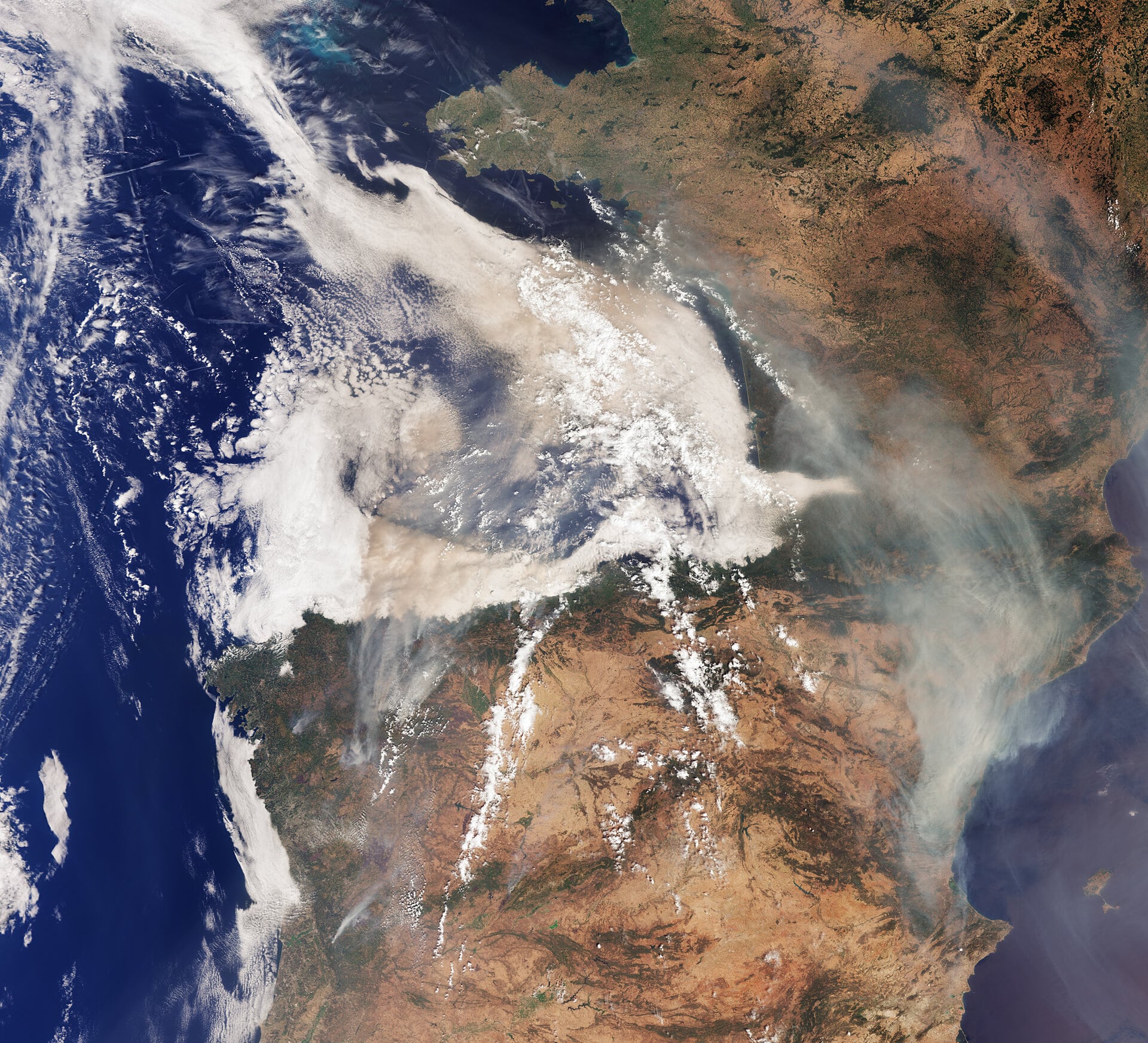 The Iberian Peninsula shrouded in smoke from forest fires. The image was taken on August 17, 2025, by the Sentinel-3 satellite. Source: contains Copernicus Sentinel data (2025), processed by ESA
The thick smoke clouds created by the fires drift north and east under the influence of prevailing winds and merge with cloud systems over the Atlantic Ocean, creating a smoke screen over the Bay of Biscay. Part of this smoke, moving northward, also returns over the Mediterranean coast of Spain. The smoke, which rose higher into the atmosphere, also reached France, the United Kingdom, and Scandinavia, mixing with smoke from forest fires in Canada and creating a hazy sky.
Such forest fires not only threaten human lives and destroy wildlife, habitats, agriculture, and property, but also seriously deteriorate air quality, exacerbating their impact on human health.
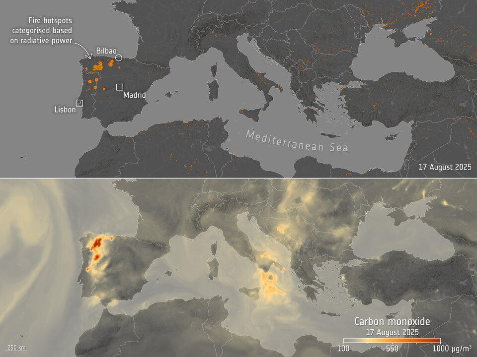 Map showing forest fire locations and carbon monoxide concentrations in Europe as of August 17, 2025. Source: ESA (data sources: VIIRS and CAMS)
The ESA map shows hot spots of fires (top) and concentrations of carbon monoxide in the atmosphere (bottom) in southern Europe, North Africa, the Mediterranean, and the Black Sea as of August 17. Breathing air contaminated with carbon monoxide can cause serious health problems. Another danger is posed by the small solid particles (PM2.5) created by fires. These can be harmful to humans as they can penetrate the lungs and bloodstream.
Earlier, we reported on how satellites helped detect hidden flooding in Greenland.