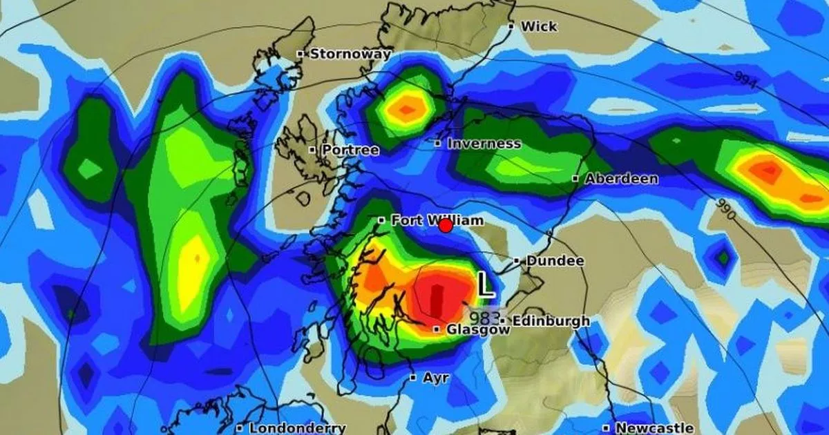
A wave of damp and chilly weather sweeping across 600 miles was said to be hurtling toward Scotland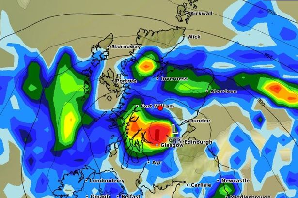 WXCharts showing the apparent rain over Scotland on Friday, August 29(Image: WXCharts )
Scotland is experiencing a pretty turbulent time in terms of what is in store weather wise. Off the back of a hot spell last week, the country now faces potential fallout from Hurricane Erin – and an apparent 600-mile rainstorm.
Scots are no stranger to high winds and intense rain. Just last month, the Met Office was forced to issue millions with weather and flood warnings due to Storm Floris, which caused travel disruption and power losses.
So, with summer slowly but surely crawling to an end, just how much time does Scotland have to enjoy the remnants of hot weather? And does the Met Office believe a 600-mile wall of rain is really coming our way?
Well, according to the national weather agency’s temperature map and general outlook, Scotland has just over a week to enjoy balmy and pleasant temperatures ranging from the low to mid 20s.
Admittedly, from today, Thursday, August 21 until the morning of Sunday, August 24, the mercury will hold steady in the late teens. But by Sunday late afternoon, as we head into a fresh week, the figures will creep up again.
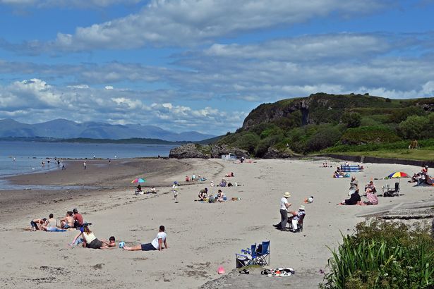 There are two weeks left of meteorological summer, and we’ve already had four heatwaves this year(Image: Ken Jack / Getty)
Next Monday shows Glasgow taking the highest temperature spot at 23C, while the rest of the country follows not far behind at 20-22C. Kirkwall in the far north will sit at 17C, but that is to be expected due to its positioning.
The following Tuesday and Wednesday offer more of the same with highs of a decent 19-20C all round.
By Thursday, we start to see a decline, with only the Glasgow and Edinburgh areas retaining that 20C mark.
And by Friday, all bets are off, as temperatures plummet to 12-14C with the exemption of Castlebay and Tiree in the Western Isles. At 15C, these two spots might make a perfect weekend getaway for those missing the warmth.
Content cannot be displayed without consent
In terms of the 600-mile rain wall that is expected around the time the toasty temperatures subside, the Met Office says that while the “language is eye-catching, the forecast paints a more nuanced picture.”
A spokesperson explained: “Low pressure is expected to dominate early in the period, bringing spells of rain and showers, with the potential for windy conditions. However, confidence in deeper low-pressure systems near the UK is currently low.
“Drier and brighter spells are also likely, and temperatures may be above average at times, though broadly near-average overall. The chance of hot spells or heatwaves is reduced compared to earlier in August.”
BBC lead weather presenter and meteorologist Simon King also put his head above the parapet and said a 600-mile rain wall, supposedly forming off the back of Hurricane Erin, is actually “physically impossible”.
“These reports are simply suggesting that the low pressure containing the remnants of Hurricane Erin would be 600 miles wide as it moves to the west of the UK, a size very typical for this type of weather system that affects the UK,” Simon pointed out.
“Rain doesn’t fall in a continuous sheet stretching for hundreds of miles so there’ll be no ‘wall of rain’ to come with it, either.”
The Record previously reported how weather maps from WXCharts, which uses Met Desk data, predict a wave of damp and chilly weather sweeping across a 600-mile stretch of the country on Wednesday, August 27.
 Join the Daily Record WhatsApp community!
Get the latest news sent straight to your messages by joining our WhatsApp community today.
You’ll receive daily updates on breaking news as well as the top headlines across Scotland.
No one will be able to see who is signed up and no one can send messages except the Daily Record team.
All you have to do is click here if you’re on mobile, select ‘Join Community’ and you’re in!
If you’re on a desktop, simply scan the QR code above with your phone and click ‘Join Community’.
We also treat our community members to special offers, promotions, and adverts from us and our partners. If you don’t like our community, you can check out any time you like.
To leave our community click on the name at the top of your screen and choose ‘exit group’.
If you’re curious, you can read our Privacy Notice.
According to WXCharts, the disruptive conditions would start to take effect from midday on August 27, with the heaviest rainfall apparently coming for southern Scotland and the only Scots region exempt being Aberdeenshire.
This reported incoming weather front could cause the mercury to drop as low as 5C in central Scotland. The Met Office, however, shows a different outlook for this period.
The national weather agency throws up sun and cloud for the last week in August when the rainstorm is meant to hit. And, as mentioned, the temperature holds steady in the late teens for most – far from plummeting into single figures.