Satellite images show moor fire burning for more than two weekspublished at 12:02 British Summer Time
12:02 BST
 Emma Pengelly
BBC Verify journalist
This morning I’ve been using satellite imagery and heat-source data to see if we can map the spread of a fire in the North York Moors over the past 18 days.
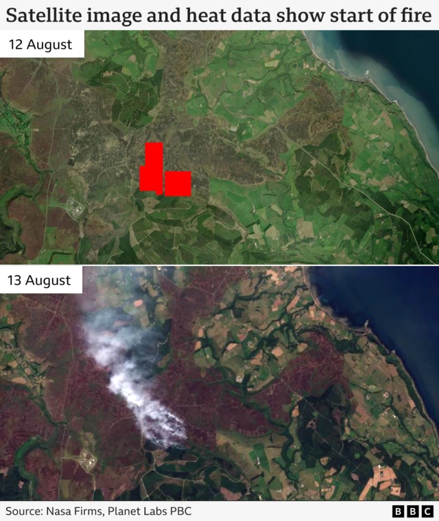
The Langdale Moor fire broke out on 11 August and firefighters have been on the scene ever since.
The earliest view of the blaze from space – published by satellite image provider Planet – was captured on its third day and shows smoke drifting north-west over the moorland.
Meanwhile, Nasa’s Fire Information for Resource Management System (Firms), which detects hotspots on the earth’s surface, first picked up a heat source in the area on 12 August, represented by the red blocks on the map below.
On 13 August the fire was declared a major incident by North Yorkshire Fire and Rescue Service (NYFRS).
Nasa’s Firms continued to detect hotspots for the rest of the week before they began to reduce in number from 16 August.
That afternoon NYFRS still had six fire engines and specialist appliances at the scene.
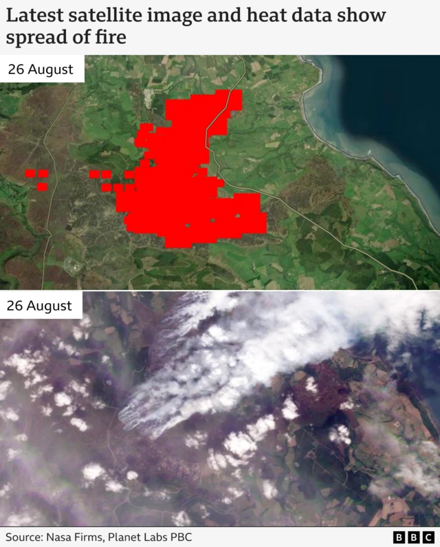
But on Monday 25 and Tuesday 26 August there was a significant increase. Overnight into Tuesday the blaze had spread, NYFRS confirmed.
A satellite image captured on Tuesday shows plumes of smoke billowing to the north-east.
Speaking in the last few minutes, the NYFRS chief said there has been no further spread of the fire in the past 48 hours.
You can follow the latest on this BBC News live page