The flood alerts cover a large part of the west coast of Wales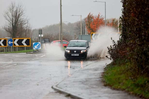 The warnings are in place due to a mix of high tides and weather conditions(Image: John Myers)
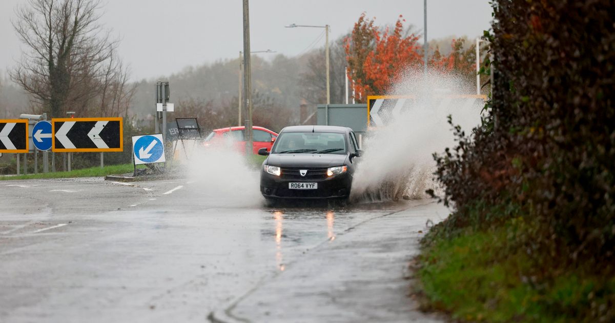
Flood alerts have been issued for several areas along the Welsh coastline after a week of wet weather which has seen thunder and lightning hit large parts of Wales.
The Natural Resources Wales (NRW) flood alerts are in place for Swansea Bay and the Gower, Pembrokeshire, Ceredigion between Clarach and Cardigan, Llyn Peninsula and Cardigan coastline, Carmarthenshire and North Gower. They were all issued earlier in the week but remain in place on Friday morning (September 12), with the unsettled weather set to stay.
NRW warns of “a risk of flooding as a result of the combination of the high tides and weather conditions”.
The alert for Swansea Bay and the Gower, which was issued on Thursday afternoon, reads: “Flooding of low-lying land and roads is expected. Be careful on beaches, promenades, coastal footpaths, roads, low lying land and close to the estuary. We will continue to monitor the situation.”
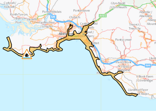 The alert affecting Swansea Bay and the Gower coast(Image: Natural Resources Wales)
The six other alerts also warn of flooding of low-lying land and roads in other parts of south west Wales but the alert for Carmarthenshire, which has been place since Tuesday, also suggests that flooding to property is possible. For the biggest stories in Wales first, sign up to our daily newsletter here.
The warnings come after a week where Wales has been battered by a continuous onslaught of rain following months of dry weather which saw Wales record the driest spring on record.
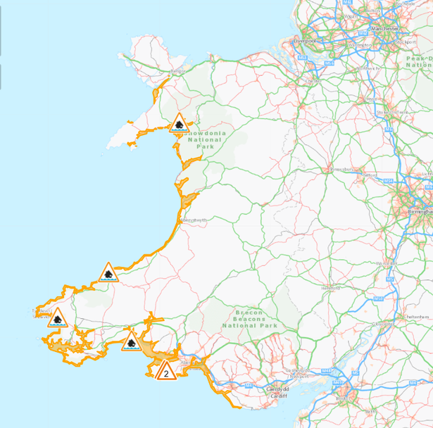 Flood alerts are in place along the Welsh coastline(Image: Natural Resources Wales)
This week has seen a mix of unsettled weather as heavy storms and thunderstorms are set to continue into the weekend, marking a wet start to September.
On Thursday morning, several homes in Cardiff were struck by lightning on a residential street in the Caerau area of the city. A spokeswoman for the fire service confirmed that one property suffered external and internal damage during the strike shortly before 8am.
The Met Office forecast for Wales on Friday states: “Patchy cloud and scattered showers spread eastwards, these may be heavy at times and carry a risk of thunder. Some sunnier spells remain between the showers. Feeling cooler. Breezy, particularly over higher ground and along coasts. Maximum temperature 17°C.”
“Showers continuing this evening, perhaps heavy, particularly over higher ground. An organised band of rain and cloud pushes east through the evening, with heavy downpours possible. Some clearer spells follow. Remaining breezy. Minimum temperature 9°C.”
The weather won’t ease just yet as scattered showers and heavy rain persisting on Sunday and Sunday, September 14, expected to see near-gale force winds and heavy rain.
Get daily breaking news updates on your phone by joining our WhatsApp community here. We occasionally treat members to special offers, promotions and ads from us and our partners. See our Privacy Notice.