Home » Latest Travel News of UK » Scotland on High Alert as Hurricane Humberto Approaches UK with Severe Weather, Get the Latest Updates Here
Published on
September 29, 2025

The arrival of Hurricane Humberto to the UK means local weather authorities are readying for the likely occurrence of strong winds, rain, and ensuing travel disruptions. Hurricane Humberto, which strengthened to Category 4 over the weekend and is now remaining over southwestern the Atlantic, is likely to traverse the the west of the UK. With weather warnings for Scotland, the UK Met Office is readying for worst case scenarios as most of the storm threatens westerly and Atlantic facing parts of the UK. Taking precaution is the best way to prepare for the storm that is going across the Atlantic.
Hurricane Humberto Brings Strong Winds and Rain to the UK
Hurricane Humberto, which briefly escalated to a Category 5 storm before weakening back to Category 4, is set to affect the UK later this week. The storm’s influence on the UK weather will primarily affect Scotland, where persistent, heavy rain and strong winds are expected. These conditions are forecasted to last from Wednesday evening through Friday morning, as Humberto tracks closer to the UK.
The Met Office has issued a yellow weather warning for Scotland, where rain is expected to be particularly intense, with some regions likely to receive between 200-250mm of rain. The heaviest rainfall will occur over the hills and mountains, potentially leading to flooding and hazardous travel conditions. In addition, strong winds will exacerbate the situation, making travel even more difficult.
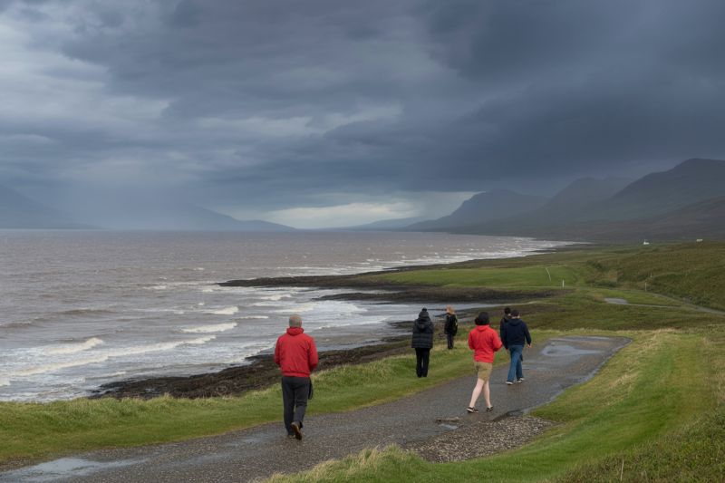
For those traveling to or from Scotland, especially tourists visiting popular destinations like Edinburgh and the Highlands, the storm may cause significant delays. Flooded roads, power outages, and the closure of certain tourist sites could disrupt travel plans, and visitors are advised to check local conditions frequently.
Potential Impact on Travel: Delays and Disruptions for Tourists
As Hurricane Humberto moves closer to the UK, its impact will be felt by both locals and tourists. Travelers heading to the UK should be prepared for delays, particularly in areas of Scotland where the heaviest rain and strongest winds are expected.
Tourists planning to visit Scotland’s scenic attractions, such as Loch Ness, the Isle of Skye, and the Cairngorms National Park, may experience disruptions in transportation, as roads and rail lines could become impassable. Heavy rain could lead to localized flooding, cutting off some rural areas and making it difficult to access remote tourist spots. Additionally, visitors planning to enjoy outdoor activities such as hiking, cycling, or sightseeing may need to rethink their plans, as conditions could become dangerous due to fast-flowing floodwaters and reduced visibility.
In the south of the UK, while the weather is expected to be more settled, travelers in London and other major cities may still face delays due to the ripple effects of the storm. Even if the South remains relatively dry, the storm’s overall impact on transport systems could lead to issues for tourists traveling by train, bus, or air.
Met Office Warnings for Scotland: Flooding and Power Outages Likely
The Met Office’s yellow weather warning for Scotland has highlighted the risk of flooding and potential disruption to travel. As much as 250mm of rain could fall on the hills and mountains in the region, potentially leading to flooded roads and difficult conditions for drivers. Some areas may experience dangerous levels of fast-flowing floodwater, which poses a risk to life and property.
Authorities have also warned of possible power cuts as the storm’s winds and rainfall cause damage to infrastructure. For tourists, this could mean disruptions to hotel bookings, cancelled tours, and closed attractions. Many tourist accommodations in Scotland are preparing for the possibility of power outages and have advised guests to take necessary precautions, such as charging electronic devices in advance.
Visitors are urged to check their travel arrangements, particularly if they are planning to visit areas prone to flooding. The Met Office advises travelers to stay up-to-date with weather warnings and local reports, as conditions can change quickly in the aftermath of such storms.
Heavy Rain and Fog in the South: Travel Impact on the East and Southeast
Although the worst of the weather will impact Scotland, travelers in the southern parts of the UK should also be prepared for difficult conditions. The Met Office issued an additional yellow weather warning on Monday morning due to dense fog that had covered parts of the East and Southeast of England. Areas such as East Anglia, Essex, Surrey, and Greater London were particularly affected, with visibility dropping to as little as 50 meters in some locations.
For travelers relying on public transport, including trains and buses, this fog has the potential to cause delays and slow down travel times. Visitors planning to explore London or nearby attractions such as the Tower of London or Buckingham Palace may find their sightseeing plans disrupted as they navigate through reduced visibility and slower travel times.
Those with early morning flights or train journeys may face difficulties, particularly if they are traveling in affected areas. The fog warning is expected to clear later in the morning, but travelers should still anticipate disruptions throughout the early hours of the day.
What to Expect from the Weather in the Coming Week
The weather forecast for the rest of the week shows that the UK will experience a classic northwest-southeast split, with different weather patterns across regions. While the South East of the country remains settled, with light winds and clear skies, the North West and Scotland will face persistent rain and stronger winds as the influence of Hurricane Humberto takes hold.
By Wednesday, rainfall will become heavy across the North West, particularly affecting Scotland. Winds will pick up on Friday, and it is expected that areas in the North and West will see the strongest gusts. This will be accompanied by heavy rain, potentially turning into a significant weather event that could impact travel plans over the weekend.
Meanwhile, conditions in the South of the UK will remain relatively dry, although cloud cover will increase throughout the week. Tourists visiting London and other major cities in the South will enjoy more stable weather, though travelers should still keep an eye on potential weather warnings.
Preparing for the Storm: Tips for Travelers
Given the expected weather disruptions, tourists visiting the UK should take steps to ensure their safety and minimize the impact of the storm on their travel plans. Here are some key tips for travelers:
- Check Local Weather Reports: Stay informed about weather warnings and updates, particularly if you are traveling in Scotland or the North West. The situation could change quickly, and travelers should remain flexible in case of cancellations or delays.
- Prepare for Flooding: If you’re planning to travel to rural or mountainous areas, be aware of the risk of flooding. Avoid driving in heavy rain, and check for road closures in affected areas.
- Pack Accordingly: Bring waterproof clothing, sturdy footwear, and an umbrella to deal with the rain. Be prepared for windy conditions, particularly in Scotland.
- Allow Extra Time for Travel: Whether you’re traveling by train, bus, or car, make sure to allow extra time for delays. Fog, rain, and winds could slow down travel times, so it’s essential to factor in potential disruptions.
Stormy Conditions Ahead for the UK and Visitors
This week, Humberto’s aftermath will bring inclement weather conditions to the UK. Strong winds, heavy rain, and even flooding will impact Scotland more than the other regions. Sightseers in the area will want to prepare for poor weather which will include flooding, and for areas with unofficial visibility guides. If everyone, including tourists, follow the weather alerts and avoid the areas with floods, it will bring some safety to the expected storms.
