A yellow weather warning has been issued for strong winds between 4pm on Friday and 6am on Saturday.
The Met Office said it may lead to disruption across all six counties.
“Storm Amy is expected to bring a spell of strong winds to Northern Ireland during Friday and Friday night,” it said.
“Westerly winds will pick up during the afternoon, peaking during the evening with gusts of 50 to 60 mph likely for many areas and could reach 60 to 70 mph for a time.
“Exposed coasts and hills will see the highest gusts which could exceed 70 mph.
The weather alert was issued due to the slight chance of damage to buildings including the risk of tiles being blown from rooftops.
There is also the possibility of delays to road, rail, air and ferry services and the potential for power cuts and disruption to mobile phone coverage.
“There is a small chance that injuries and danger to life could occur from large waves and beach material being thrown onto sea fronts, coastal roads and properties,” the Met Office states.
“There is a small chance of injuries and danger to life from flying debris.
“There is a small chance that some roads and bridges could close.”
It comes after a Met Office forecaster said windspeeds of 40mph and heavy rain is expected on Thursday before a short pause on Friday morning.
Heavy rain and stronger winds will resume both inland and on the coast in the evening.
“This is the one that we are a little bit concerned about,” the meteorologist said.
“It’s likely to actually develop and deepen very quickly, so likely to be associated with some strong, very strong and gusty winds.”
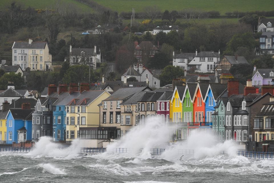
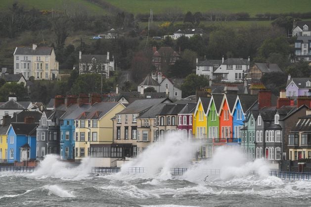
Whitehead during 70mph winds caused by Storm Kathleen in 2024. Pic Andrew McCarroll/Pacemaker Press.
News Catch Up – Wednesday 1 October
“At the moment, we’re looking at some sort of gales developing across Northern Ireland, even inland, potentially sort of severe gales around, around some of the NI coasts. So it is one we are keeping a close eye on at the moment.”
On Tuesday the forecaster stressed there was still some uncertainty over the exact track of “this deep air of low pressure” as it passes to the north but hinted that a warning would soon be issued.
Temperatures are expected to drop to a low of 7C on Friday with a high of 14C.
Weaker windspeeds will continue on Saturday rain expected to last for most of the day.
Blustery conditions should begin to settle on Sunday which should be much drier.