In an early sign of the winter weather that’s coming, the dreaded polar vortex is making news yet again.
The polar vortex is “ramping up from its summer slumber,” said meteorologist Judah Cohen in an Oct. 1 email to USA TODAY.
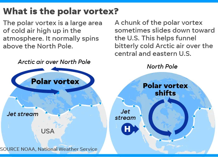
The vortex is a gigantic, circular area of cold air high up in the atmosphere that typically spins over the North Pole (as its name suggests). It’s strongest during the winter and usually weakens or even disappears in the summer. Its position can determine what part of the U.S. that Arctic air will invade.
A misunderstood weather pattern
The polar vortex is not a synonym for “cold snap,” according to the Polar Vortex Blog at Climate.gov, and it’s not the only weather pattern to blame for blasts of cold air.

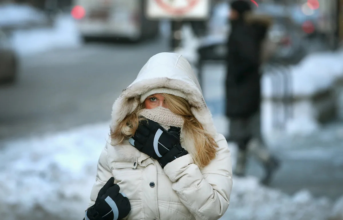
A commuter makes a sub-zero trek through the Loop on January 6, 2014, in Chicago, Illinois, as the polar vortex takes hold on the U.S.
Perhaps counterintuitively, a strong polar vortex actually keeps coldest weather bottled up near the North Pole.
The stronger the polar vortex, the milder the United States’ winter is as the vortex makes it harder for cold air to plunge deep into North America, Weather.com meteorologist Jonathan Erdman said.
And when it’s weak, that means cold air is more likely to invade the United States.
Meanwhile, the phrase “polar vortex” has captured public attention and is now often misused to describe short-term bouts of frigid weather, experts told USA TODAY earlier this year.
“Weather can happen regardless of what the stratosphere is doing,” said Isla Simpson, a scientist with the National Center for Atmospheric Research.
In any event, don’t fear the polar vortex. It isn’t like a tornado or hurricane; it’s not something you can look up and see in the sky one day; there’s no freakish spinning whirlwind of ice and snow roaring down from Canada.
012919-polar-vortex
Polar vortex forecast: Big change coming
At the moment, “the polar vortex is predicted to be weaker than normal for the foreseeable future,” Cohen said Oct. 1. Cohen is director of seasonal forecasts at Atmospheric and Environmental Research.
“It is looking like there will be a stretched polar vortex event the second week of October (like we had multiple times last winter but the impacts are much weaker in early October) that should bring some cooler temperatures to the eastern US, even if briefly,” he said.
Cohen explained that the cooler temperatures should be felt around October 10. “Right now it is looking pretty modest, maybe a few degrees below normal but a big change from the near record warmth preceding it,” he said in an email to USA TODAY Oct. 2. “Often with these events, it turns out to be cooler than first predicted by the models.”
Polar vortex is nothing new
The vortex has likely “existed in some form for the past 4.5 billion years,” according to senior scientist Jeff Kiehl of the National Center for Atmospheric Research in Boulder, Colorado.
In fact, it’s thought that the term “polar vortex” first appeared in an 1853 issue of the magazine Littell’s Living Age, the National Oceanic and Atmospheric Administration said.
And although it’s been understood by scientists for several decades, it only entered the popular lexicon as a synonym for miserably cold winter weather a few years ago.
Contributing: Dinah Voyles Pulver, USA TODAY
This article originally appeared on USA TODAY: The polar vortex is awakening again. Is cold weather in the forecast?