Brits are bracing for a huge rainstorm, with winds of up to 80mph set to sweep across large parts of the country over the weekend and a huge band of rain bringing torrential downpours
05:00, 12 Sep 2025Updated 06:40, 12 Sep 2025
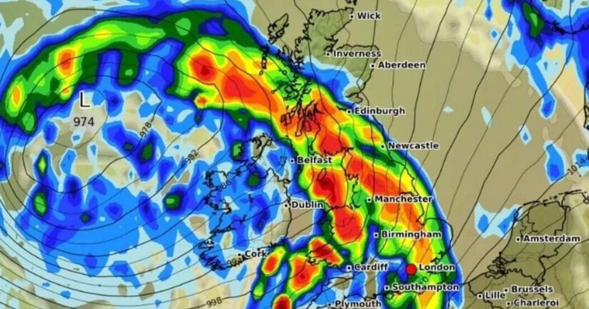
 Heavy rain is expected to drench large parts of the UK(Image: WXCharts)
The UK is set to be battered by a massive rainstorm in the coming days, with weather maps revealing exactly when and where the deluge will hit.
Maps from forecasting site WXCharts show a huge band of rain – stretching 630 miles from the Hebrides in Scotland to southeast England – set to sweep across the country on Sunday, September 14.
In England, downpours are expected to begin at around 9am on Sunday, drenching major cities including Manchester, Newcastle, Birmingham, Southampton, Plymouth and London. Near Manchester, rainfall could reach up to 5mm/hr, while in Newcastle, it is expected to hit around 2.5mm/hr.
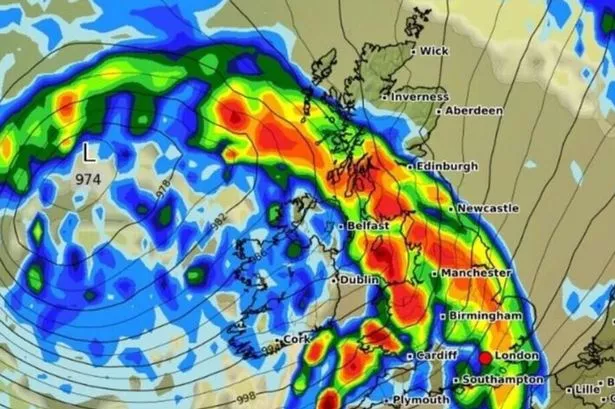
READ MORE: Met Office tells Brits in 49 areas to ‘prepare’ 3 essential items for 22 hoursREAD MORE: Exact date Brits to bask in 25C Indian summer as weather maps turn bright red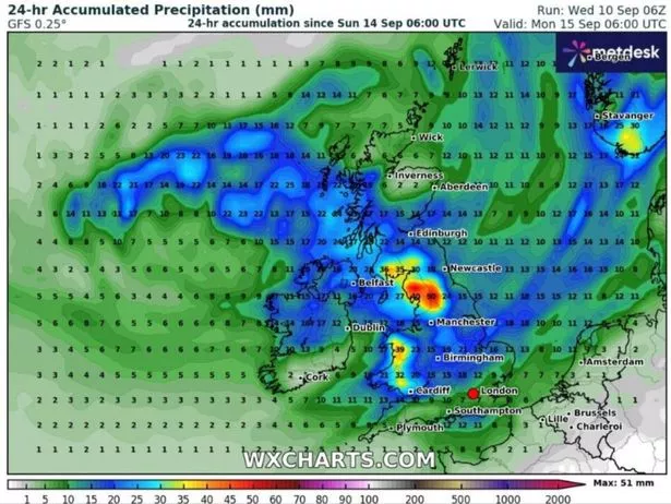 Rainfall near Manchester could reach up to 5mm/hr, based on weather maps by WXCharts (Image: WXCharts)
Wales won’t be spared either, with Cardiff likely to see up to 1mm/hr of rainfall. Meanwhile, in Scotland, Edinburgh will face the heaviest rain, with up to 5mm/hr of rain expected.
Further north, parts of the Highlands may dodge the worst of the downpour in the early hours, but maps suggest the wet weather will push northwest by midday. In Northern Ireland, Belfast is expected to see the heaviest showers, with around 1mm/hr of rainfall.
The Met Office has issued a yellow weather warning, with severe winds of up to 80mph expected. The alert covers much of west and southwest England and Wales, as well as the southern coast of England, and will be in place from 8pm on Sunday to 6pm on Monday.
The warning urges Brits to keep an eye on any loose items around their homes, and advises securing them to avoid injury. The Met Office warned: “There is a small chance of injuries and danger to life from flying debris.”
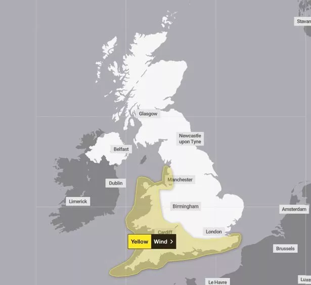 Met Office issues ‘danger to life’ weather warning as 49 areas face travel chaos(Image: Met Office)
Those in the affected regions can also expect damage to buildings, spray or large waves in coastal towns and travel chaos, with a chance roads and bridges could close. Power cuts may occur, with the potential to affect other services, such as mobile phone coverage.
In its guidance on staying safe during a storm, the Met Office says: “Stay indoors as much as possible. If you do go out, try not to walk or shelter close to buildings and trees […] Do not drive unless your journey is really necessary.”
Paul Gundersen, Chief Meteorologist at the Met Office, said: “We have been monitoring a deepening area of low-pressure over the North Atlantic that might bring impactful weather to the UK, most likely on Sunday and Monday. At present, a named storm is unlikely.”
The national weather agency’s forecast for Friday through Sunday reads: “Remaining changeable with sunny spells and blustery showers, these frequent and occasionally heavy with a risk of hail and thunder. More persistent rain likely arriving on Sunday. Feeling cool.”
In its long-range forecast from September 10 to 19, the Met Office says: “Much of this period will be unsettled, with low pressure dominating the pattern.”