
Typical Manchester weather is set to return
15:10, 25 Oct 2025Updated 15:10, 25 Oct 2025
 More rain is on the way
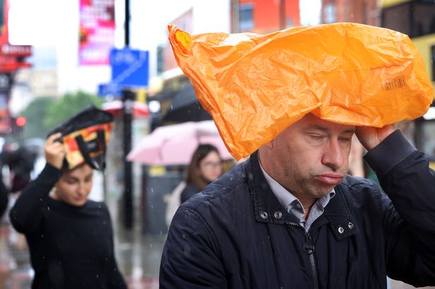
Storm Benjamin has battered the UK and while it seems the worst is over the Met Office has warned that more rain is on the way.
Conditions are set to remain unsettled next week, with chilly weather expected to hit Greater Manchester. Saturday has seen mostly dry conditions with sunny spells, but feeling colder than Friday due to northerly winds.
So far, it has been a crisp autumn day.
It comes as some parts of the UK are expected to see flurries of snow and hail this weekend. Wintry conditions are expected in parts of Scotland on Saturday night (October 26) and throughout Sunday.
While Manchester is not expected to see any snow, cold conditions will continue.
Join the Manchester Evening News WhatsApp group HERE
The Met Office say dry weather is expected to continue into this evening, with ‘plenty of early evening sunshine, leading to a dry and clear night’. Temperatures will remain low throughout the evening.
On Sunday, there will be a bright but chilly start to the day; however, typical Manchester rain will return.
The Met Office says: “Cloud soon thickening from the northwest with outbreaks of rain moving through during the afternoon.”
Weather maps show rain covering Greater Manchester, with Wigan, Bolton and Rochdale due to receive the highest levels of rainfall.
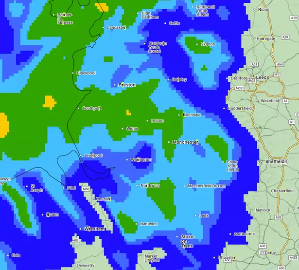 Wet weather is expected for much of Sunday (Image: Met Office)(Image: Met Office)
Never miss a story with the MEN’s daily Catch Up newsletter – get it in your inbox by signing up here
Rain is set to begin at around 8am on Sunday morning and will continue throughout the rest of the day, with rain forecast to stop for most of Monday day, before resuming Monday evening.
This rainy spell is set to continue through to midday on Tuesday.
The Met Office predicts more rain to come in their outlook for Monday to Wednesday, saying: “Cloud soon thickening from the northwest with outbreaks of rain moving through during the afternoon.”
Weather for the next week is predicted to be changeable, with temperatures returning closer to average. Breezy winds from the North-West continuing will continue into next week, with lows of 7C.
Looking ahead in it’s predictions for the end of October and into the start of November, an ‘unsettled start’ is expected across the UK.
The Met Office adds: “An area of low pressure is expected to lie close by, bringing outbreaks of rain to many areas.
“The rain may be heavy and prolonged in places, and accompanied by some strong winds.
“Western areas of the UK will probably see the highest rainfall totals.”
There is also a risk of strong winds in places across the UK, but some drier and brighter interludes are possible according to the Met Office.