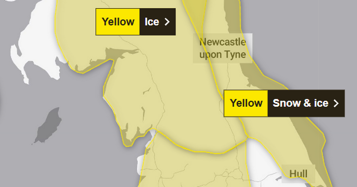
A blast of Arctic air sweeping across the UK is set to plunge the nation into sub-zero temperatures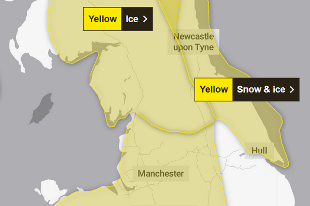 Severe weather warnings have been issued across Greater Manchester this week(Image: The Met Office)
A severe weather warning has been issued for Greater Manchester by the Met Office as an Arctic blast sweeps the UK.
Temperatures in the region are forecast to drop to -2C this week, with lows of -10C possible in parts of the country, the weather agency said.
The forecaster has issued a number of yellow snow and ice warnings across the UK. It says rain and snow will bring a “risk of icy patches” and possible disruption to affected areas.
Its latest ice warning covers parts of the East Midlands, East of England, London & South East England, North West England, South West England, Wales, West Midlands and Yorkshire and The Humber.
The warning comes into effect at midnight tonight (November 19) and remains in place until 11am on Wednesday.
 Snow and ice warnings issued by the Met Office on Wednesday (Nov 19)(Image: The Met Office)
The Met Office said in its warning on Tuesday (November 18): “Outbreaks of rain will spread southwards on Tuesday night into Wednesday morning, potentially falling as snow on hills for a time, before clearing to the south.
“As skies clear later, allowing temperatures to fall close to or below freezing, this will bring the risk of icy patches on untreated surfaces. Some temporary slushy snow deposits will be possible where snow persists for long enough, especially on grassy surfaces, but any significant accumulations will be largely restricted to communities and transport routes above about 300 m elevation.”
Issuing advice to those in affected areas, the Met Office said: “Plan to leave the house at least five minutes earlier than normal. Not needing to rush, reduces your risk of accidents, slips, and falls.
“If you need to make a journey on foot, try to use pavements along main roads which are likely to be less slippery. Similarly, if cycling, try and stick to main roads which are more likely to have been treated.
“Give yourself the best chance of avoiding delays by checking road conditions if driving, or bus and train timetables, amending your travel plans if necessary.”
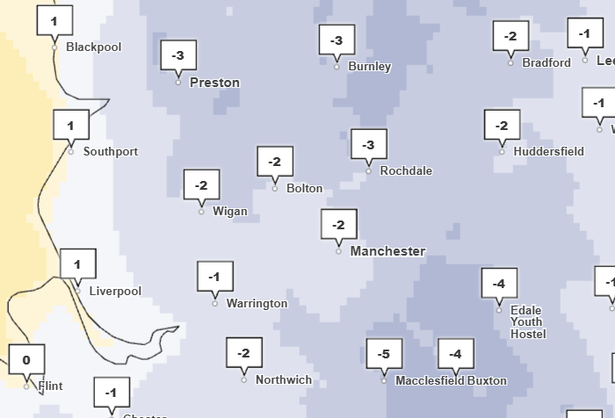 Overnight temperatures could drop to -2C in Greater Manchester on Thursday (Nov 20)(Image: The Met Office)
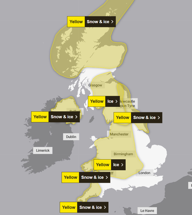
A total of seven weather warnings have been issued across the UK for Wednesday, including five snow and ice warnings, and two ice warnings.
Deputy Chief Forecaster Tom Crabtree said: “Wednesday to Friday will be the coldest part of the week, and this period has the greatest potential for impactful weather, with multiple warnings in place.
“Overnight, temperatures could get down to minus ten, with a significant wind chill from the strong northerly wind making things feel even colder.
“Wintry snow showers are expected to extend south through Wednesday and into Thursday, mainly affecting north facing coastal areas. Snow accumulations are possible, including 2-5 cm to some low-lying areas in the north and east where showers are frequent. On hills in parts of Northern Ireland, the northeast of England and Scotland, 5-10 cm of snow could fall and accumulations of 15-20cm are possible above 300 metres in parts of northeastern England and Scotland.
“Although many places will see plenty of sunshine, daytime temperatures will be well-below average, with a widespread frost setting in during the evening, especially in sheltered areas.
“With sub-zero temperatures in the first ‘cold snap’ of the year, updates to the current warnings are possible, so its important people keep up to date with the forecast.”
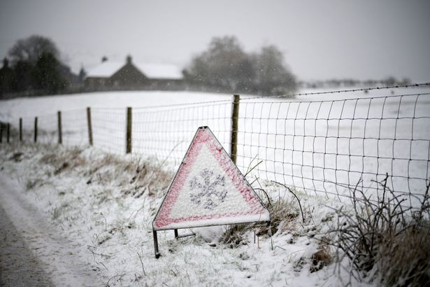 A cold spell is forecast to hit the UK this week(Image: Getty Images)
Ahead of the cold spell, the UK Health Security Agency (UKHSA) issued an amber cold health alert for parts of England, including Yorkshire & Humber, the North West and the North East, while all other regions in England will be under a yellow alert.
The alerts came into effect at 12pm on Monday (November 17) and will remain in place until 8am on Saturday (November 22).