Signs with ‘restricted area’ warnings appeared on coastal beaches in Mexico after troops were spotted in the territory
US troops ‘accidentally invade Mexico’ after landing on beach and ‘misjudging border’ following rejection Trump’s cartel strike offer.
Picture:
International Boundary and Water Commision (IBWC)
US troops were seen to ‘accidentally invade’ Mexico amid rising tensions over Trump’s threats to bomb cartel members as part of his ongoing ‘war on drugs’.
Images emerged of camouflaged figures landing on the beaches and erecting signs hours after the rejection of Trump’s cartel strike offer by Mexico.
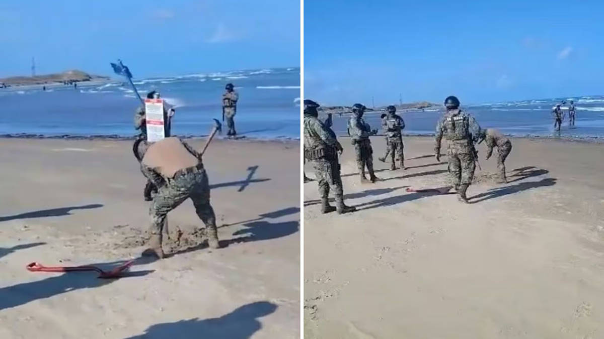
US ‘contractors’ arrived by boat on Monday at Playa Bagdad, with the figures seen to hammer signs into the sand proclaiming the area as US territory.
The Mexican Ministry of Foreign Affairs has since confirmed that the navy has removed the signs after “water depth” and other geographical markers “altered the perception of the international boundary’s location”.
On Tuesday, the International Boundary and Water Commission was seen to weigh in, a bi-national agency that determines the border between the two countries – with images showing the troops’ presence emerging.
According to the Daily Mail, local security trucks rushed to the beach to meet the troops after sightings emerged.
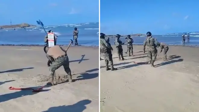
US ‘contractors’ arrived by boat on Monday at Playa Bagdad, with the figures seen to hammer signs into the sand proclaiming the area as US territory.
Picture:
International Boundary and Water Commision (IBWC)
The coastal area is located close to where the Rio Grande, a river which originates in the US, flows into the Gulf of Mexico.
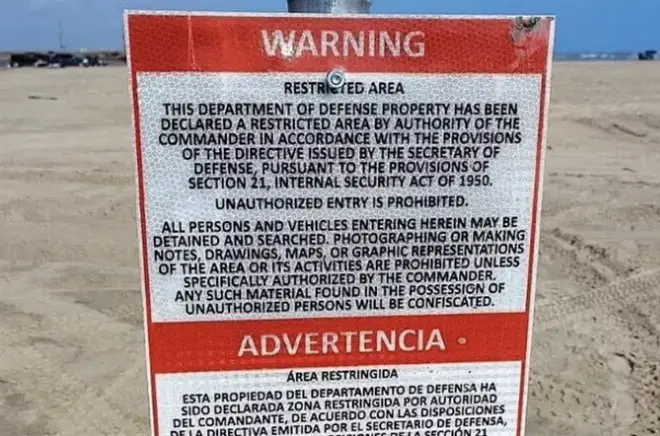
Written in English and Spanish, the signs claimed that the beach was the property of the US Department of Defence and had been declared restricted by ‘the commander’.
The signage added that unauthorised access or any form of photography was strictly prohibited in that area.
“If you are found here, you may be detained and searched,” it read.
It led Mexican President Claudia Sheinbaum to declare that the IBWC would arbitrate the dispute.
The following day, after reports of ‘troops storming the beach’ emerged, the Pentagon was forced to release a statement confirming its troops had made an erroneous landing.
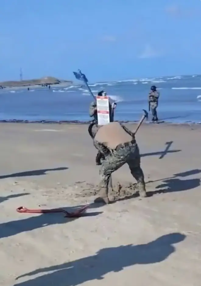
The coastal area is located close to where the Rio Grande, a river which originates in the US, flows into the Gulf of Mexico.
Picture:
International Boundary and Water Commision (IBWC)
Explaining the soldiers had hammered signs into the beach’s golden sands, the US military added that the personnel had been sent to mark “National Defense Area III”.
The statement, the US Embassy in Mexico said: “Changes in water depth and topography altered the perception of the international boundary’s location.
“Government of Mexico personnel removed 6 signs based on their perception of the international boundary’s location.”