The UK could see more snow in areas with temperatures set to plummet below zeroJames Holt Senior Live and Breaking News Reporter and Astha Saxena
20:28, 23 Nov 2025
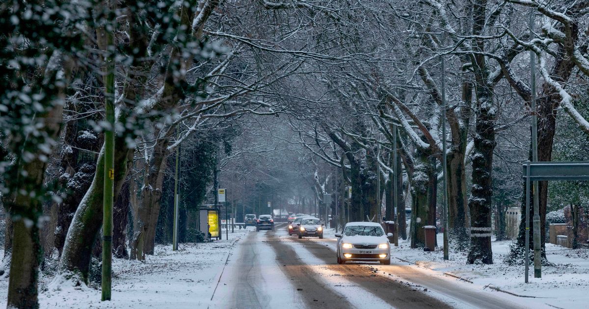
 The UK could see more snow in areas with temperatures set to plummet below zero(Image: Jason Roberts /Manchester Evening News)
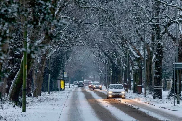
The UK faces the prospect of further snowfall as fresh weather charts reveal wintry conditions are set to return within days.
The UK has just endured its coldest autumn evening, with the mercury expected to drop to a brutal -12.6C across Scotland during the week last week. This extreme reading represents the most bitter November evening in 15 years.
Fresh meteorological charts suggest icy conditions will once more pound the country later in the week. WXCharts data has turned white and purple for November 30, signalling significant prospects of snowfall across swathes of Britain and freezing temperatures, the Express reports.
The forecasting maps suggest snow could descend upon Birmingham, Manchester, Bristol, Leeds, the Cotswolds and Stoke-on-Trent as temperatures crash to a bitter -2C. During the week this week, Manchester will see temperatures hit freezing overnight.
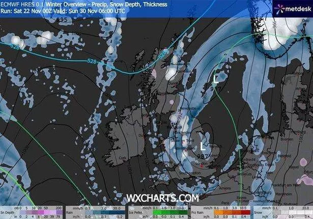 The white patches show areas where snow could fall (Image: WXCharts)
The most severe conditions will strike around Inverness and Aberdeen, where thermometers could plunge to a punishing -6C. It comes after Met Office forecasters predicted that weather would return to milder and more average temperatures for this time of year.
Conditions for the coming week are also expected to be windier and wetter. The Met Office added: “Cooler air arriving in the north may allow some wintriness to develop in the extreme north of the country by the end of Monday.”
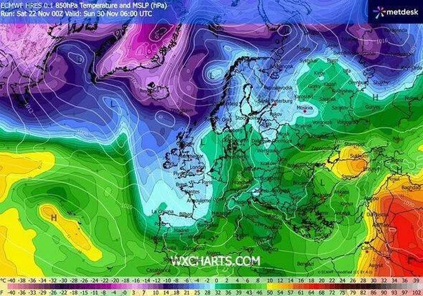 A weather map showing how cold different parts of the country will be (Image: WXCharts)
The Met Office’s long-range forecast from 27 November to 6 December warns: “After a settled start across much of England and Wales, it will be quickly turning unsettled across Northern Ireland, Scotland, and then the remainder of England and Wales through Wednesday and into Thursday, with cloud and rain bearing Atlantic systems heralding a step change back towards more changeable, or even unsettled conditions through the last days of November into early December.
“Rain could at times be heavy and prolonged, with the risk of gales. There could be some short-lived transient settled periods too, perhaps bringing an increased risk of frost and fog for a day or two, this most likely further south east.”