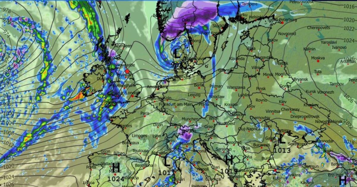
Brits have been warned to brace for plunging -5C temperatures next week – as a swirling Arctic brings icy rain and even snow. New weather charts show a long band of icy showers sweeping the UK on 30th November into 1st December, bringing chilly rain as the mercury drops subzero.
But maps also reveal that on high ground in the Lake District, in Cumbria, Northumberland and in Scotland the rain will turn to snowfall, which will settle in the Highlands and round Inverness. It comes as the Met Office have warned gusts of up to 75mph could hit parts of northern Scotland later, with people warned of possible disruption.
The Met Office has issued a yellow warning of strong winds which will be in force from 4pm on Thursday until 11am on Friday this week.
The warning covers Orkney, Shetland and western parts of the Highlands and Argyll and Bute. Forecasters said very strong south-westerly winds will develop during Thursday evening, continuing overnight before easing from the west through Friday morning.
Gusts of 60-70mph are likely widely within the warning area, with a few places seeing gusts of more than 75mph at times.
They warned people to expect travel disruption as air and ferry services may be affected, and there may be difficult driving conditions for high-sided vehicles on some routes.
Forecasters said there is a small chance of injuries and danger to life from large waves and beach material being thrown on to sea fronts, coastal roads and properties.
There is also a slight chance of some damage to buildings, such as tiles blown from roofs, with a small chance of injuries and danger to life from flying debris.
Looking at next week’s icy rain and snow, the Met Office long-range forecast from 1st December-10th December reads: “Changeable and often unsettled conditions are expected across the UK during this period.
“Low pressure systems will tend to dominate meaning showers or longer spells of rain for much of the UK, though some brief drier, more settled interludes are also possible.
“The wettest weather is perhaps more likely in parts of the west, but heavy rain is possible almost anywhere at times through this period.
“The greatest chance of snow will probably be over northern high ground. Given the dominance of low pressure, strong winds are also likely at times.
“Overall, temperatures are predicted to be close to average, though colder conditions may occasionally encroach into northern areas. Some frost is to be expected where drier, clearer conditions develop overnight.”
With snow falling Brits will be starting to ponder whether they will see a white Christmas on n25th December 2025.
BBC lead weather presenter Sarah Keith-Lucas reassured those keen on a seasonal white blanket that over half of all Christmas Days in the UK have seen snow falling somewhere.
She added: “Longer-range weather forecasting models are beginning to show possible trends for the Christmas period, influenced by wider teleconnections – large-scale interactions in which weather patterns in distant regions create atmospheric waves and flows that affect conditions thousands of miles away.
“One such potential influence to our winter weather is a ‘warm blob’ in the Pacific Ocean which could favour higher pressure and colder conditions developing in Europe.
“Meteorologists are also keeping an eye on the development of a potential La Niña event over the coming months – the colder phase of the El Nino Southern Oscillation (ENSO) cycle.
“Whilst the link between La Niña and UK weather isn’t clear cut, the Met Office suggests that historically it promotes high pressure to develop in the Atlantic in early winter. This could mean a higher than average chance of colder weather to start December.
“Overall most computer models are hinting at a trend towards slightly calmer and colder conditions developing towards 25 December, so perhaps there’s a chance of seeing something white on the big day!”