Weather expert warns Wales and other parts of the UK face 20-day period of heavy rain in build-up to Christmas
Christopher Sharp Trendswatch Reporter
15:20, 01 Dec 2025
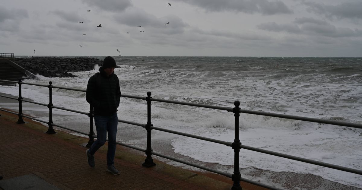
 A weather expert has said the UK could be hit by 20 days of rain(Image: John Keeble, Getty Images)
A weather expert has issued a warning that Wales and other areas of the UK could face 20 days of relentless rainfall in the run-up to Christmas.
Jim Dale from British Weather Services suggested that the festive season could see a series of wet weather systems arriving from across the Atlantic, potentially causing havoc on Britain’s roads and creating perilous driving conditions.
Jim explained that two main factors were contributing to these conditions: the onset of winter and the effects of climate change.
His cautionary words about the impact of “aggravated” and “aggregated” rain came just hours after the Met Office issued a ‘danger to life’ warning for parts of England and Wales due to anticipated heavy rainfall, reports the Express.
Jim warned: “The big one at the moment is the rain, and it’s starting today. Going forward, the next 20 days looks to be predominantly Atlantic driven, low pressure driven, associated frontal systems within those low pressures and copious amounts of rain, particularly for western areas.
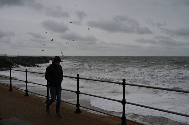
 The UK is braced for wetter weather over the next few weeks (Image: Getty)
“There will be much above average rainfall in western areas, Wales, west England, north west England. As you go progressively eastwards that tales off a little bit.
“It’s definitely the western region scenario that people, from today onwards, people have to pay attention to in terms of rivers rising and driving conditions.”
The relentless rainfall could create “difficult conditions” including flooding, Jim warned. He explained: “It will be aggravated rain that just makes the next rainfall event more concerning; with that there will be strong developing winds.
“This will take us to the December 20 and at that point we’re going to see colder weather start moving in because the 528 line, the thickness line, will start to move south.
“As time goes on I think we’re going to see more amber and yellow warnings, and potentially a red if it’s get bad enough knowing that the Atlantic will be driving these low pressure towards us.”
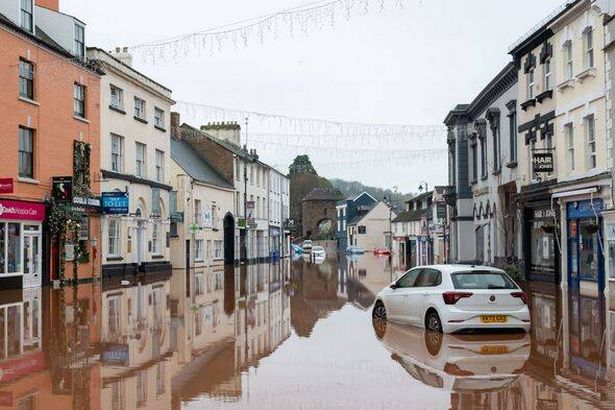 Jim’s warnings came after floods struck Monmouth a few weeks ago(Image: Getty)
The meteorologist urged the public to exercise “careful” vigilance regarding weather conditions.
At the end of last week, the Met Office issued an uncommon amber weather warning alongside a danger to life alert for areas of Wales, which came into effect today (December 1).
In its statement, the Met Office explained: “An area of heavy rain is expected to move over South Wales between late Sunday and late Monday.
“Whilst rainfall amounts will vary, some heavy and persistent rainfall is likely to fall, especially over high ground, for example, Bannau Brycheiniog. Rain should clear to the east Monday night.
“20-40 mm of rain will fall extensively across the wider region, but 60-80 mm is expected to accumulate over some south- and southwest-facing high ground in south Wales, with a few places perhaps seeing nearer 100-120 mm.
“In addition to the potential for flooding impacts, this increases the chance of landslides on both natural and infrastructure slopes. Strong south to southwesterly winds will also accompany the heavy rain, with gales possible around coasts and over high ground.”