Weather forecasters have predicted snowfall across vast swathes of the country this month with as much as five inches of snowfall expected in some areas across the UK Weather forecasters have predicted snowfall across vast swathes of the country(Image: Getty Images)
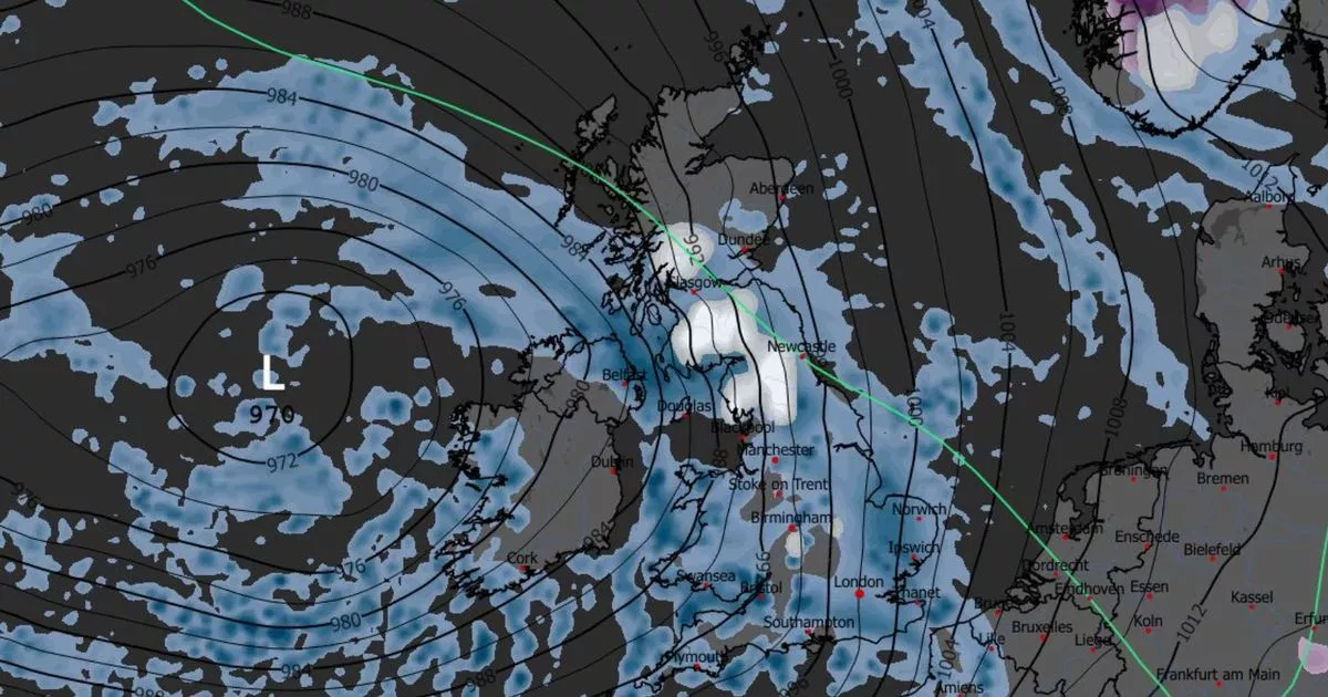
Brits will brace for an onslaught of wintery conditions, with a 330-mile wall of snow forecast to hit the country.
New weather maps from WXCharts, which uses Met Desk data, show a 330-mile wall of snowfall battering Britain within a few days. Temperatures are set to fall below zero in much of the country on Friday, December 5, with snow falling around Aberystwyth, in Wales, at about 3pm.
The stretch of snow is forecast to spread from north Wales up to Aviemore, in Scotland, by about 6pm the same day. According to the forecast, as much as five inches of snow could be dumped in northern Wales with about one inch falling in pockets across Scotland.
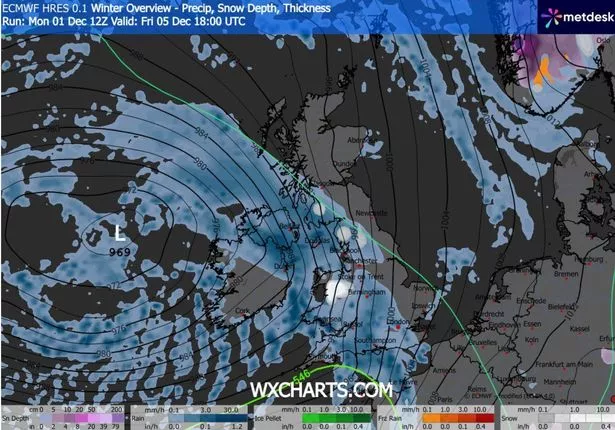 The weather maps show scattered snowfall across the country (Image: metdesk)READ MORE: UK snow forecast as Brits face being buried in Arctic blizzard lasting 21 hoursREAD MORE: UK weather warning as Brits facing ’20-day deluge’ before Christmas
The same weather maps show a more miserable time for millions in the UK with southern England, the West Midlands, the North West and Wales bearing the brunt of the harsh rains. Northern Ireland and the south west of Scotland facing a similar onslaught.
The Met Office warns of rainy spells in the run-up to Friday, although it mentioned there would be some brighter interludes between. In its long-range forecast, Met Office forecasters said some regions could expect heavy rain.
 Weather maps show a 330-mile wide wall of snow falling across the UK (Image: metdesk)
The December 6 to December 15 forecast said: “Likely a continuation of the unsettled conditions seen for much of the week with further showers or some longer spells of rain affecting much of the country.
“On Saturday a frontal zone is expected to move east and this could bring a spell of locally heavy rain, particularly on hills exposed to the strong southerly winds. Behind this turning brighter but with showers, some of which could be heavy and thundery.
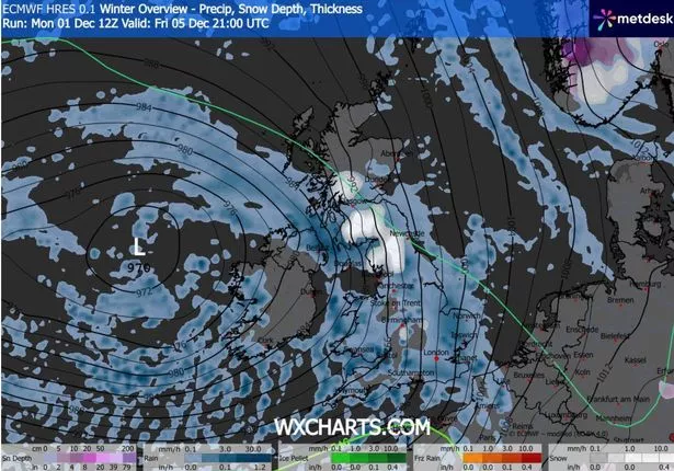
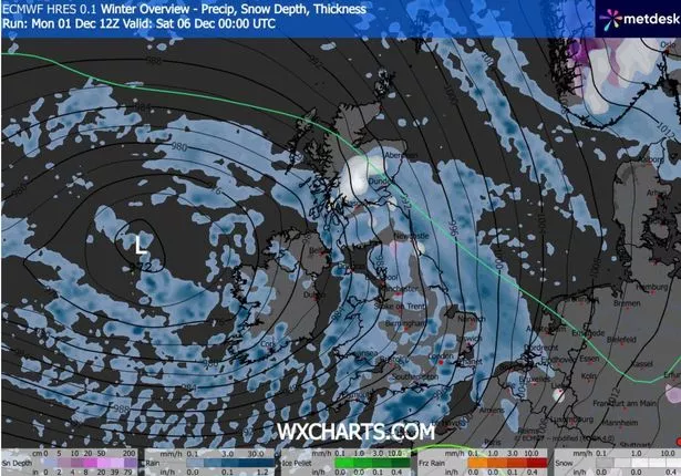 Maps show a massive wall of rain spreading across the country (Image: metdesk)
“It’s possible we could then see yet more organised, locally heavy rain move across most areas on Monday. Generally temperatures will be close to average, but it will likely feel quite chilly in the often wet and breezy conditions. However we are unlikely to see much in the way of frost or fog in this unsettled spell.”
Moving toward Christmas, there is some possibility of hill snow, mainly in the north, in the period between December 16 to December 30. The Met Office added: “Overall, near or slightly above average temperatures are most likely, though some colder spells are also possible, especially should any prolonged settled spells develop.”