Snow is forecast in some places amid the storm, during which temperatures will feel like -6C and gales will reach 75mph, as the weather takes another unpleasant turn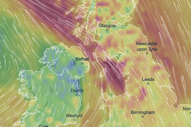 The red and orange hues show high winds for Friday
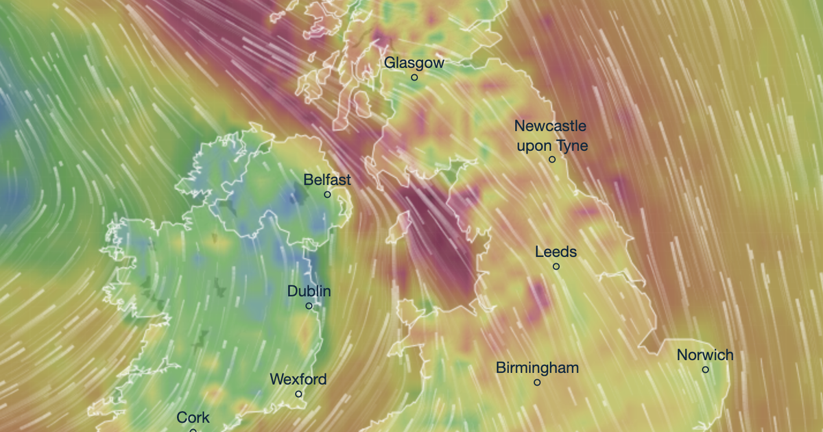
Striking weather maps turn a scary red as 75mph gales will batter the UK during a fierce storm this week.
Forecasters say it will be wet and windy throughout Friday, and cold enough for snow in isolated places. The worst of the weather is likely across Wales, the Northwest of England and parts of Scotland as the low pressure moves in from the west.
Maps issued by forecasters at Metdesk show red hues across western parts of the UK, which denote the strongest winds. Gale speeds are anticipated to hit 75mph along Scotland’s west coast, and parts of the Lancashire coast by 6pm on Friday. They will rage throughout the night, becoming strong inland across Cumbria and Northumberland in the early hours of Saturday.
Snow is forecast on higher ground across the Lake District, Northumberland and County Durham during Friday night. Heavier snowfall is expected across the Scottish Highlands at the same time, though it will be rainy for the majority of the rest of the UK, particularly across Lancashire and Cumbria.
READ MORE: UK weather: Exact date temperature will feel like -7C amid bleak Met Office forecastREAD MORE: Kate and William’s Forest Lodge lease exposed after Andrew probe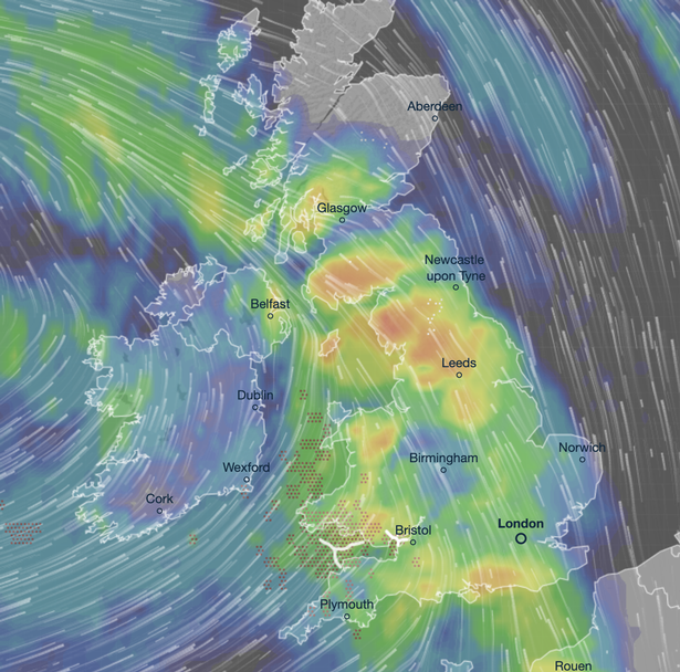 This weather map shows rain forecast for most of the nation on Friday
It will feel as cold as -7C, as we reported earlier this week, because of the huge winds. The actual air temperature will be warmer but it will feel significantly colder, especially across northern England and Scotland.
It will be a stark contrast to Tuesday when the mercury exceeded 12C in Slough, Berkshire. It was also 12C in Swanage, Dorset, on Tuesday, a day during which most of the country dodged rain. Around 20mm of rain fell in Porthmadog, borth Wales.
But the rain during Friday’s monster storm will work eastwards during Friday night, becoming heavy across Aberdeenshire and East Lothian. More than 16mm will lash across these parts in just a few hours, it is thought.
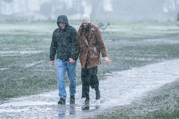 It is expected to be wet and windy, as pictured here at Wimbledon Common, southwest London (Image: Amer Ghazzal/REX/Shutterstock)
Showers will linger throughout Saturday too. It has led to concern about flooding, with dozens of flood warnings and alerts in place for the coming days. Most of these are across the Midlands, which will endure rainfall throughout Friday.
The meteorologists at Netweather have written on its blog: “Into Friday, patchy rain and showers will continue for some, especially near to coasts. The next band of rain will arrive from the southwest during the day though. Saturday looks to be a particularly active day with a good rash of showers, some merging into longer spells of rain, all thanks to low pressure overhead.”
And Sunday could be bleak too, especially across the Midlands. The Met Office says on its website: “Early fog, then bright and breezy, with fewer showers on Friday. Further wind and rain sweeping northeastwards through the day. Brighter with blustery showers on Saturday. Further rain on Sunday.”